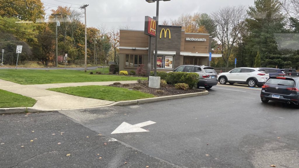
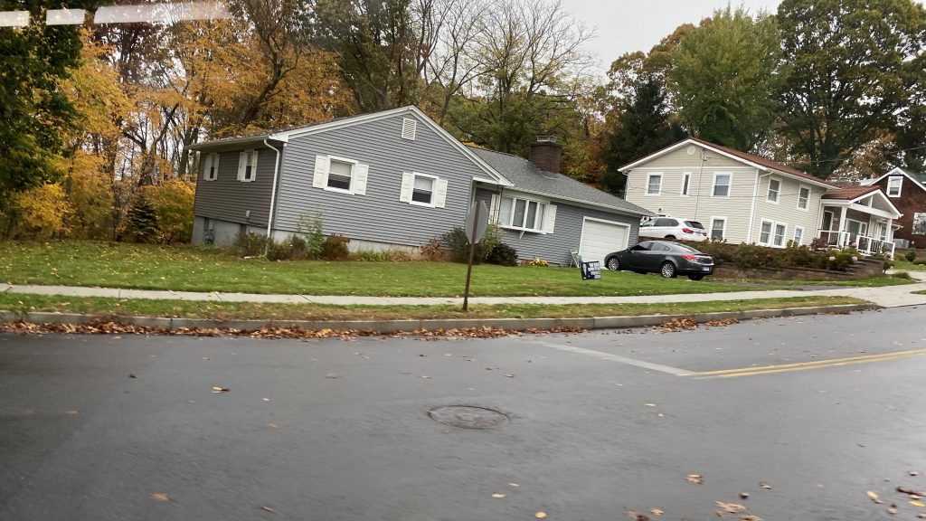
Alrighty, after I reviewed East Somerville solo, I took the next train (20+ minute wait!!!) to Ball Square, at which point I’ve decided I’d get breakfast at Kelly’s Diner. By the way, 10/10 pancakes. It was here that I’ve also rejoined with Noel, Conor, Lynx, Miles, Jeremy, Jules, and the others. After tagging along with them and subsequently catching the 80 to Medford for Miles’ video review of that station, we returned to Ball Square. So, with that in mind, how does the station stack up?
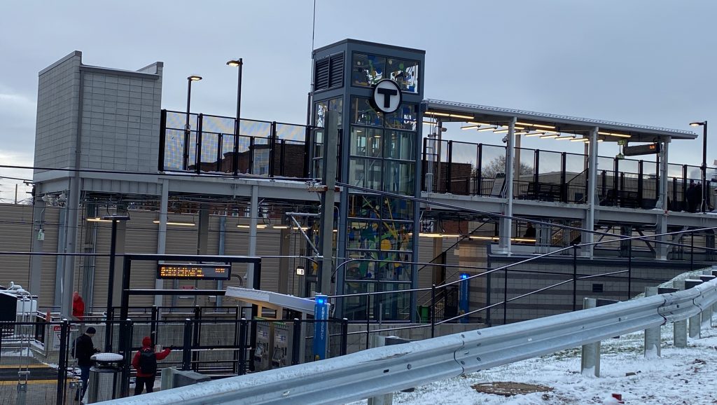
The elevator-accessible entrance from across Kelly’s Diner
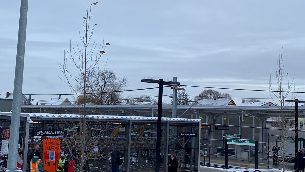
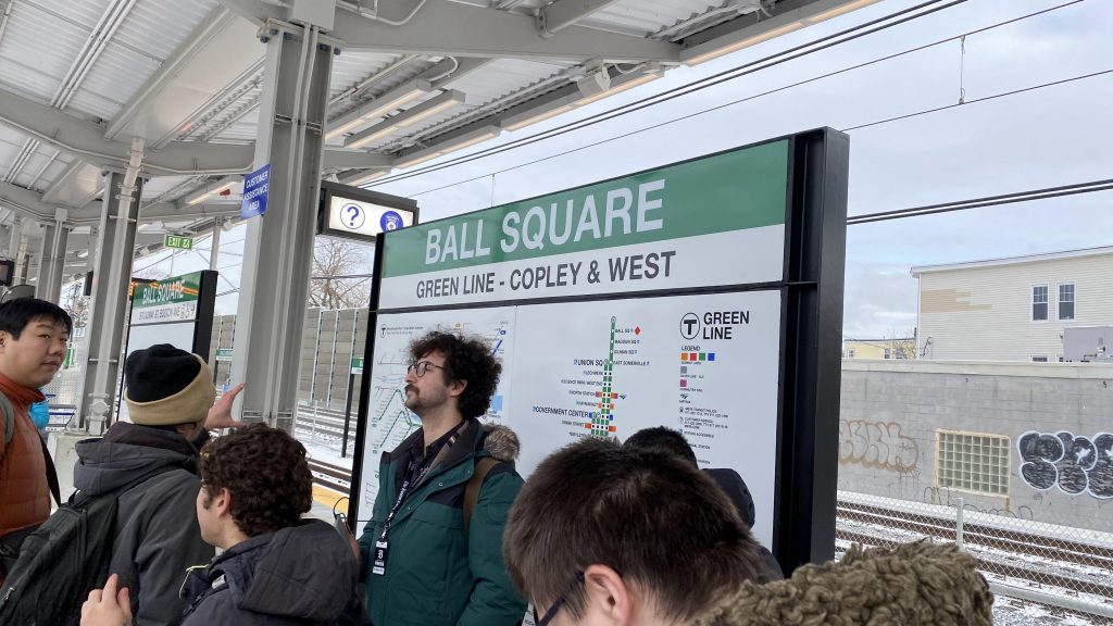
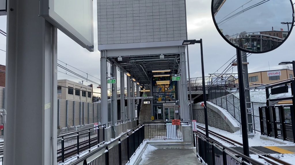
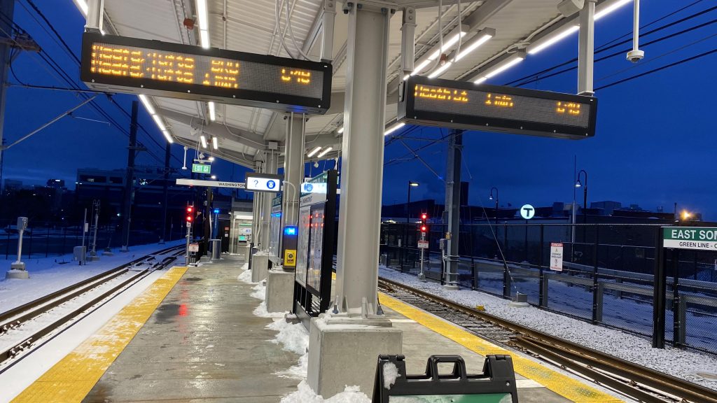
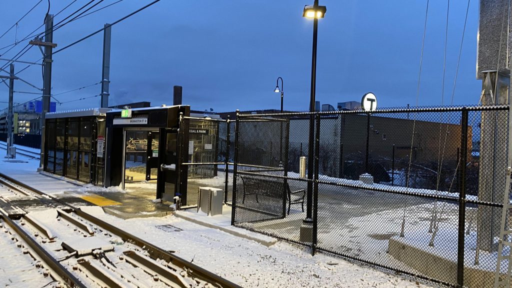
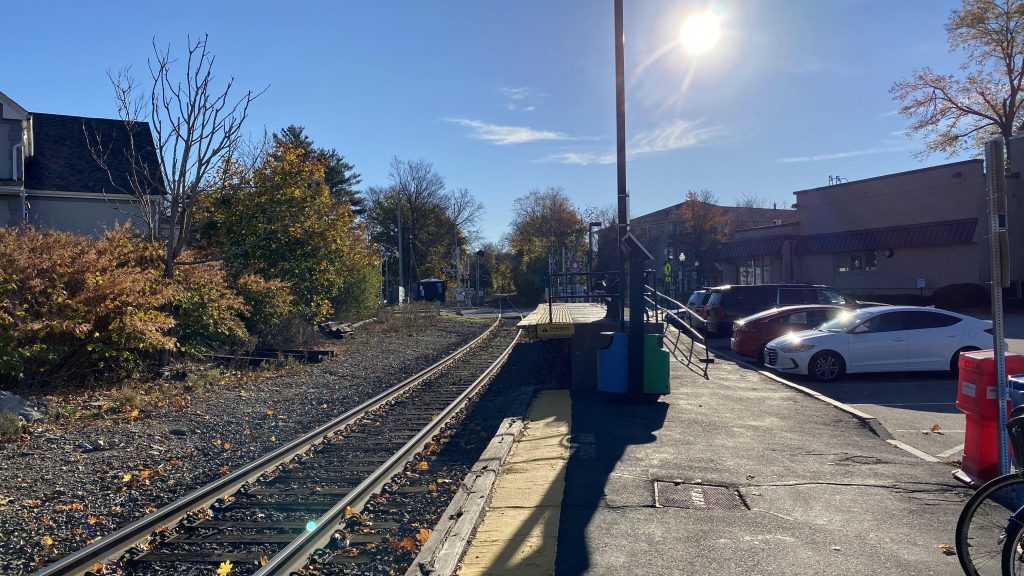
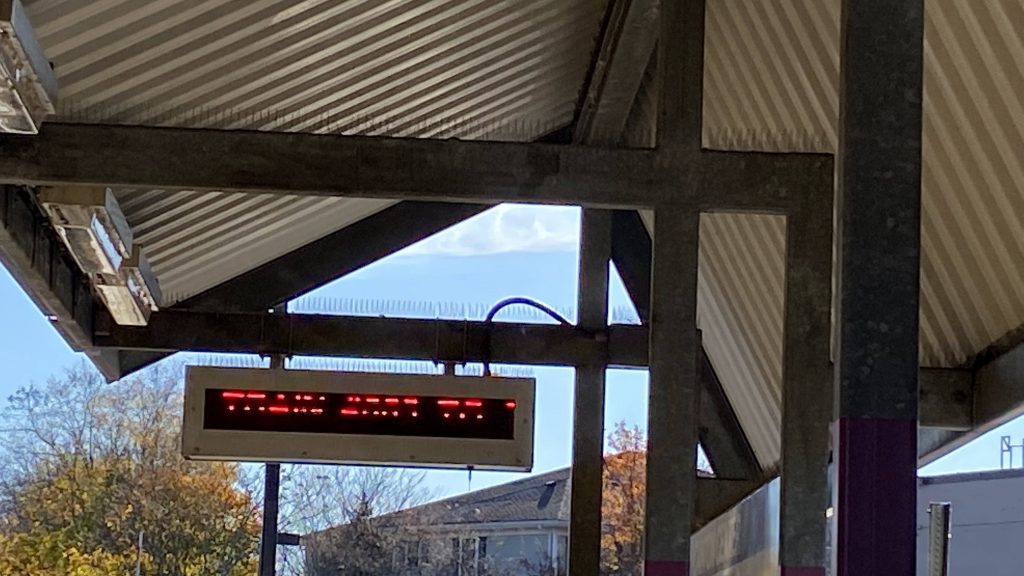
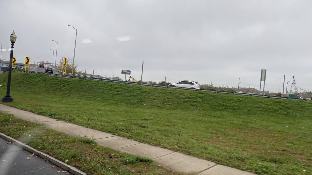
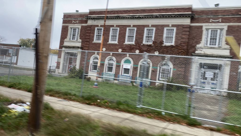
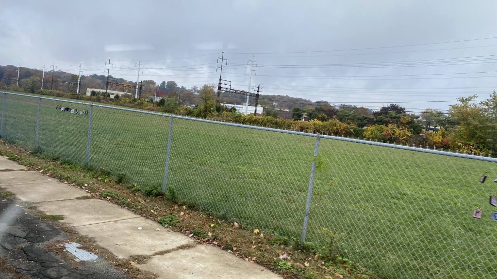
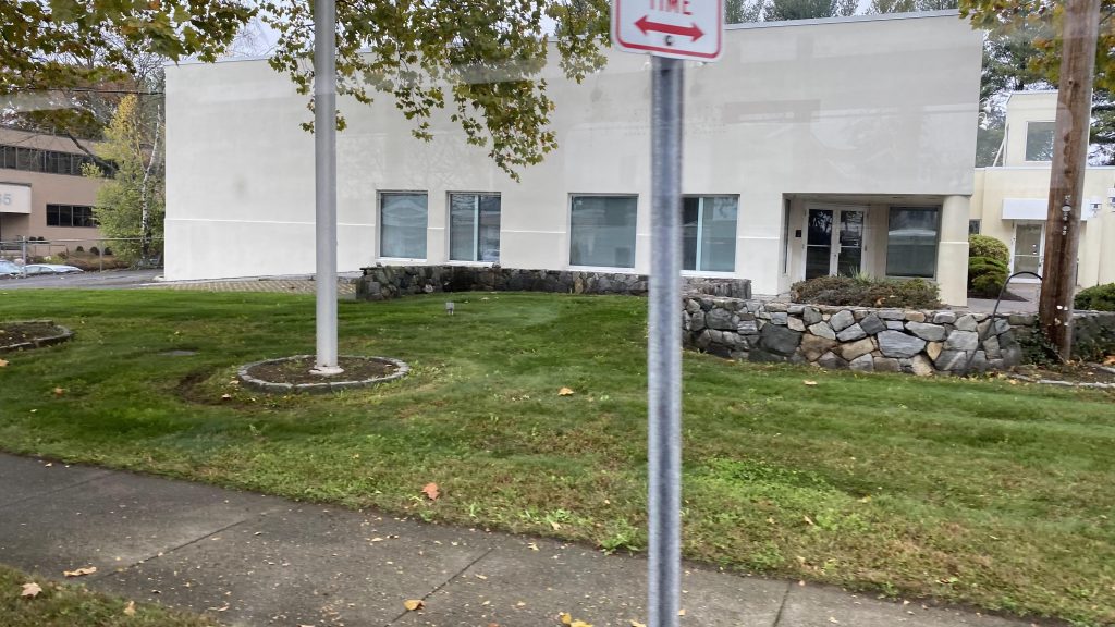
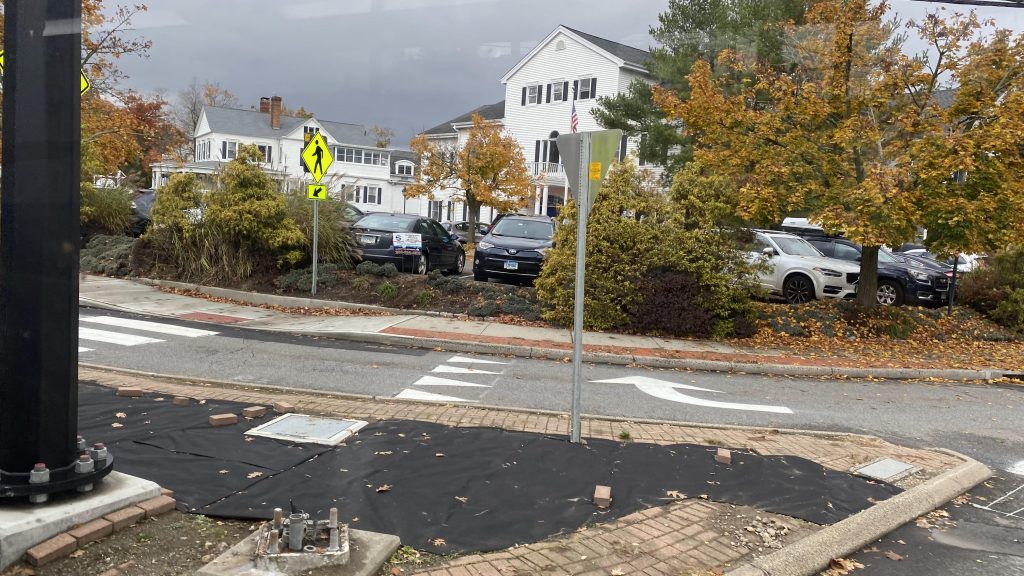
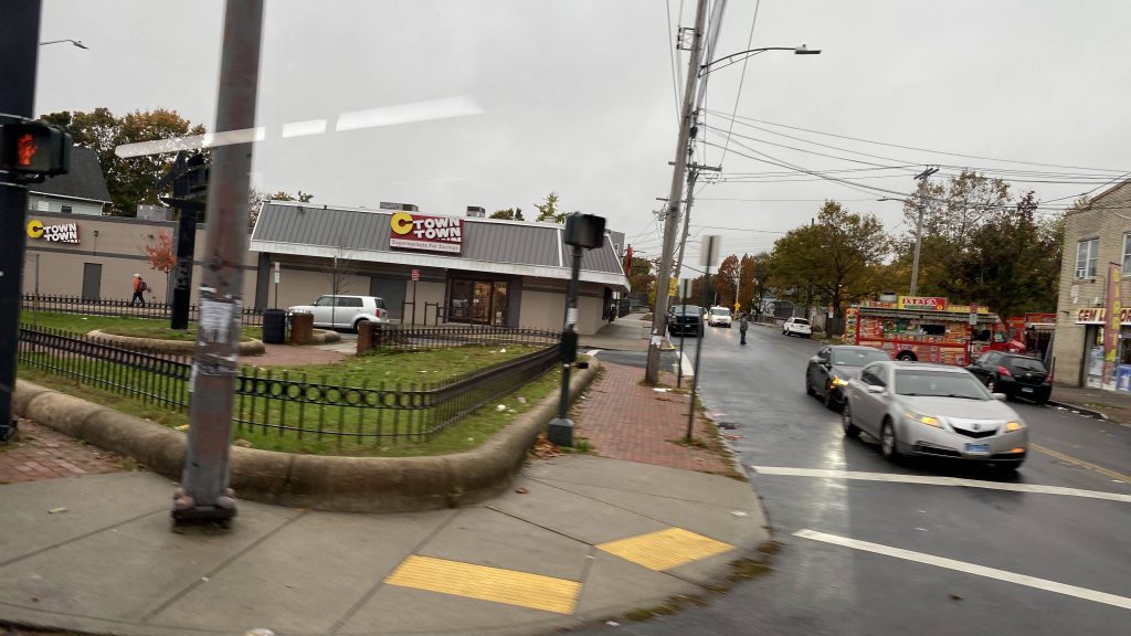
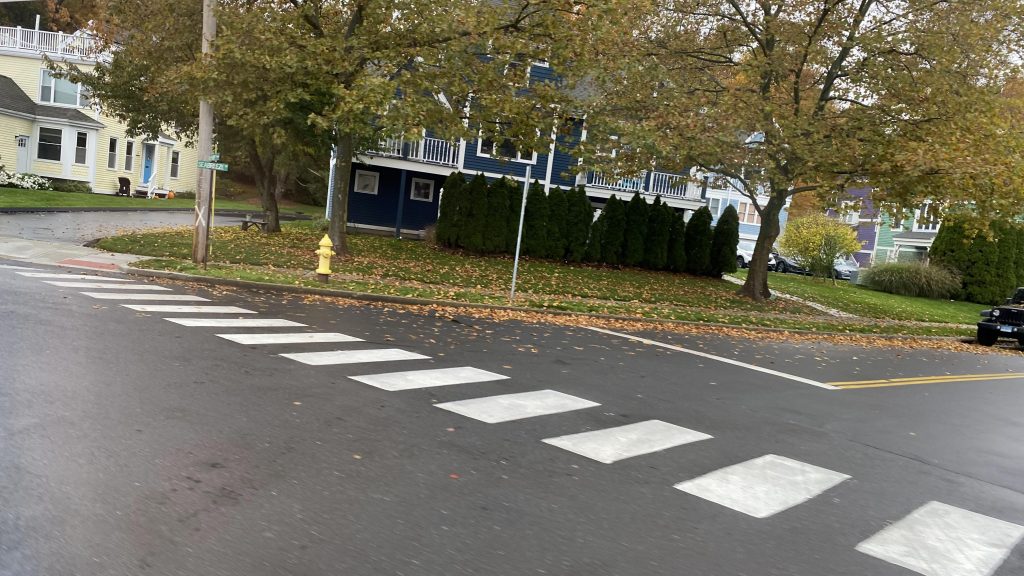
So, first off, the station has one non-redundant elevator (numbered inconsistently, with it being 769 on the inside, nice), but that’s not an issue since the other entrance, beside the Pedal & Park, is a grade crossing. Countdown clocks can also be found, so you can make the judgement call to run for your train. Behind the elevator is also what appears to be a pretty cool party area. Neat.
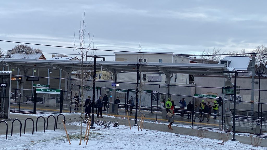
The island platform
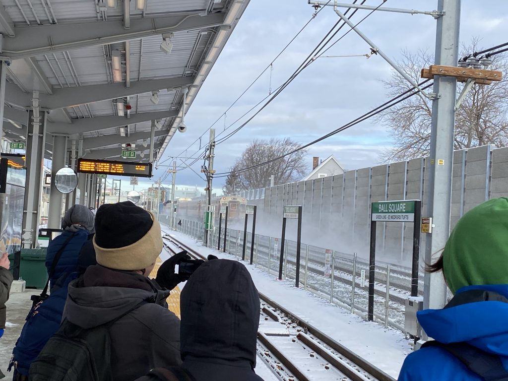
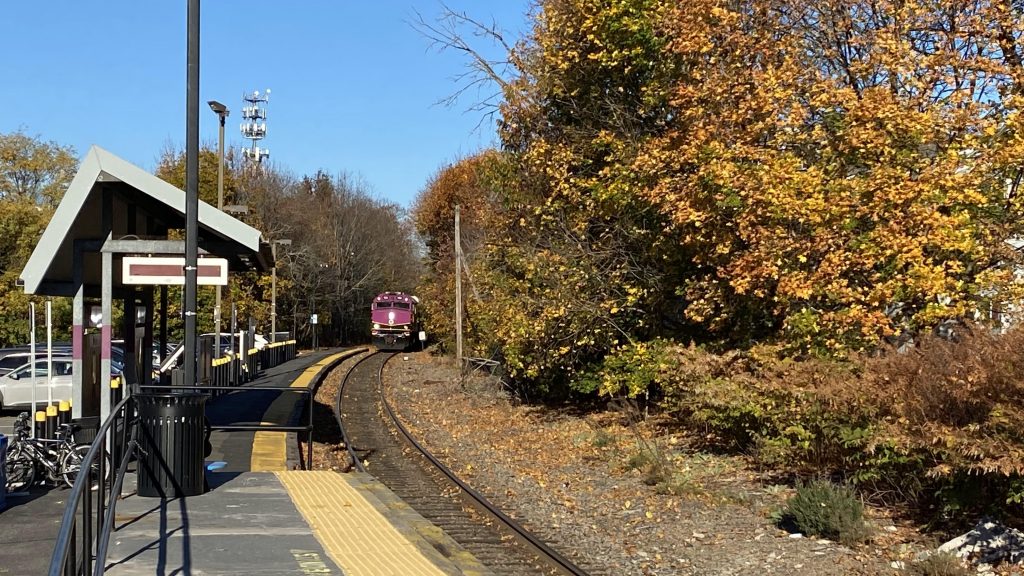
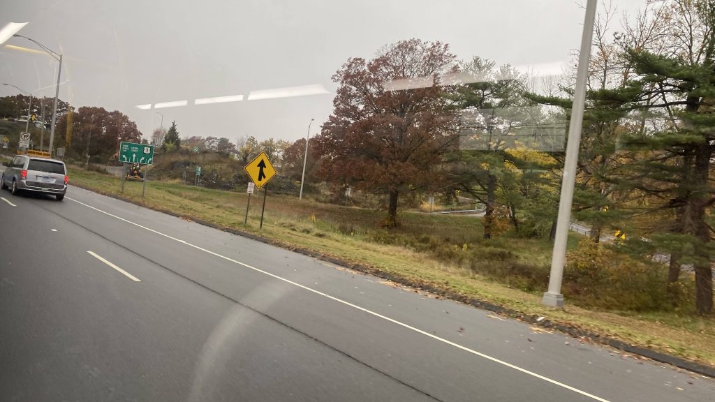
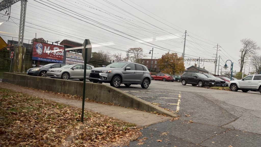
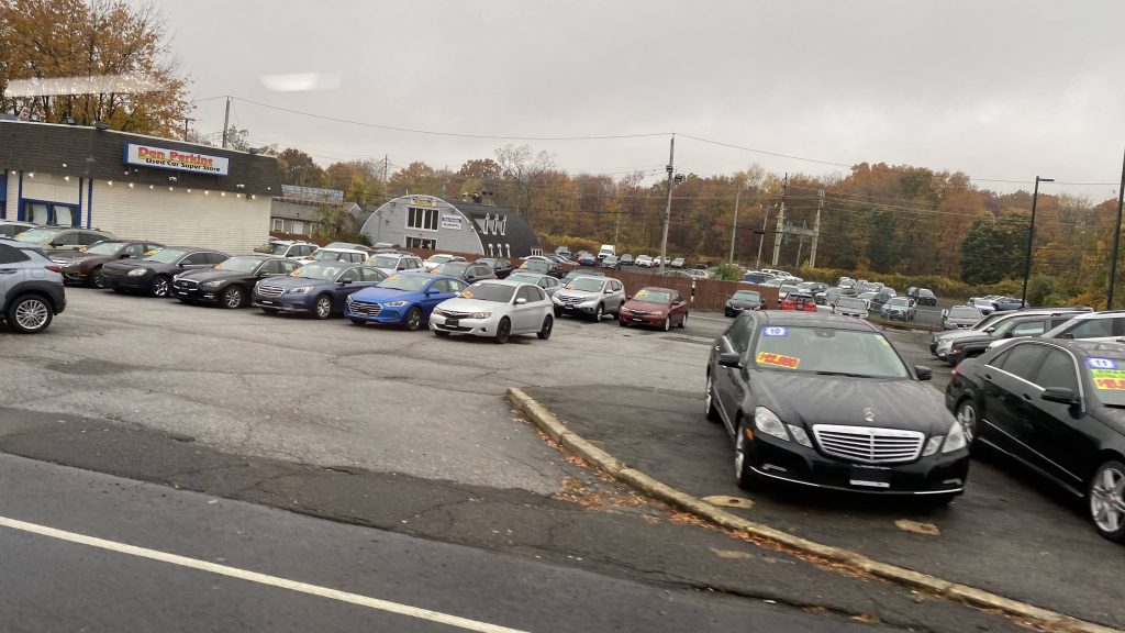
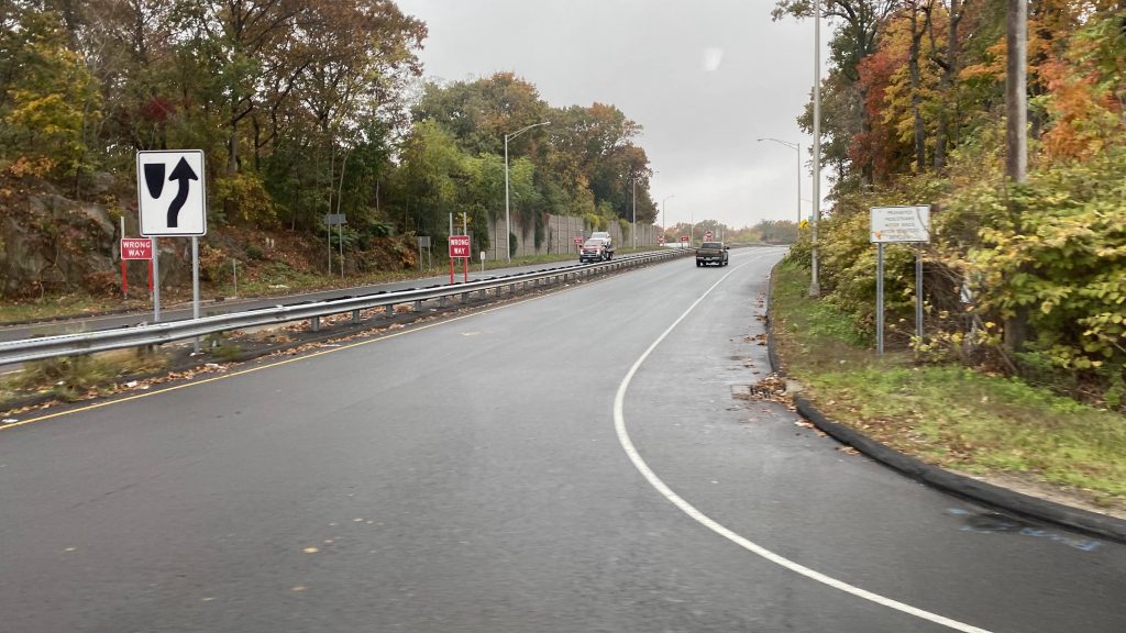
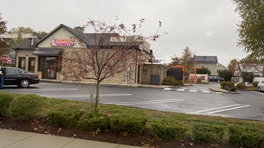
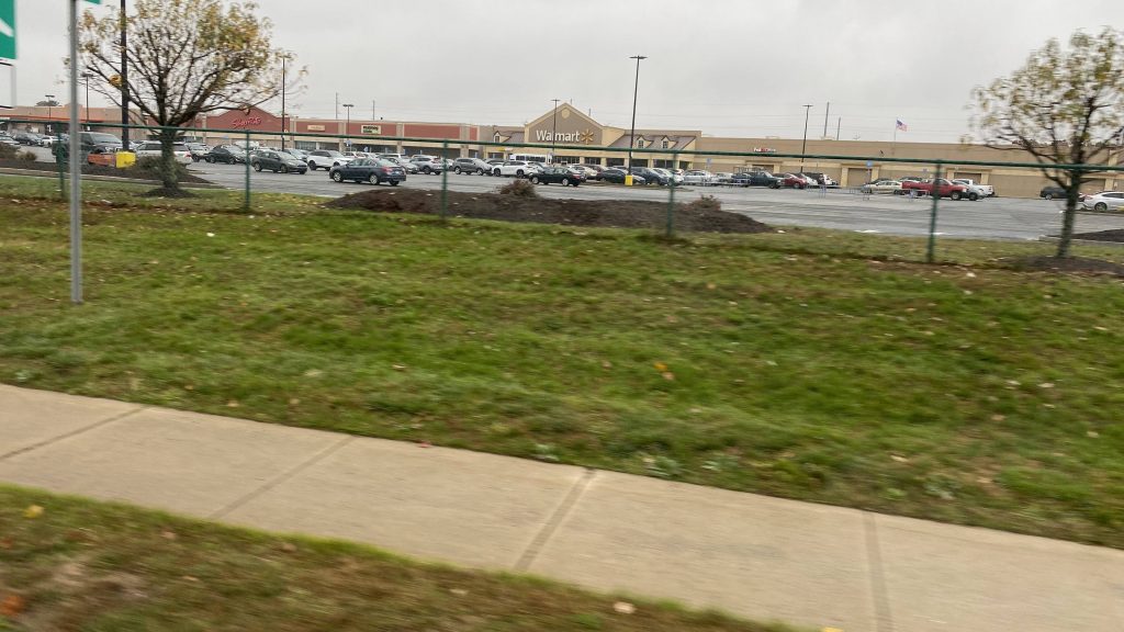
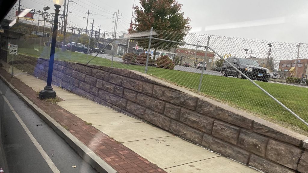
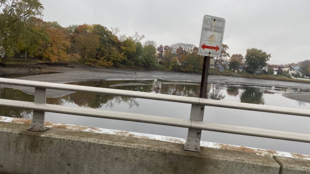
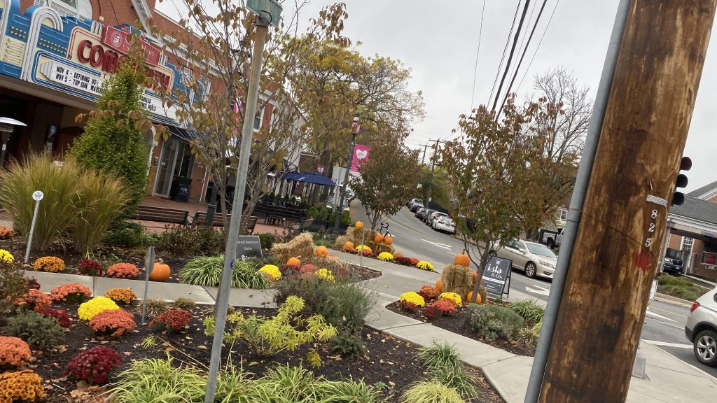
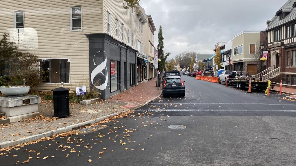
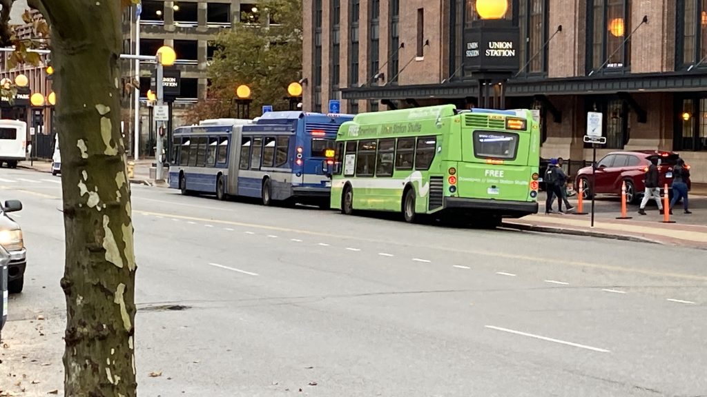
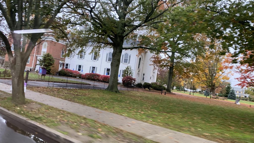
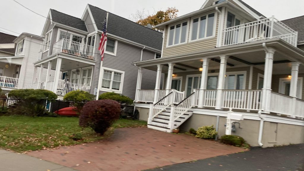
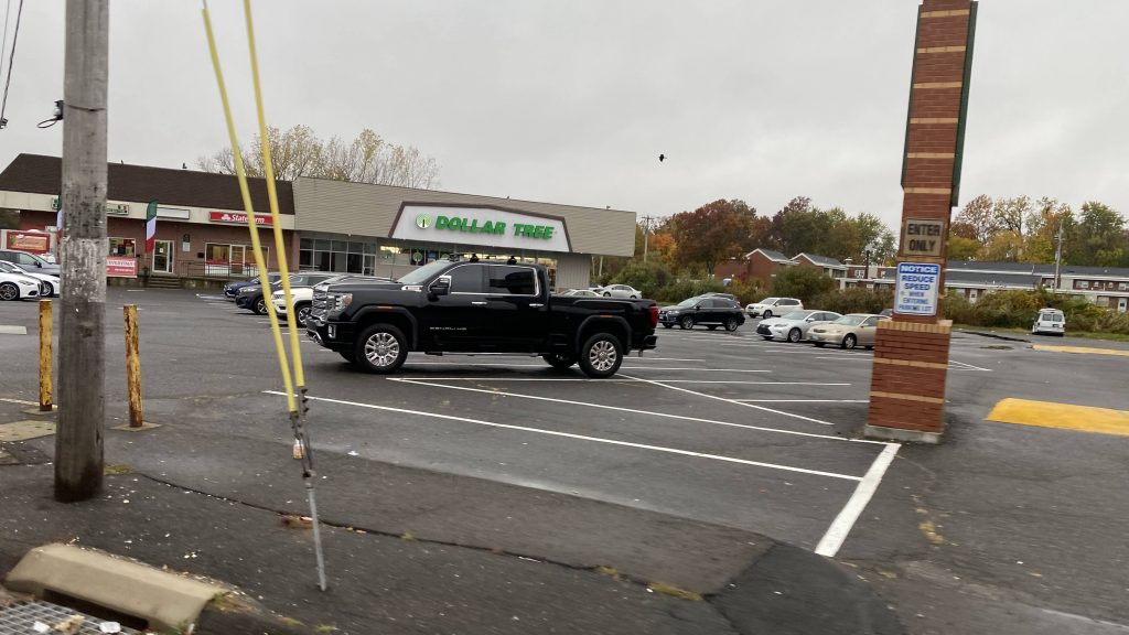
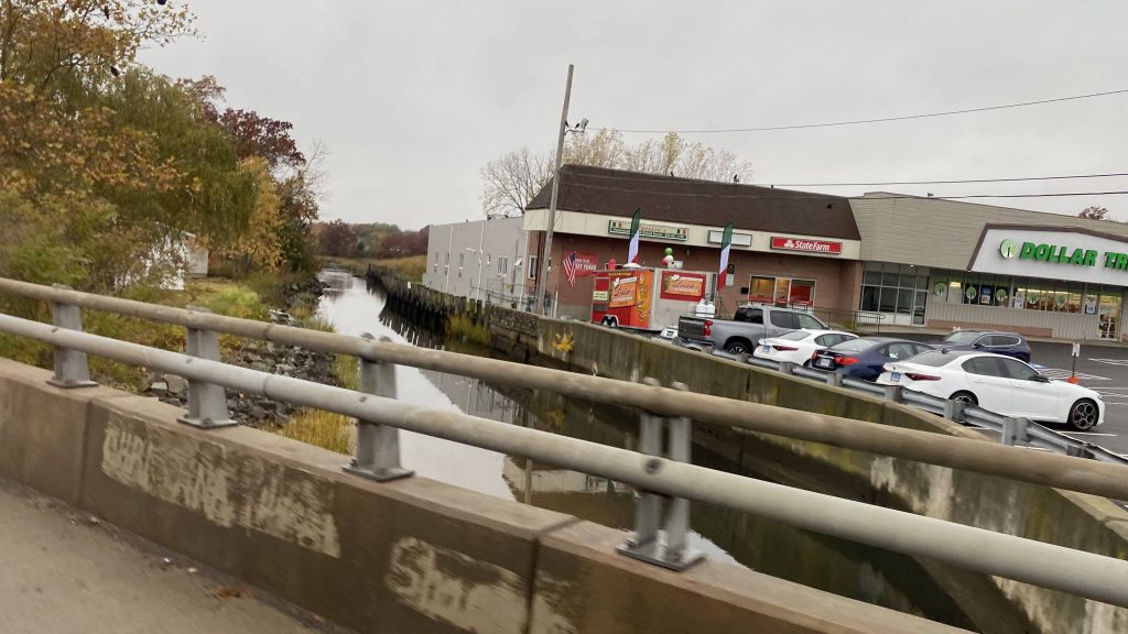
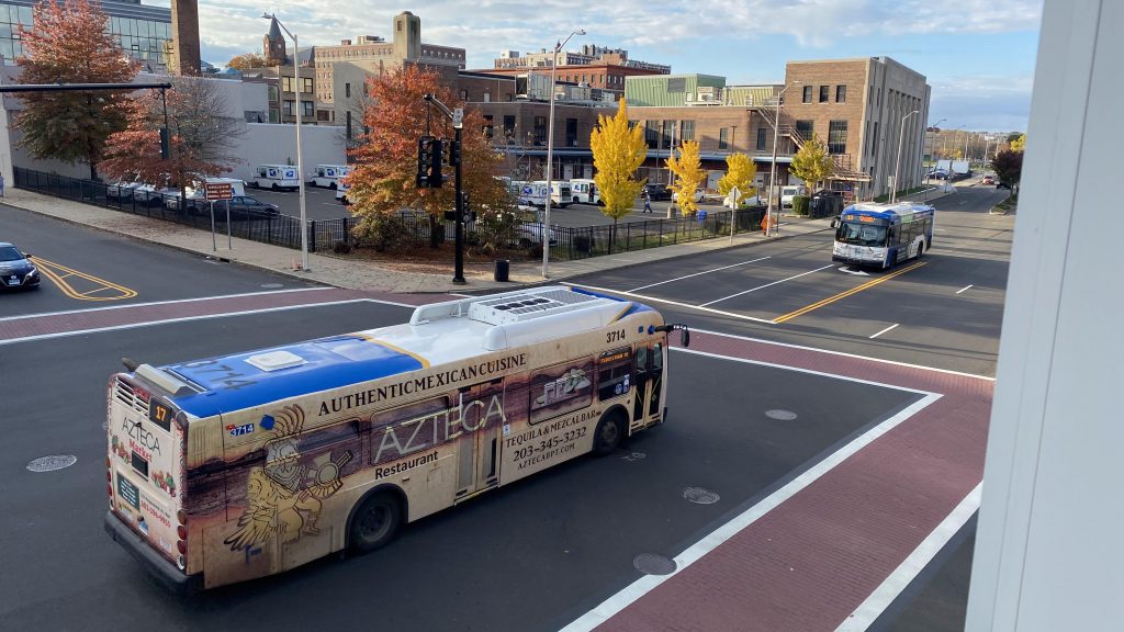
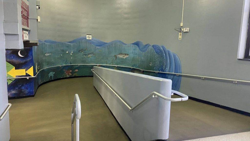
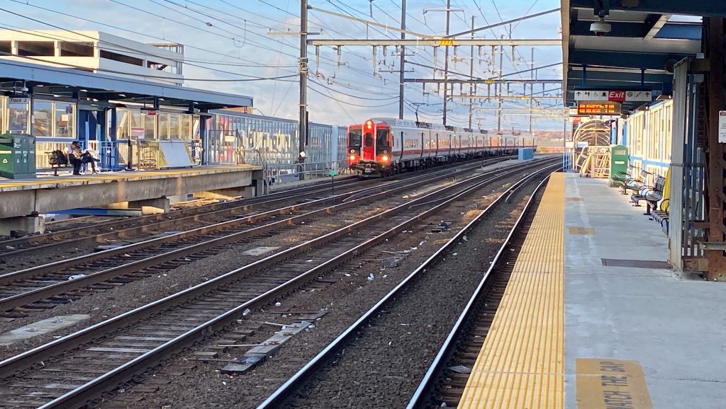
Just like the rest of the Green Line Extension stations, the station uses an island platform with benches, trash bins, and signage. It works, nothing exciting. And yes, also like the rest of the GLX, it uses the honor system. Booooo! On the other hand, though, I’d argue this is a better railfanning spot than Medford/Tufts, for the Lowell Line and the Downeaster. In terms of nearby, you have Ball Square, the station’s namesake. It’s a pretty decent neighborhood, and while I didn’t explore it too much, Kelly’s Diner is pretty good for breakfast.
Zoomed on the Pedal & Park. Also, NIMBYs.Zoomed in signageHelvetica and someone interviewing MilesOutbound Lowell train and snow trail!The elevator!
The good: It’s in a very good location! Like, there’s actually stuff around unlike East Somerville! And, to be honest, this has got to be a personal favorite for the subway system, period. There’s also plenty of local businesses and restaurants to be had.
The bad: Still, honor system. Also, there’s no bathrooms here unlike Medford.
Nearby points of interest: The many shops and restaurants of Ball Square! I can personally vouch for Kelly’s Diner being good.
Transit connections: Green Line (E) MBTA bus (80, 89, 89/93)
Overall, I personally prefer this station over Medford when it comes to railfanning the Lowell Line and the Downeaster. However, objectively, it’s still slightly worse than Medford.
Rating: 7.5/10
From here, Myself, Miles, and co. would then take the next Green Line train to go further down the line. Stay tuned for Magoun and Gilman Squares!
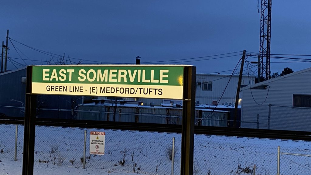
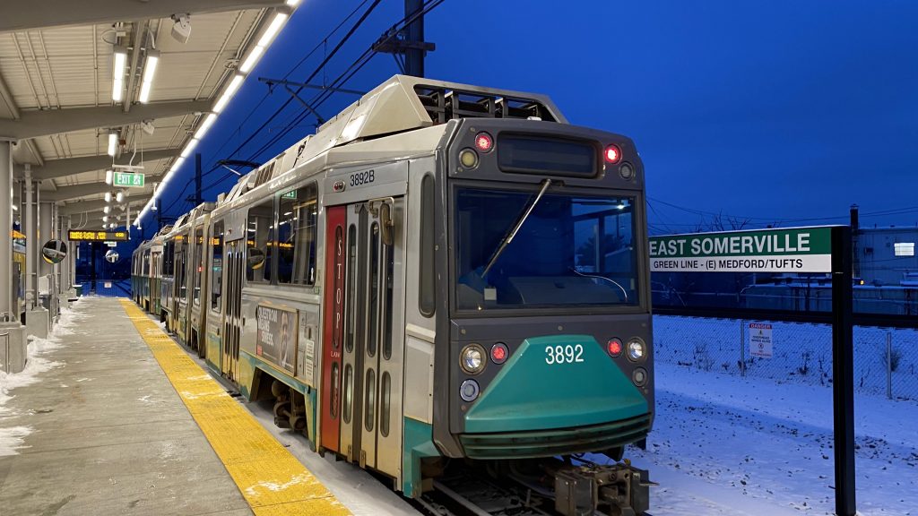
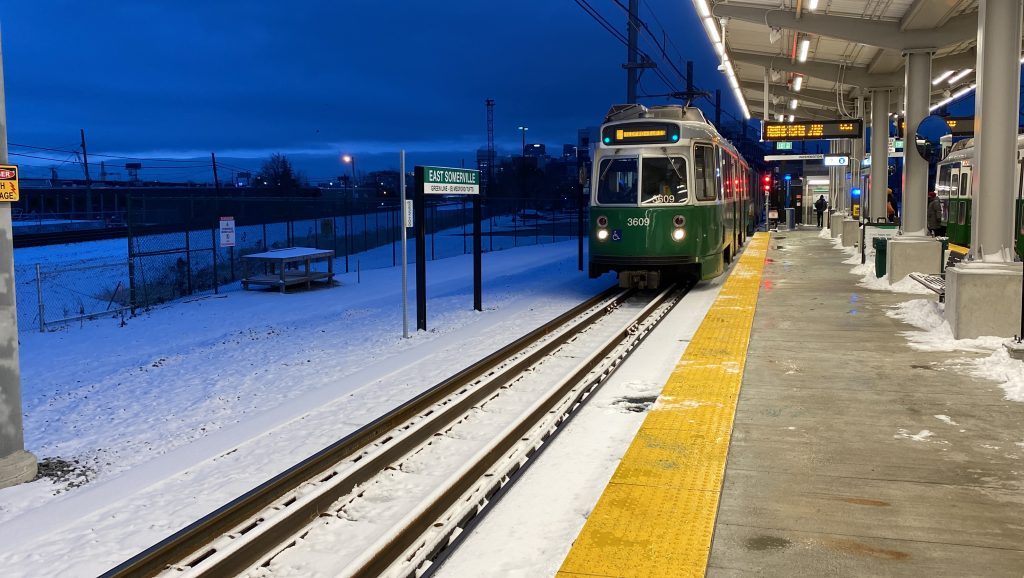
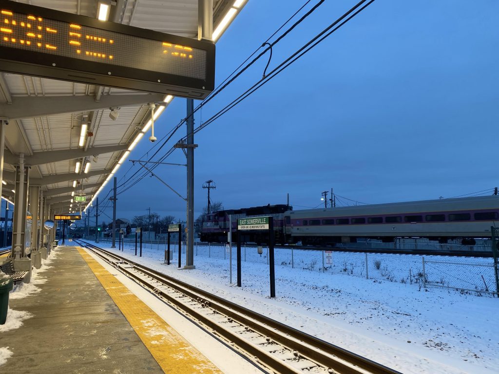
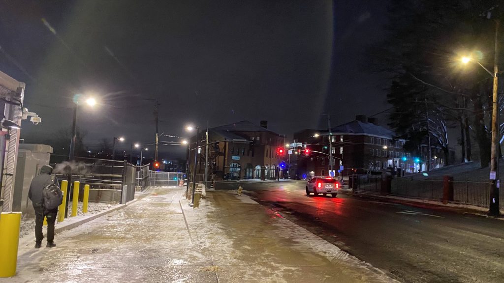
After Medford, we were in the central subway on the Green Line. Wait, who’s that in the Princeton beanie? Well, if it ain’t Conor! Yeah, I met him at the Silver Line meetup with Miles, but here we were again by chance this time. We also coordinated to meet up with Lynx at Riverway, but instead he got on at Heath Street. I didn’t even realize it was him at first, only to find out he was only 13. Yeah, I was surprised myself. Anyways, moving on, I eventually parted ways with the two of them, as Lynx had to go to school and Conor went to the Ball Square festivities. And, that brings us (you, the reader, and I) to East Somervile.
The signage
I encountered Toby on the train, with him getting on and me off, quickly asking if there was anything to note about East Somerville. He said no, nothing of note. And yes, he was right.
The platform
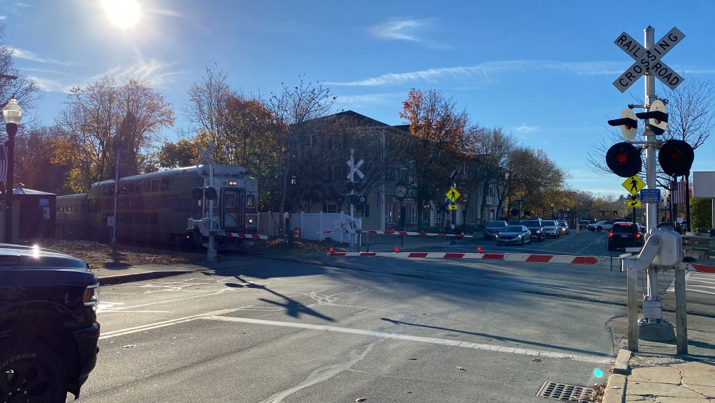
You’ve got benches, artwork, vending machines, and a grade crossing for access. There’s also a Pedal & Park at the other side of the grade crossing, as well as what looks like a 3rd track. Yeah, there’s not much special about this one.
A Type 8!The system map“LET’S GET KINKI!”Another Type 7!The crossing and the Pedal & Parkgeepeefourty
The good: It’s got a Pedal & Park!
The bad: Yeah, there’s not a lot to the station. No TOD or anything to make it stand out. And, as such, it feels kinda “middle of nowhere”
Nearby points of interest: I’m not exactly familiar with the area, but it seems mostly industrial and suburban in nature. Union Square isn’t far, though!
Transit connections: Green Line (E) MBTA bus (86, 91)
Overall, this one’s a dud. I mean, I’m sure in due time it’ll get decent ridership, however it feels very “middle of nowhere” at the current time. At least it has a Pedal & Park and bus connections!
Rating: 6/10
Fortunately, after this, I wasn’t too insane, so I went up to Ball Square for some breakfast. Stay tuned!
Thursday, November 17, 2022. To this point, we’ve only heard the Medford branch of the Green Line was scheduled to open in “late November”, however that was seeming more and more like horse crap. But there was a board meeting scheduled for the day, so maybe there was hope for an announcement of a date. While I couldn’t attend, someone else did.
Meet: Brooke.
She was sick and had the day off from work, and as such (despite unfortunate circumstances) were able to attend the virtual board meeting. Then it gets to the 10 AM hour and the moment of truth……
December 12, 2022. 4:45 AM.
However, I still did not have my work schedule for the day yet. But, some hope was in me still, as I had two options: 1. pray I had Monday and either Sunday or Tuesday off that week 2. Call out if I had to go in Monday and either Sunday or Tuesday.
Fortunately, come Saturday after Black Friday, I got my work schedule: Sunday & Monday off. Perfect, I thought, as I proceeded to begin prepping. To have a rat’s chance in Hell at succeeding, I needed: – a $20 for a day pass (on CharlieCard or a Commuter Rail zone 1A ticket) – enough money for an Uber to Medford from South Station – a ticket for Regional #166 (departs 12:26 AM on Monday) – a zone 8 Commuter Rail ticket (for the return) – something to snack on – money for breakfast (I was planning on going to Kelly’s Diner in Ball Square)
This was, by far, the most deranged, insane, sadistic, masochistic, unhinged idea I’ve conjured up. And I was going to fucking do it. I was committed, and nothing could stop me. Not even the forecasted snow.
Fast forward to December 11th. I wake up at 5:30ish in the morning and bathe, as usual. Before meeting up with a friend, I had planned to buy some snacks for later at my local CVS. From there, I spent the day with them, with their mom being nice enough to offer English muffins for breakfast (thanks!). From here, after hanging with her for a bit, I decided on an impromptu visit to my dad, who lived in the same area, as the 22 was being useless as usual. Of course, after spending the rest of the day with him, he dropped me off at Providence Station relatively early, at 7:30 PM. I had 5 hours to spare.
The last inbound MBTA of the night!And an Amtrak!
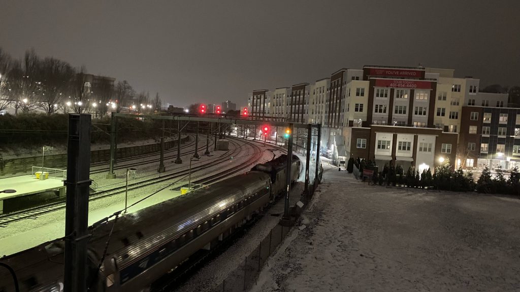
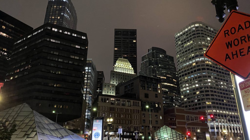
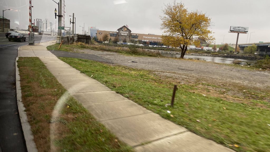
I managed to get a couple of shots of trains, and after about 6 hours and a 20 minute train delay on the last train, I finally made it to Boston. To be quite honest, Boston feels like an entirely different place at 1:30 AM. Hell, I’ve never seen downtown Boston as sleepy as I had. Even taking the Uber to Medford, with the view of the casino in Everett was an entirely different feeling. With my dropoff being a 7-Eleven, I had a mile walk ahead of me after buying some water. Of course, me being me, I braved the walk (it wasn’t bad), and I made a deviation on the way to admire the Boston skyline from afar, from Ball Square.
This feels weird, but relaxing at the same timeBoston at 2 AM!Ball Square!
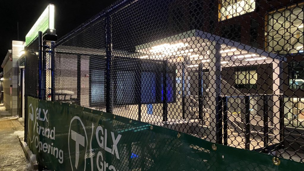
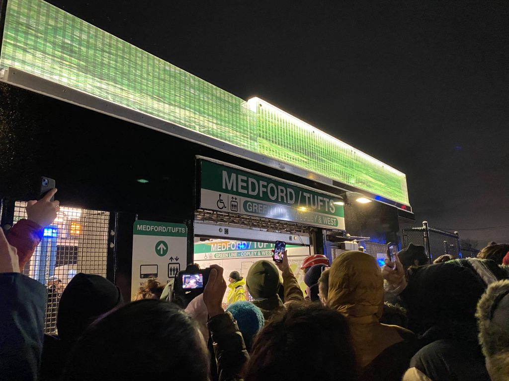
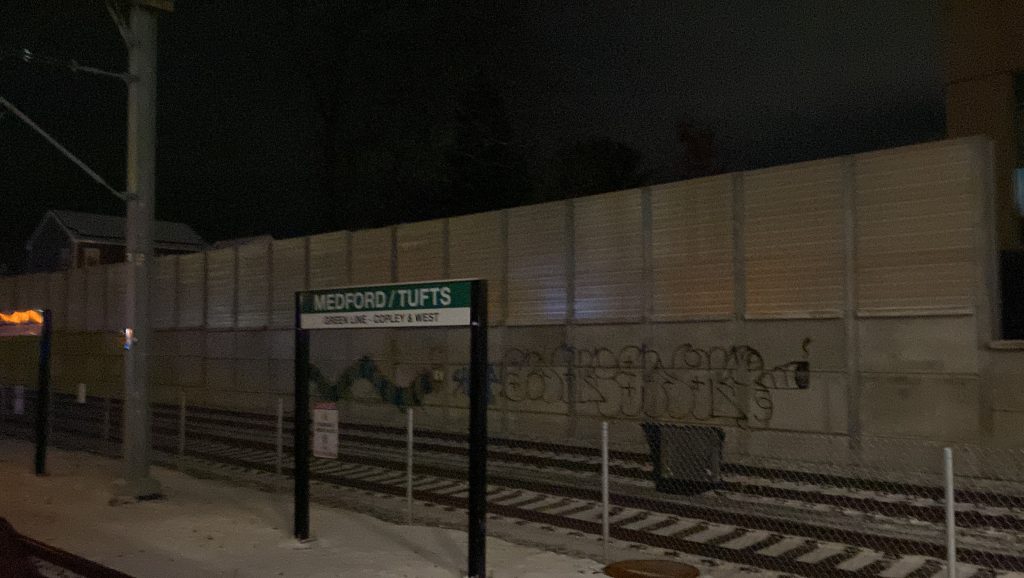
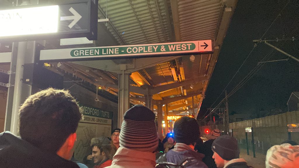
Of course, we’re not here to talk about Ball Square. We’re here to talk about Medford/Tufts University. So, I made my way there, and when I did there was a big wig from Tufts, along with some MBTA personnel, some of whom I talked to about the GLX, mainly more at the fact it’s finally finished after more than a lifetime of effort. So, thankfully, I wasn’t alone.
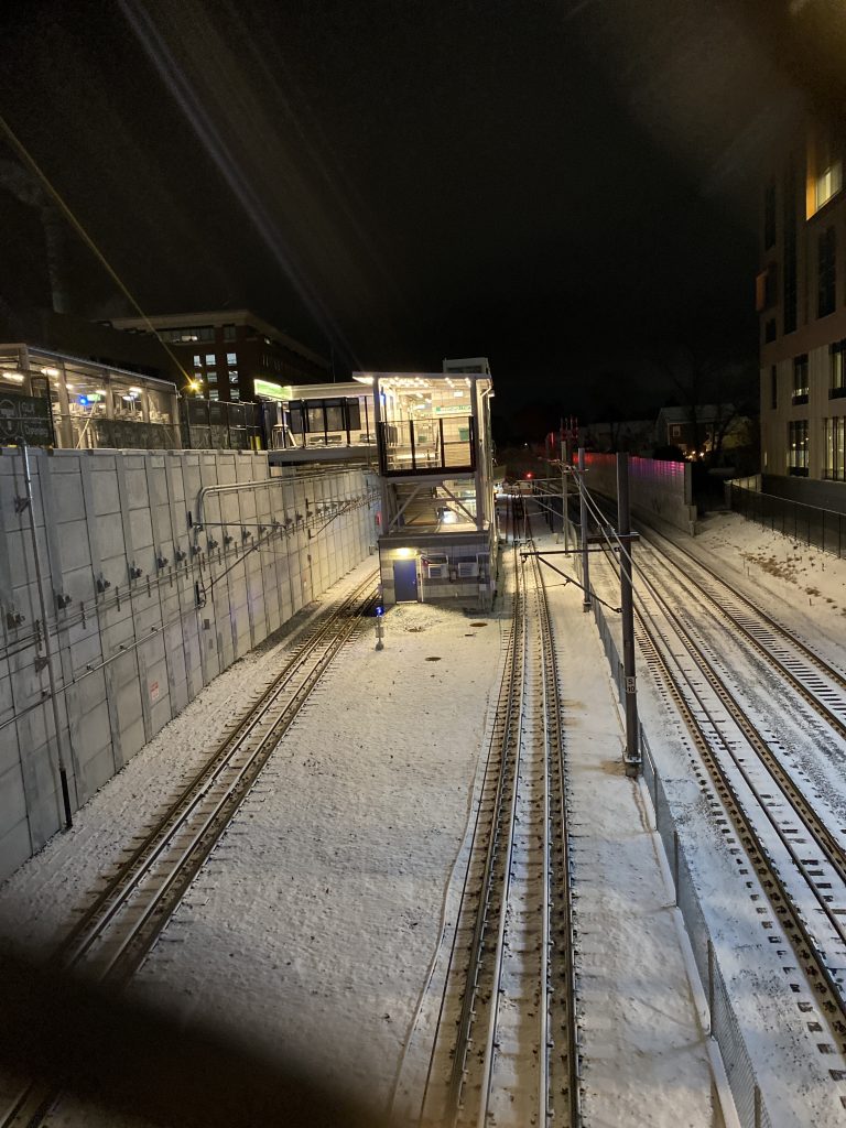
The tracks!
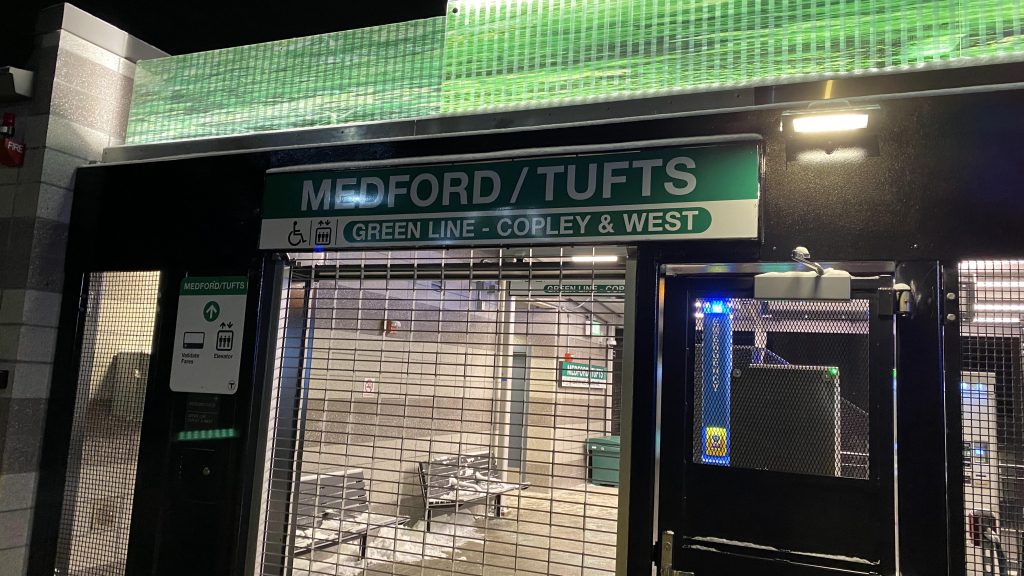
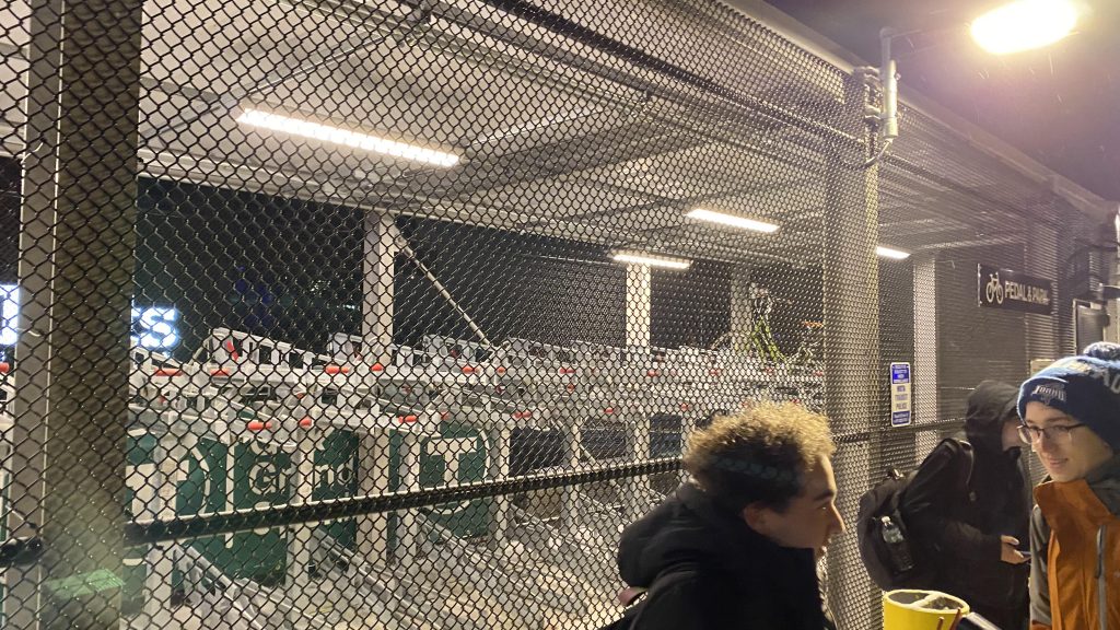
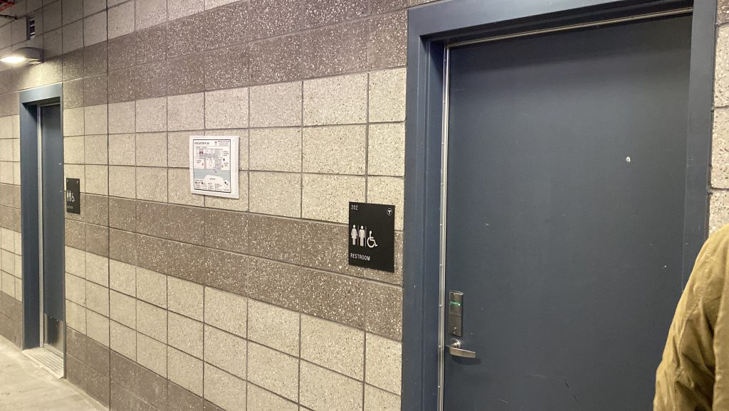
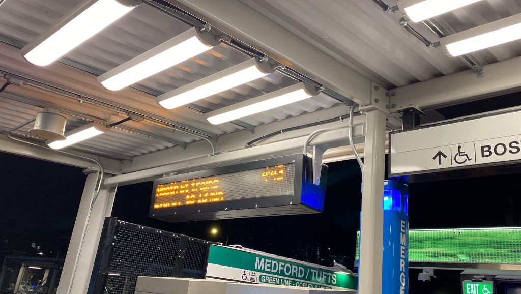
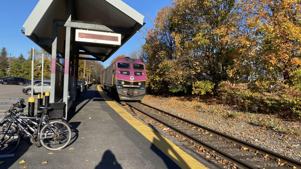
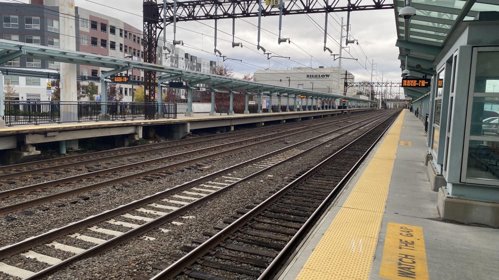
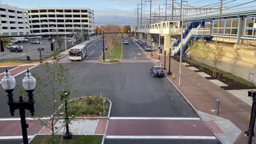
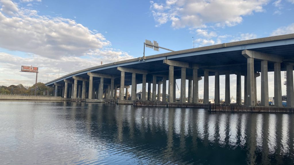
The station is sandwiched between College Avenue, Boston Avenue, and the Lowell Line’s right of way. A small bridge goes over one of the tracks, where fare vending machines, elevators, and a restroom(?!) can be found. No fare control though, so looks like it’s the honor system again. Moving down to the platform, you have two track stubs for the Green Line to terminate, some artwork, the Helvetica signage, a system map, and a sign indicating which track is departing like at Forest Hills, Alewife, and Braintree. Neat! A Pedal & Park can also be found at the station entrance.
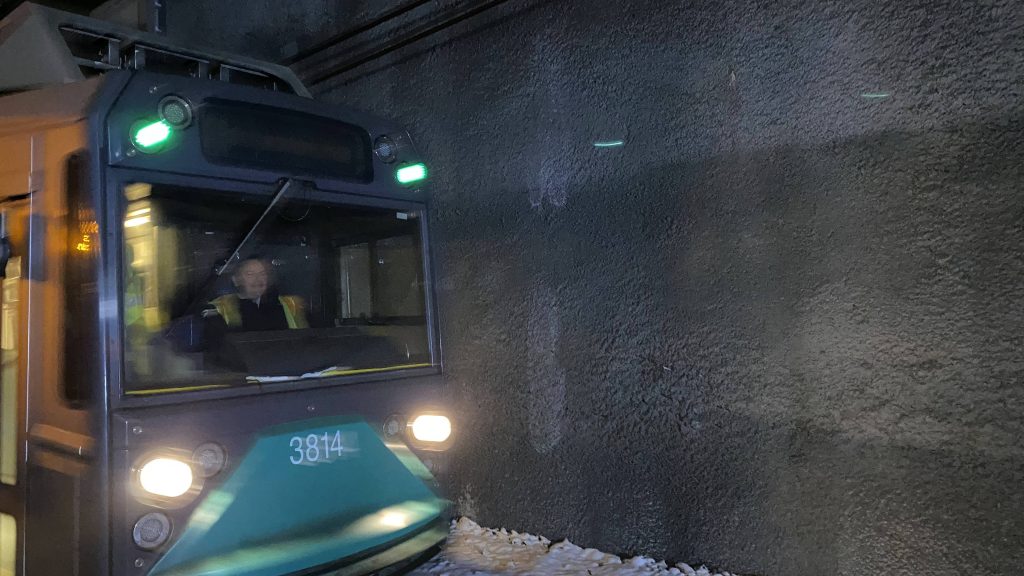
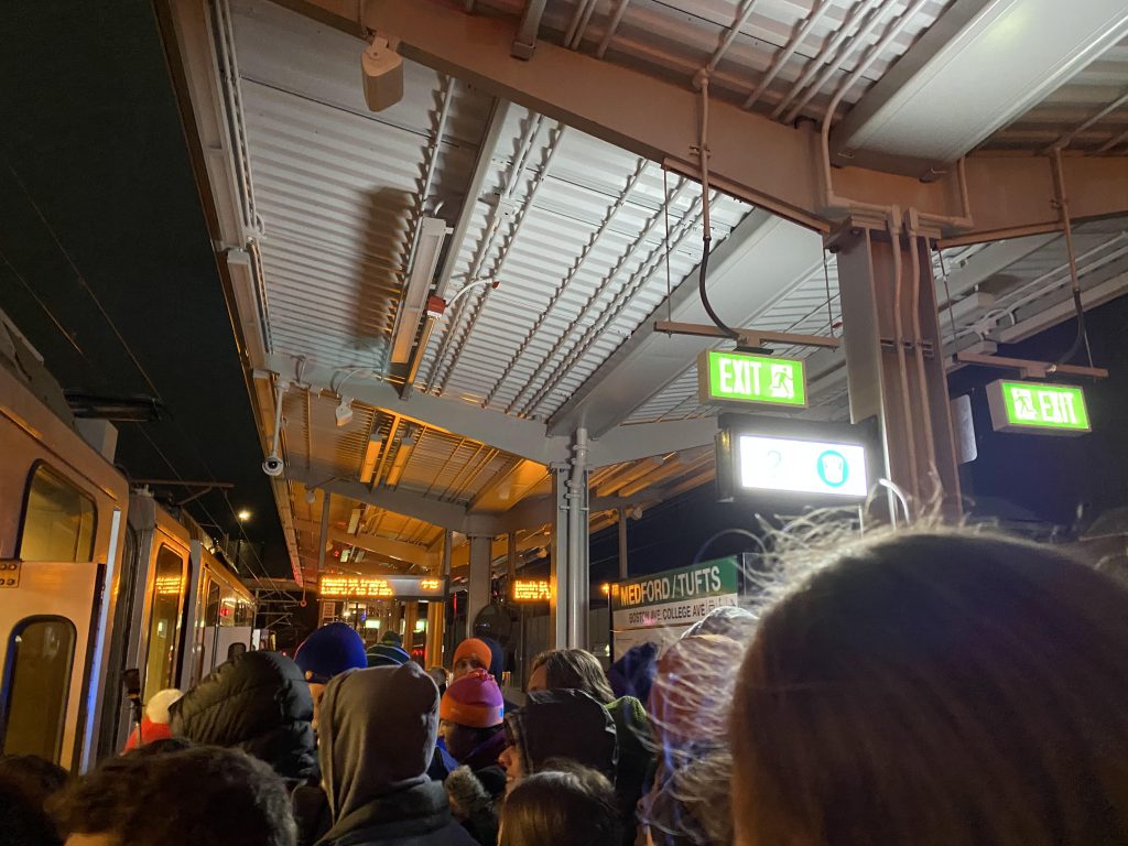
The Helvetica signage!Pedal & Park! Also, meet Toby!Another peek inside!Never challenge a Tufts student to a transit grand opening at odd hours, Mr. Poftak!RELEASE THE HOUNDS!Bathroom!Union had nonfunctional elevators, this has dead pixels!Helvetica at track level!We made it!The first train pulling in – with a type 8 leading!There was an attempt (don’t worry, I got on the type 8!)
The good: It’s a very, VERY important location! Tufts University formerly had (and barely, at that, with a hill in the way) Davis Square, and just Davis Square, for rapid transit. Now, they get the Green Line to the front door! Also, there’s bathrooms! You don’t see that at many stations not named “North, South, or Back Bay Stations”!
The bad: Really? Honor system still?! Yeah, they just yelled at us to not worry about validating for the first train. Still had to pay for the return from Heath Street, but that was to be expected. Also, the bus stops aren’t well signed.
Nearby points of interest: Tufts University is the big name here!
Transit connections: Green Line (E) MBTA bus (80, 94, 96)
Overall, this station is major, and is probably going to be the source of heavy ridership for the branch. Furthermore, the nature of the station (bringing rapid transit directly to Tufts) makes it quite a historic day for the area. Will the rest of the stations hold up? Stay tuned to find out!
Rating: 8/10
From here, I rode the train all the way to Heath St., and tried to go back up, meeting up with Conor on the train, and Lynx at Heath St. Unfortunately for us, the train was taken out of service at Park St., and we had to wait. And, while they all went to Ball Square for festivities, I skipped out, instead opting to check out East Somerville. Stay tuned!
Alrighty, so now that I’ve covered the two stations on the Stoughton Branch, now it’s time to look at the line itself.
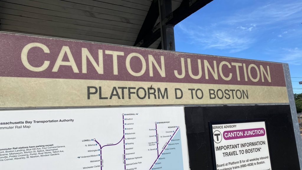
Canton Junction!
The line is a 4 mile branch coming off the Northeast Corridor mainline at Canton, Massachusetts. Among the places it stops at, aside from Canton Junction, are Canton Center and Stoughton. Service here is weekdays only, with hourly trains. Unfortunately, though, service is only that way because of the fact that the whole line is single-tracked. Also, every station has mini-high platforms, and the branch is also riddled with grade crossings, so bear that in mind. In terms of “how scenic is this?”, not very. If you’re into trees, you’d enjoy it.
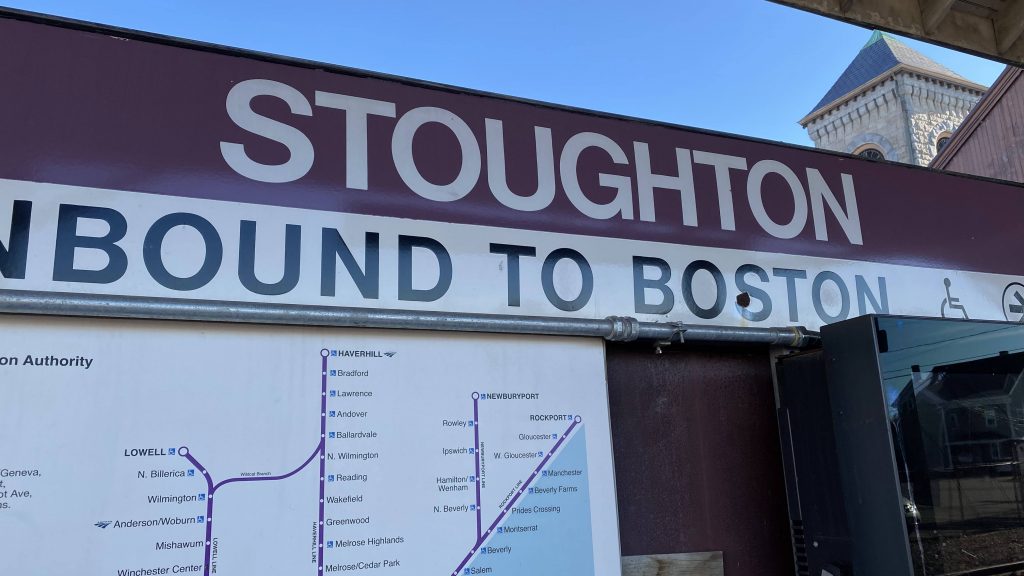
Canton Center!Stoughton!
The good: It regularly serves Stoughton outside the rush hour!
The bad: Trains are seemingly always delayed here for inexplicable reasons, and there’s a lot of grade crossings. It also doesn’t help that the entire line is single-tracked, and operates on weekdays only.
Nearby points of interest: Not much, aside from Canton and Stoughton.
Overall, here’s what I’d change. Hear me out: Either double track the entire line to Stoughton (the space DOES exist!), and electrify it.
OR: we chuck a bunch of multiple units (diesel or electric? Your choice.) to operate as shuttles between Canton Junction and Stoughton, with rush-hour service using locomotives to South Station.
However, it turns out there ARE plans to electrify the line with the South Coast’s phase 2 extension, also including double tracking and station rebuilds. Thank GOD.
Alrighty, so we finished Canton Center, now let’s look at the other station on this branch.
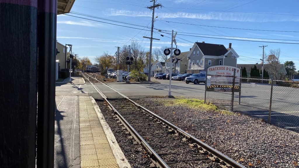
Helvetica!
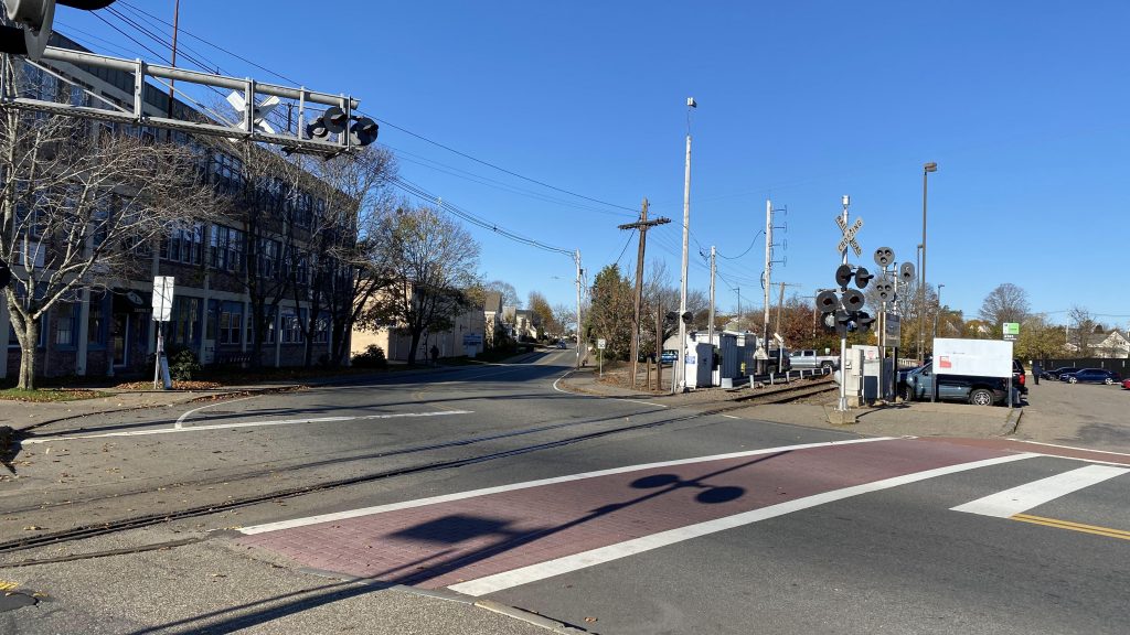
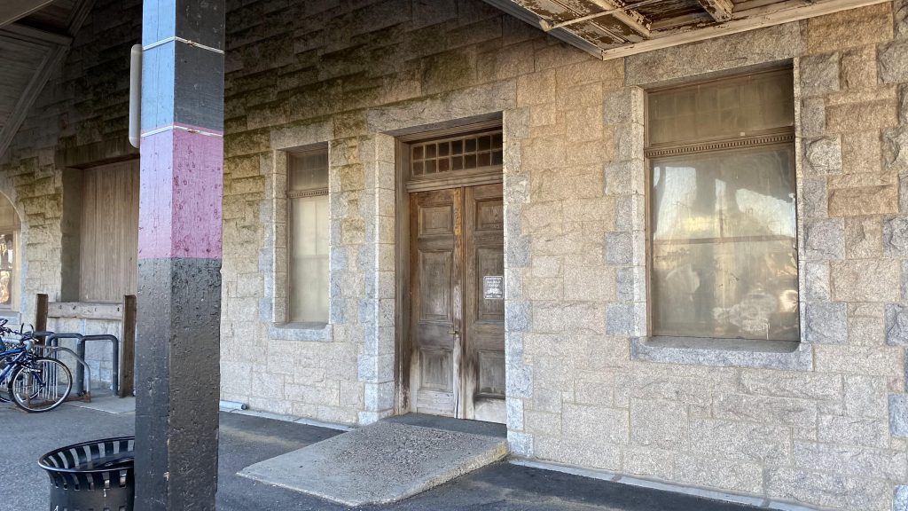
So, first off, the damn train spills over a couple of streets when letting people on and off! That means, as soon as a train leaves the siding where it lays over (remember, it can’t sit at the station otherwise it’ll block two streets for upwards of 30 minutes!), the bells ring and the gates come down. Furthermore, the low-level section of the platform is bisected by Wyman Street. At least there’s a few benches and a sheltered area – but not on the mini-high. WHY?! THAT’S LITERALLY THE ONLY AREA YOU CAN BOARD AT ON OFFPEAK HOURS! There’s also a station building, but there’s nothing inside. Or, rather, there is – just, nothing usable. But hey, at least unlike Canton Center (and Junction, for that matter) there’s actually a departure board!
UhhhhhParkingAnother crossing!Can’t exactly read thisThe station building
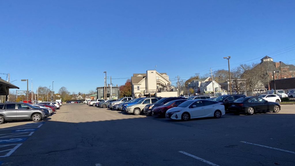
The good: It’s in Stoughton’s town center! There’s also an abundance of parking, if that’s your thing
The bad: There’s no benches on the mini-high! WHY?! And, this is one of those “screw you” stations where, if you’re cutting it really close, you can be screwed over by the existence of the crossings. There’s also not much in the way of a station building, since it’s closed. The platforms are also bisected by Wyman Street. Yikes.
Nearby points of interest: Downtown Stoughton seems like a nice place!
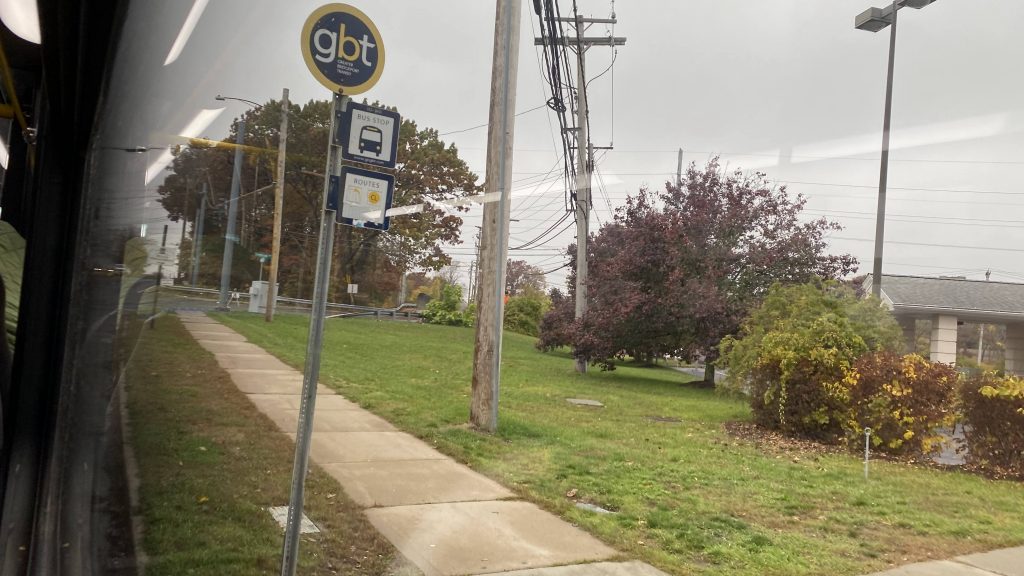
Transit connections: Commuter Rail (Stoughton Line) BAT (14)
Overall, I’d delete the crossings and grade separate the whole thing if I could change the station. The building itself is nice, but those crossings are a problem, and even Stoughton’s officials find it a problem with a proposed rebuild in South Coast Phase 2. So, my proposal to that would be to grade separate the whole line.
Alrighty, so today’s excursion was a trip up to Canton and down the Stoughton branch. And, as such, I’ll be taking a look at the two stations on this branch line. Meet: Canton Center.
Helvetica!
So, Canton Center is the lesser-used of the two stations on the branch, clocking in at just under 500 daily riders. Actually, this is the least-used station on the line, aside from the South County Extension stations. As for parking, the amount is relatively anemic, as it’s located in Canton’s town center. There’s also a singular side platform with a mini-high……which isn’t sheltered. Yeah, that’s a major “screw you”. That grade crossing? Also a major “screw you”. The way it works, trains have to stop to pick people up/let them off outbound, INCH CLOSE TO THE CROSSING, STOP TO LET THE GATES COME DOWN AS THE ENGINEER IS BLASTING THE HORN, AND THEN GO FULL THROTTLE AFTER THE GATES COME DOWN. Yeah…
Oh look, a train!Mmmmmm, diesel!Not a lot of parkingSee ya! Oh look, an old-school sign akin to what used to be used on the mainlineThe sorry mini-highAnd away she goes!TRAIN #869 TO STOUGHTON IN SIX MINS (hehe nice…)This was train 867, I think the sign might be broken.
The good: Well, it’s a good enough “relief” station for those who don’t want to be on crowded northbound Providence trains! Sure, there’s no indoor waiting area, but odds are you’re probably going to be parking and riding here, which isn’t a big issue since the lot is small as-is. There’s also seating!
The bad: NO, NO, NO! WHY IS THE MINI-HIGH UNSHELTERED?! WHY THE GRADE CROSSING SITUATION?! WHY, HOW, WHY?! There’s not even any weekend service down here, aside from the MBTA’s 716! Never mind that, the fact you’d have to inch to the crossing to force it to come down. What is this, the Shore Line East at New London?!
Nearby points of interest: Well, Canton Center seems like a nice enough downtown area.
Transit connections: Commuter Rail (Stoughton) MBTA bus (716)
Overall, just why? I guess if you want to avoid Providence trains, it’s good enough. But, like, double track and rebuild this damn place! Hell, the plan is for that to actually happen under Phase 2 of the South Coast extension.
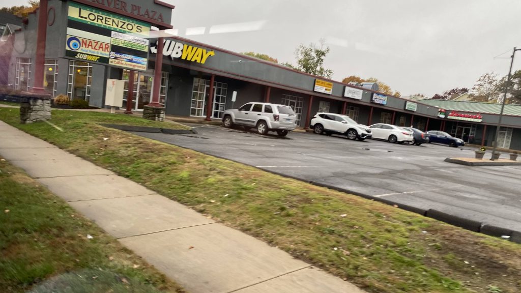
Oh boy, this one’s a doozy. So, who wants to ride a bus for 2 hours straight? Yeah, me neither. I’m not exactly an “extreme commuter” or anything like that. However, we do have a route that fits the “let’s ride a bus for 2 hours” bill. Meet: the Coastal Link.
Some backstory: So, I first found out about this route through a Miles in Transit video where he rode it the other way (Norwalk-Milford). At that point, I haven’t even considered making this blog yet, and when I did make it I wanted to do the Coastal Link, just for how long it is. Sounds fun, right? Then, I wrote my entry on the 261, and came to LOATHE stroads for the lack of anything interesting to say about them. That’s when I said “oh dear god no” when I saw that the Coastal Link was on my todo list. And, while it isn’t the longest bus I’ve ridden for distance (that’s the 95X), it definitely is the longest route by runtime (by bus, beating the 14’stwo branches). So, let’s get into this 2 hour marathon.
Leaving the mall
So, waiting at the mall after getting off the 271, all seems normal, right? Where’s the bus? It’s supposed to be laying over! I check the tracker, nothing. One bus even DISAPPEARED. My first thought was “oh crap” until 10:25 (3 minutes late!), a Milford Transit bus pulls in with the destination sign reading “CL COASTAL LINK”.
That explains it, because Milford Transit doesn’t even have GTFS or tracking of any kind. So, aboard the bus and off we go, down Route 1. Oh dear god, stroads…
I WALK TO BURGER KING, THEN I WALK BACK HOME FROM BURGER KING!!!Nah, we ain’t expressing. That’s cheating!
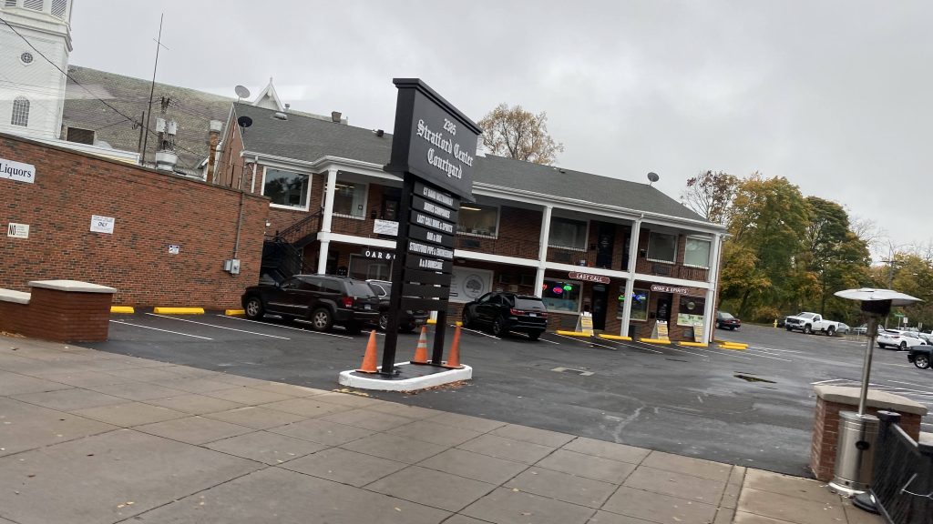
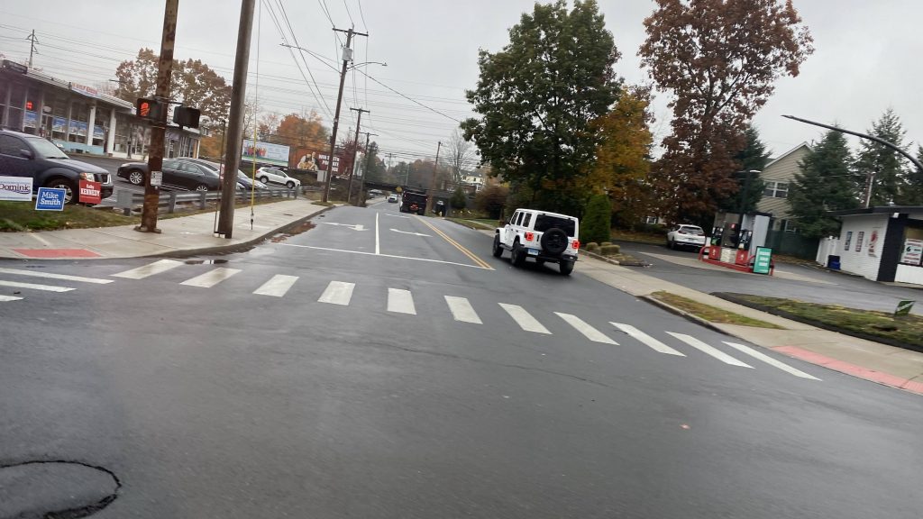
So, we go down Route 1, turn down a street into downtown Milford, and down Broad Street. At this point, we’re in flag stop territory as Milford Transit doesn’t really have signed bus stops. Several people got on, and we high tailed it out, turning onto South Broad and eventually Bridgeport Avenue. Fortunately, it was a straight shot into Stratford and deviation #1 (2? Would the mall count?)
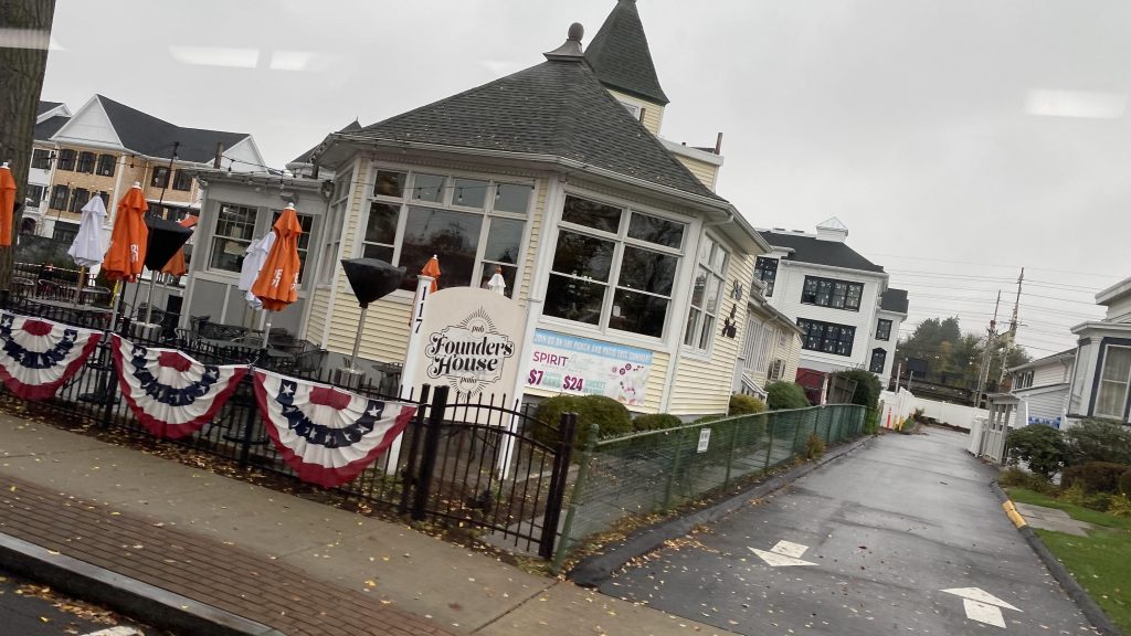
Cumby’s!Shop-Rite!Crossing a small creekMilford’s Metro-North stationFounder’s HouseI don’t even remember what this wasAnother restaurantEww, car dependencyIs that a playground?OH MY GOD IT’S A PONZI SCHEME!A shopping plazaI said NO CHEATING!!!Yep. Still in New England.Devon Center!The- *checks pronunciation* The hauser tonic river????? Did I get that right?HAUSER TONICS?!…A Family Place! (despite being a strip mall largely)
Alrighty, now that we crossed the… *looks at pronunciation key*
Hauser Tonic River? Did I get that? They named a river after Stjepan Hauser?! Oh, oh HOOSA-tonic. Damn, that’s disappointing.
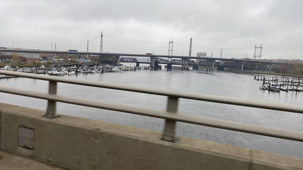
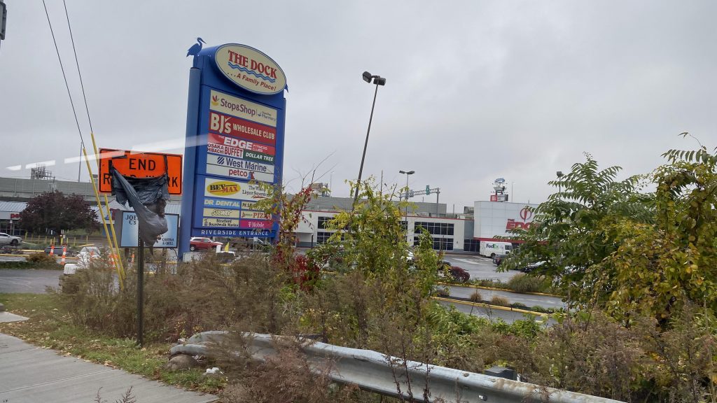
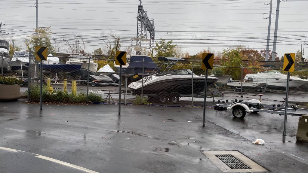
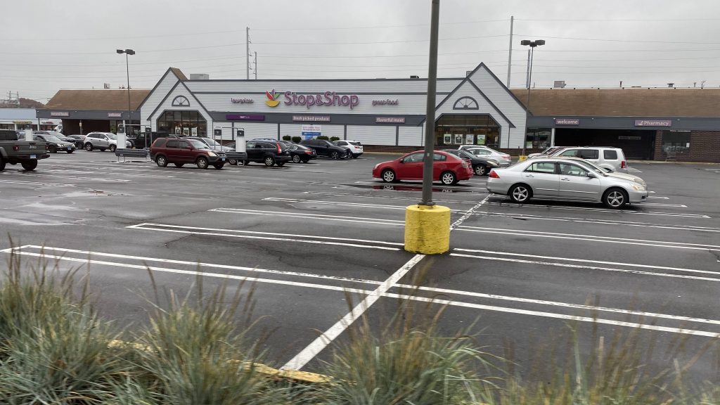
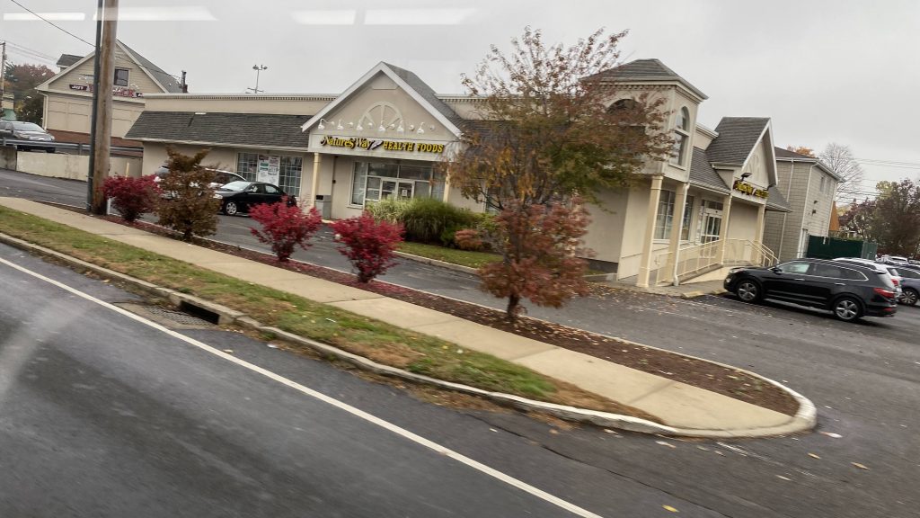
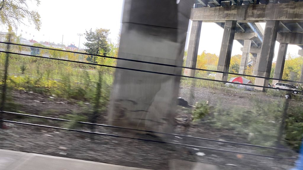
After crossing the Housatonic River, we entered Stratford, left flag stop territory (stops were signed), and deviated to The Dock Shopping Center, and a double deviation to Stop & Shop specifically. Upon finishing this, we turned onto Barnum Avenue, passing a Walmart. Turning down Main St. brings us past Stratford’s Metro-North station. From here, we pressed on further down Main St., eventually turning down Stratford Avenue, and soon enough entering Bridgeport. At this point, we had townhouses lining the streets and, while it wasn’t the best-looking area, it wasn’t the worst either. Around here was where ridership started to pick up, with the bus eventually reaching about 80% capacity. Yeah, I didn’t think I’d see a Milford Transit bus this full. As we pressed on, we crossed a couple more rivers, passed a Bass Pro Shops, and went under the interstate twice, passing homeless camps, until we deviated into the GBT Terminal.
Some more New Haven LineStop & ShopGODDAMMIT, EVEN ON MY DAYS OFF I CAN’T ESCAPE THE WALTONSA GBT bus signI spy a Waterbury trainAnother shopA small shopping plazaI spy the interstateAt this point, we were in BridgeportOoh, the playground!More New Haven Line goodness. Man, those catenaries look sorry as hellNear the Bridgeport layover yardA small churchSome housing, inching closer to the bus terminalA grassy field near I-95Bass Pro ShopsStarbucks behind the treesA homeless campThe bus terminal’s buildingIN A PINCH? CALL FINCH! (but also OH NO, DOTS!)
Alrighty, so after deviating into the GBT bus terminal, swapping an 85% full bus for a 95% full bus, we turn down John Street and Fairfield Avenue. From here, we still pass a bunch of houses and shops, pass under the New Haven Line again, and pass under I-95 again. And it’s more of the same. Again. But at least we pass a Dunkin’ and a creek! Neat.
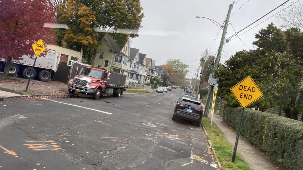
Stroad HELLYep. Still New England.Fenced off lotI don’t even want to knowA Mexican restaurant?Respect the dead, dammit!Fancy-ish street signMicky D’s!SIR, THIS IS A WENDY’S!A side streetA dead end streetA creek
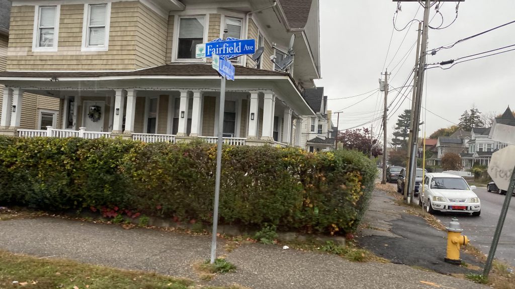
At this point, we were in Fairfield, and we’d reach Route 1. Again. But, the interchange was a bit hacky since the bus stop was positioned in such a way where a sharp turn was necessary. And yes, someone DID get on here. We kept on down Route 1, through Fairfield’s town center and past the town green. I must admit, it seems like a nice area, save for on-street parking on a stroad. We also passed by a side street near Fairfield’s Metro-North station. But, once we left Fairfield for Westport, it was stroad HELL.
Turning!Grassy!Citgo and the New Haven LineA theater!This feels like 11ft8DAIRY QUEEN!sbubbyFenced-off grassy fieldInto Westport!
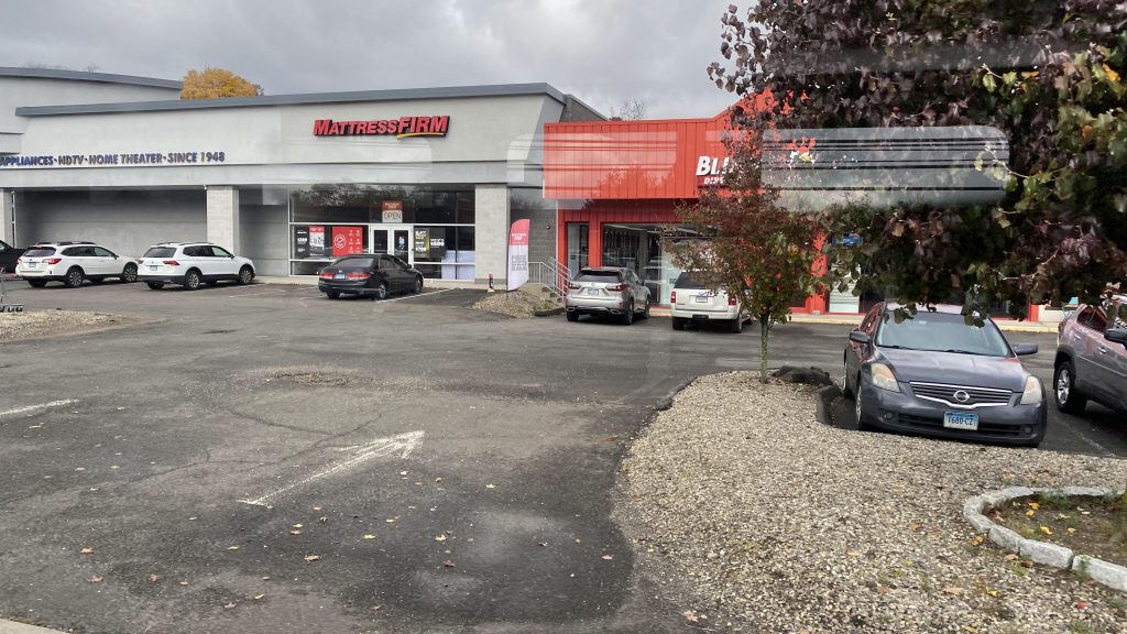
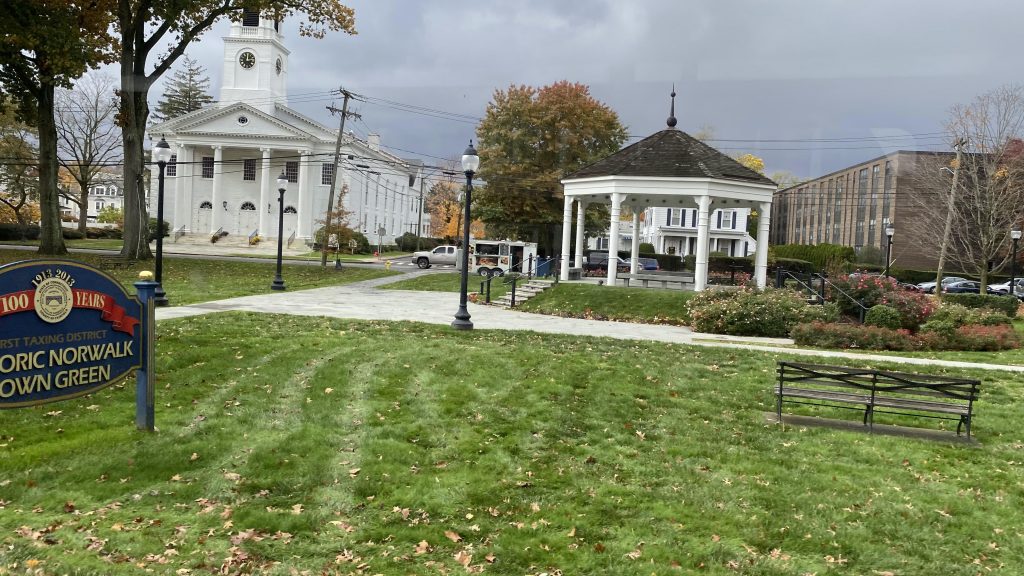
Of course, once we entered Westport, it was stroad HELL. It legitimately was nothing but shopping centers on either side. No deviations either. But, wait, there’s a proper downtown area in Westport?! Holy CRAP! Sadly, though, it’s nowhere near Westport’s Metro-North station. But then we crossed the Saugatuck River and it was the same crap. Strip malls and needlessly wide roads, all dragging on forever. Until, oh crap, we’re entering downtown Norwalk! Yeah, we took a turn at East Ave., passed the Norwalk Green, crossed the Norwalk River, and a few more turns and FINALLY we made it to the WHEELS Hub!
Oh please, more plazasLeavesI think this is an office park, I don’t rememberAn apartment and assisted living complexA smaller shopping plazaComing soon!THE GOLDEN ARCHES RETURNOh please, ANOTHER strip mall?!AND YET ANOTHER ONE! This was why highways were invented!A real estate officeMore shoppingAND MORE CAR DEPENDENCY!AND THE BILLIONTH STRIP MALLAt least there’s a storage facility!Look, money laundering!I don’t remember what this was eitherAre we there yet?!The Norwalk Green!So close!This feels like WoonsocketTrees and the Norwalk River!A BENDY BUS! (obviously, not Milford Transit, but it’s the end of the line no less)
The good: You can’t say it doesn’t serve a lot! Yeah, it serves quite a bit. Three RTA jurisdictions (5 if you include the Stamford and New Haven divisions of CTtransit!), several towns, all stretched out over 20 someodd miles. Plus, it’s pretty much THE definition of a cross-regional bus route, serving multiple major cities along the way and with the various smaller communities. Also, it’s only $1.75 (which seems to be standard statewide, regardless of authority), vs. $4.50 for an intermediate ticket on Metro-North (from Milford to South Norwalk). And it runs to 10pm?!
The bad: It’s a bit long! I mean, yes, it’s intended to connect multiple places together, but it just drags on. The fact it’s all stroads doesn’t help much here. And, no front-door service to Metro-North? Would it have hurt to deviate into Stratford’s inbound platform at least, along with Fairfield’s?
Nearby points of interest: Norwalk! Bridgeport! Stratford! Milford! Also the Post Mall (which is the largest in the state!)! Also, whatever is in Westport. Yeah, there’s not much around there given the stroady nature. There’s also Fairfield, which seems alright.
Total crossings over the New Haven & Danbury Lines: 7
Total crossings over I-95: 10
Overall, it’s a decent route. A marathon, sure. But, it gets the job done as a link between the communities it serves. Plus, the connection between transit authorities and CTtransit is always nice. But, if you’re looking for speed, just take Metro-North.
Alrighty, another CTtransit route! Now, this one’s a bit tricky as there’s THREE(!!!) variants of the route. But, looking at the schedule, the 271M to Milford is the full run, with the 271S to Savin Rock and the Sunday-only 271R being short-turns. The full run also runs every 40 minutes, while trips go to Savin Rock every 20. Now, with that out of the way, let’s get into it.
BENDY BOY
So I got on the bus at Union Station instead of the New Haven Green, and from there we were off to the races. A few turns and Route 1 later, we were on Howard Avenue. Was there a prison? Not really. However, I wouldn’t describe this as the best part of New Haven. Dangerous still? Not really, though. But it was a high ridership area, and from here, we turned down Kimberly Avenue. We passed through a bunch of row homes and shops, even a school and a park. Soon enough, we went under the interstate and over the West River, into West Haven.
Not very developed.The roads are in horrible shape, it looks likeAn apartment complexCTown Supermarket!More housingYep, still in New England.The West River
So, at this point, the road became Elm Street as we passed more of the same. Yep. More houses, more shops. Same stuff, different town. We made a turn, down Campbell Avenue, which seemed sorta walkable, I guess. It has parking on the sides of the street. Eventually, though, we’d make our way to the ocean and Savin Rock Park. By this point, ridership has fallen significantly, but there were still a few people on the bus.
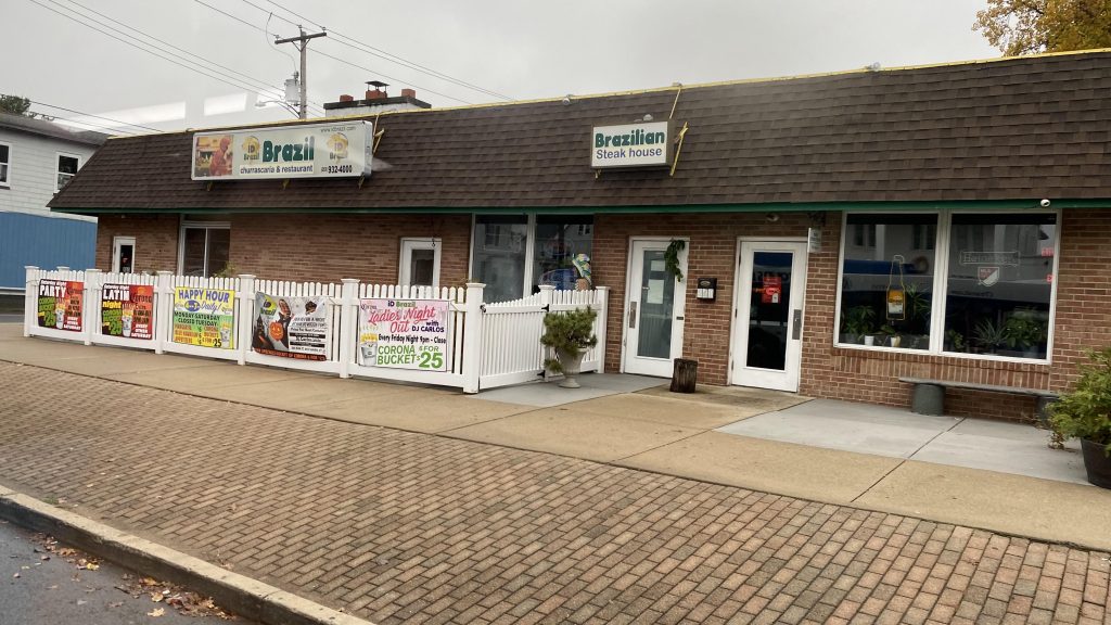
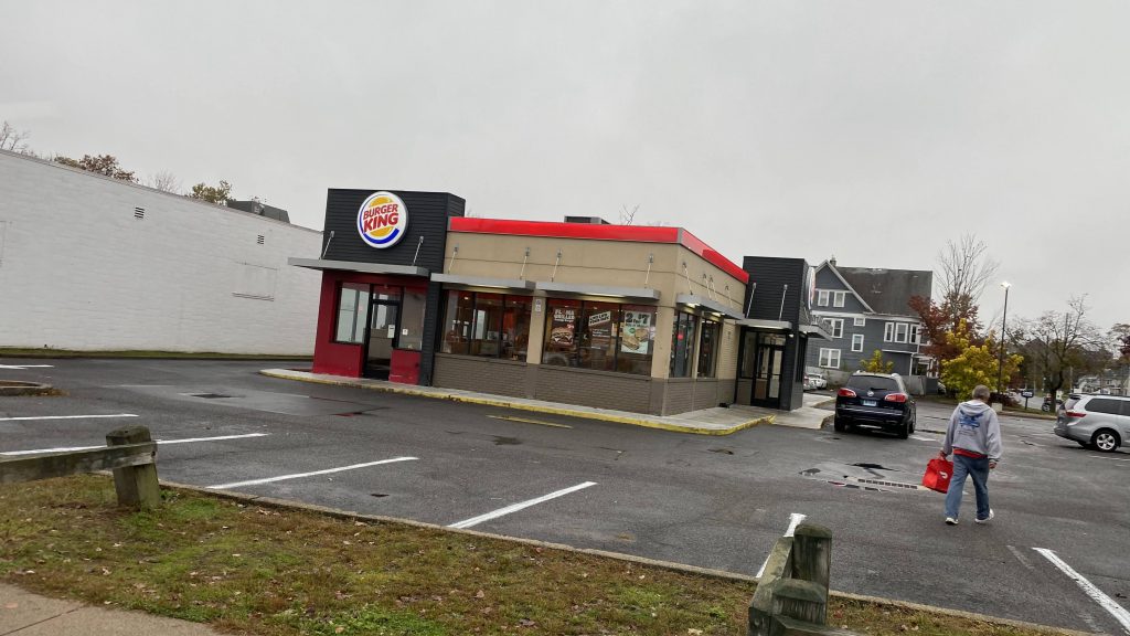
eef freefIs this a castle or something?Brazil!Kurger Bing!Town hall!Even more housing, oh my!Look, a Dollar Tree AND a Family Dollar!Scenic!
Alright, from hereon out it was what is probably rich NIMBY hell. Following the ocean, on the side I was sitting on, it was just houses upon houses, sometimes a park, but it all looked like it’d belong to rich people. There was also a beach along the way at one of the turns, and the other side had much more for the eyes to see. Eventually, there were some shops like Sunoco and Dollar General. At one point, we even turned down a side street that probably shouldn’t have buses on it. And yes, it’s part of the route.
This feels like rich NIMBY hellA fire station and a parkPond!Sunoco!Look, another Dollar Tree!And some food truckA side streetSharp turn!Another side streetDollar General!More rich NIMBY hellCrossing somethingMore housesNIMBYISM AT PLAY, BABYAYYYYOH NO EVEN THE CUTAWAY VANS HAVE DOTS!!!
Finally, we made it to Milford. From here, we turned down New Haven Avenue, deviated towards Milford’s MNRR station, and went back up the way we came. From there, we went further up Gulf Street, and down Route 1 to the end of the route at the Connecticut Post Mall.
Pond!Not yet!I SAID NOT YET!Milford’s MNRR stationRespect the dead!The mall!
The good: Well, it serves a lot of mostly high density neighborhoods! It also directly-ish serves Milford’s Metro-North station, along with the Connecticut Post Mall. Short-turns to Savin Rock are also nice, since not everyone needs to go the full hour ride out.
The bad: What’s with Sunday routing being different? It also feels like it drags on forever through rich NIMBY hell, but to be fair not many people there are probably looking to take CTtransit.
Nearby points of interest: Milford’s downtown and the Post Mall. Also, Savin Rock and the West Haven Green.
Overall, it’s a decent enough route. It definitely serves a lot, and, at least on my run, was a few minutes early. Nevertheless, I’d say that this route would be better having the express variant over the 261.
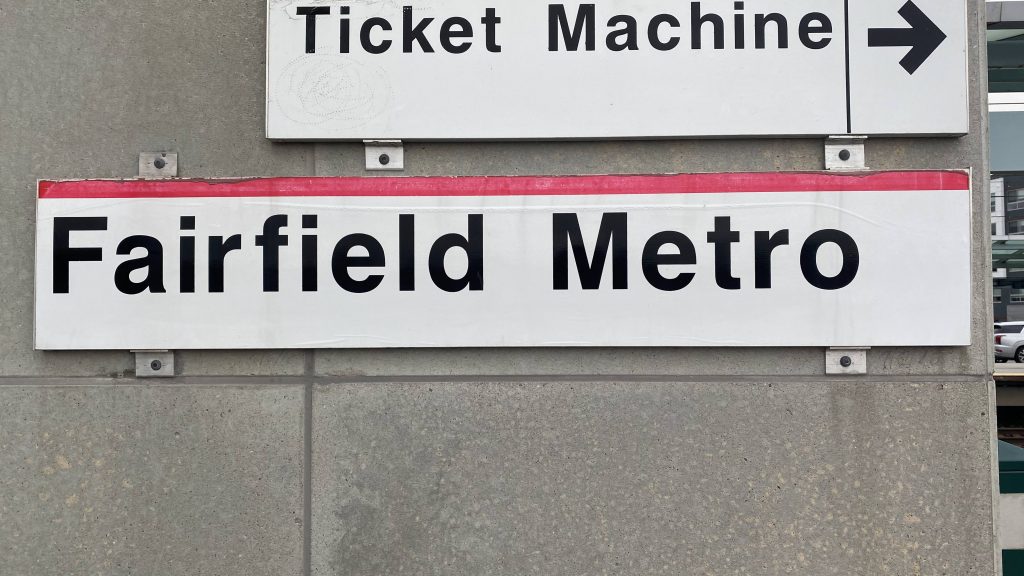
Nono, this isn’t Fairfield (Metro-North). That’s next time I’m in the area. This is Fairfield Metro (Metro-North). Okay? We good? I know, it’s a little confusing. But, let’s dig into it.
You good?
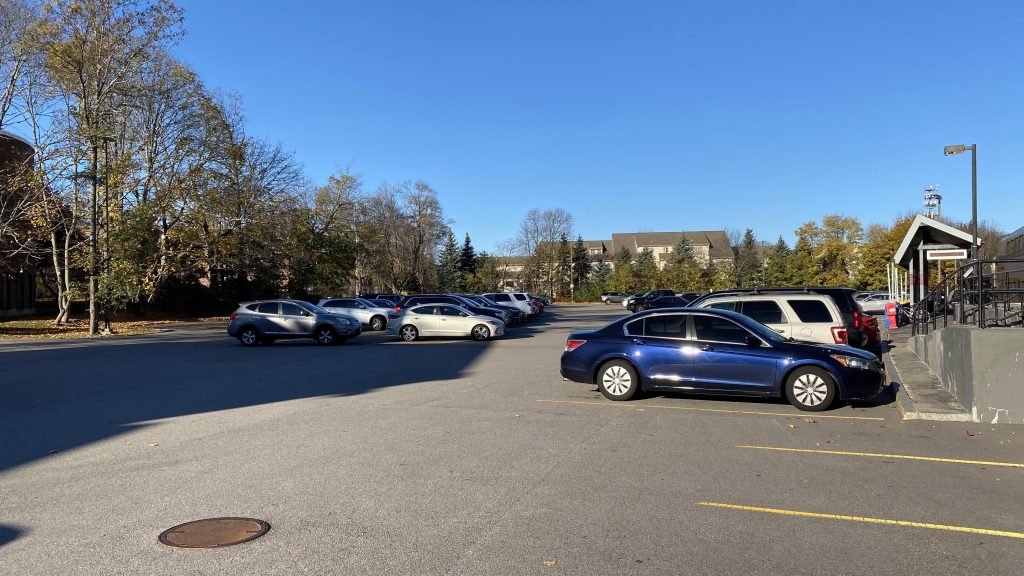
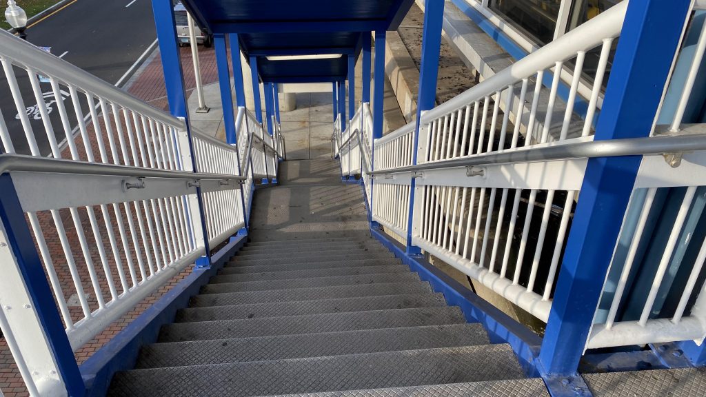
Okay, so of course, getting off the train, the platform is very much still seemingly immaculate. You’ve got benches, a huge parking lot (this was built to relieve pressure on Fairfield!), and would ya believe it, it’s fully accessible! YAY! That’s by virtue of a bridge over the tracks, which have elevator access! Ticket machines also exist here. Lastly, you have bike racks on the inbound side, along with what looks like a busway. If it is a busway, it’s kinda useless since nothing stops here, well, at the station itself. GBT stops on Kings Highway just outside the station (0.1 mile walk) with one route.
See ya!Southbound!The other platformThat’s a lot of parking!Up the bridge!There’s a destination board here!The obligatory from-bridge view. Why is the center-right track the only one with concrete ties?The busway (I think???)An Acela!
The good: It’s got ridership, that’s for sure! Given that most of the parking lot was used when I was here, it’s clear that it’s serving its purpose as a relief station for Fairfield. Furthermore, most trains stop here unless it’s an express.
The bad: The platform is kinda long, maybe overly long, but then again some trains CAN be long. Plus, what’s with that thing that looks like a busway?
Nearby points of interest: Not a lot, but there are a few shopping centers nearby.
Transit connections: Metro-North (New Haven) GBT (5 on Black Rock Tpke., 7 on Kings Hwy.)
Overall, it’s a servicable station. It’s not bad, but it just feels like it’s lacking in character. Or, maybe, the character is in how modern it is. And, as a relief station for Fairfield, it gets the job done pretty well.
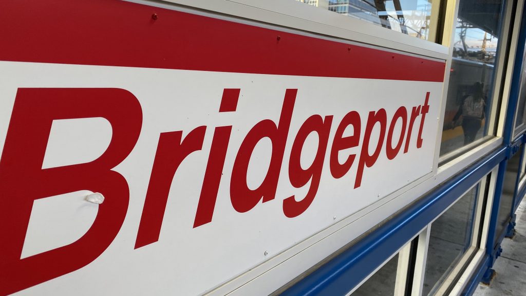
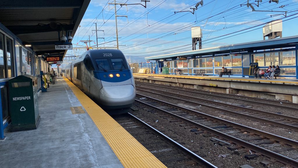
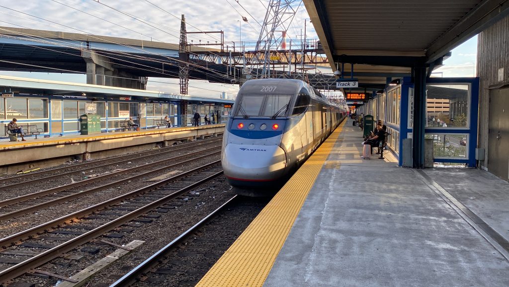
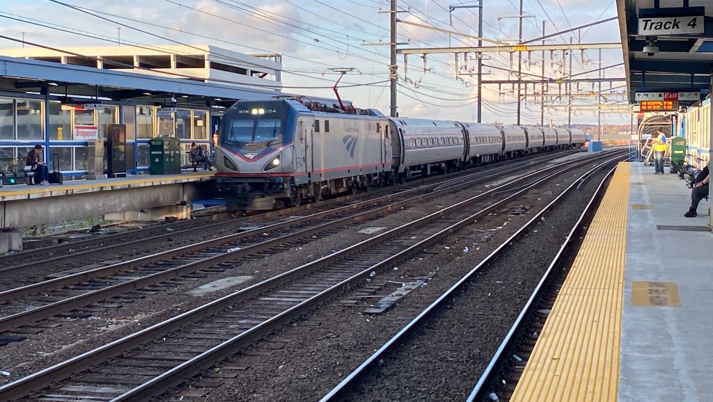
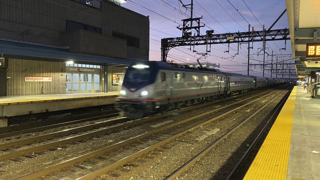
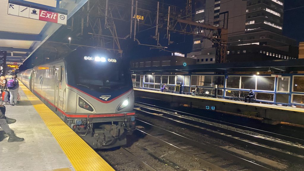
Oh boy. This one’s a biggie. So, we have an Amtrak station in the largest city in Connecticut, and it’s hardly used on that front. But on the Metro-North front, it’s very heavily used. So, let’s take a look. This one’s gonna be long.
The station signDamn, that screen can take quite the beating!
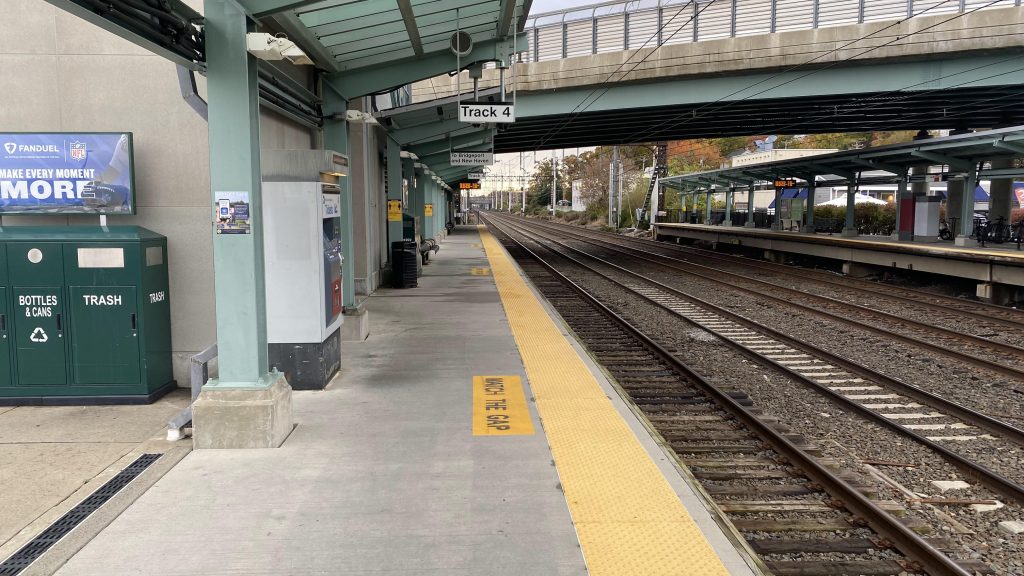
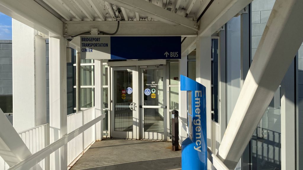
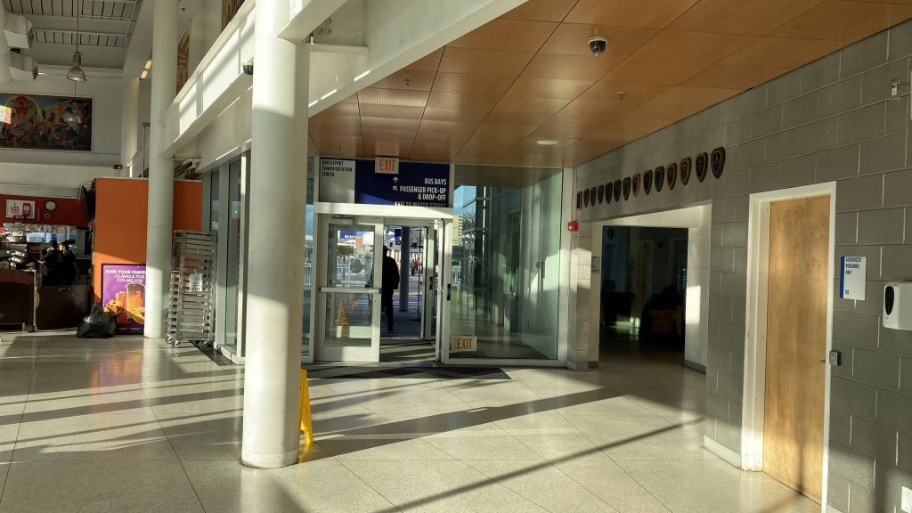
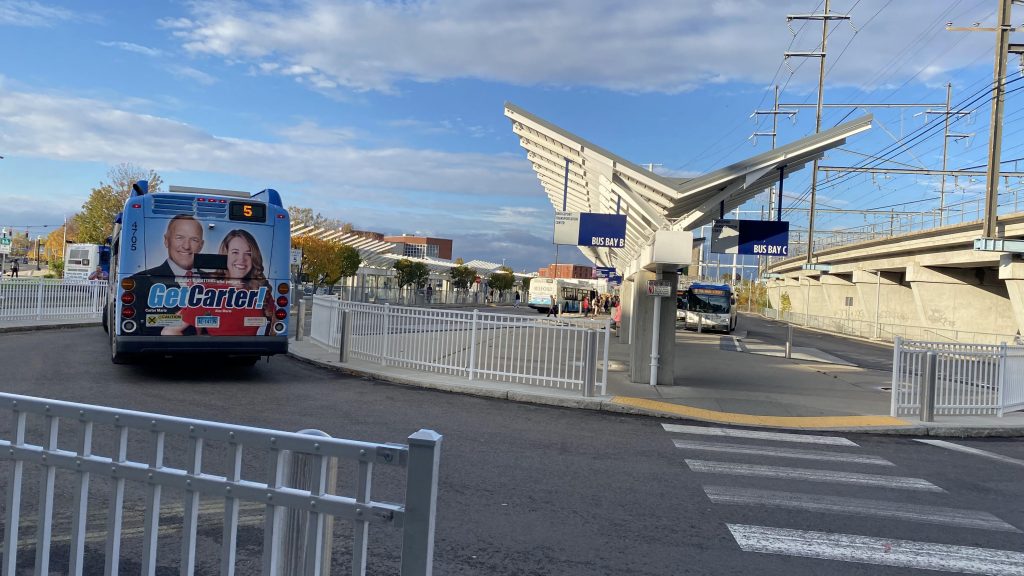
So, let’s start things off with the GBT bus terminal. It’s well-lit, modern, and has a direct (albeit long) on-foot connection to the southbound platform. Furthermore, all the berths are clearly labelled so no guesswork has to be done. Would be nice if they had schedule info here, though.
The entrance to the bus terminal from the train stationThe waiting area. Yes, that’s a Dunkin’!Get Carter!
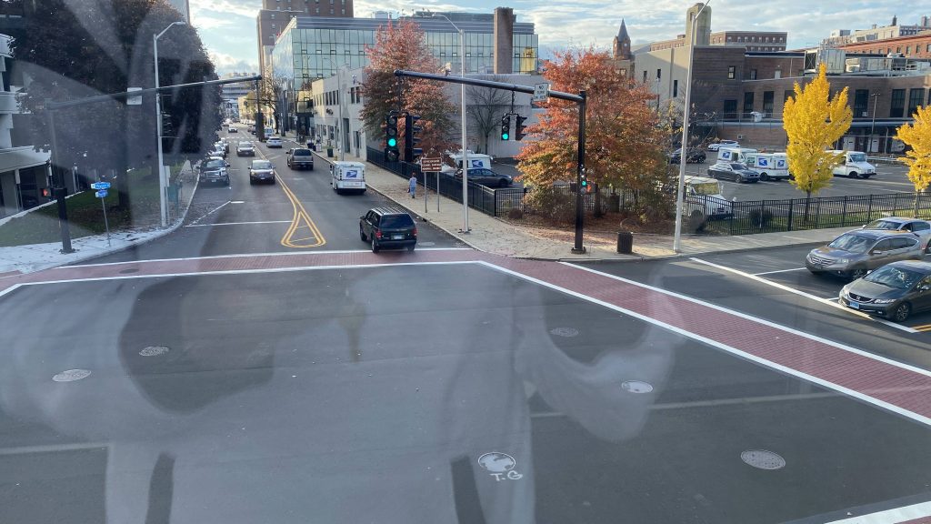
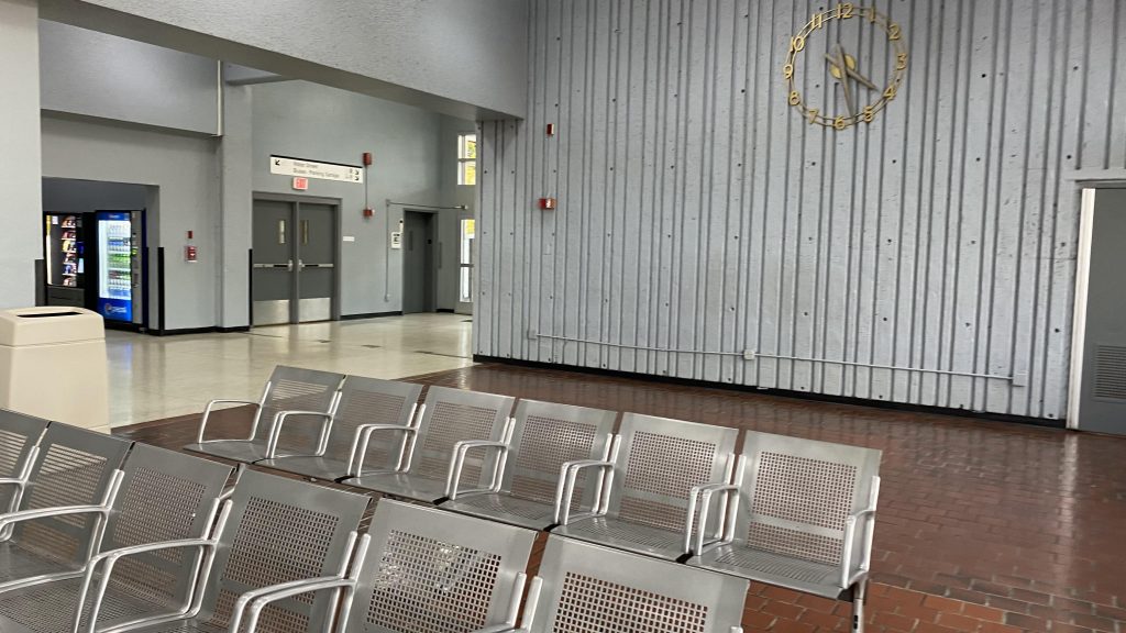
From here, after burning my eyes out with the dots on the buses, I went back and into the station building. On the inbound side, you have the restrooms, an MTA Police booth, an MTA information booth (unstaffed), a Quik-Trak machine, a cafe, and access to the parking garage and Water Street. The station building itself is actually located directly above Water St., so that’s cool.
Stroad and a reflectionOH NO, DOTS!Water St., from the station buildingThe waiting area
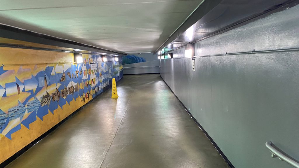
Access between the platforms is done via an underpass, which also provides more street access. Elevators are also found here, as well as solicitors.
The underpassThe other sideWoahThe outbound waiting room
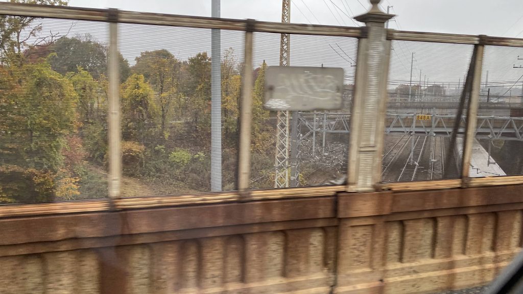
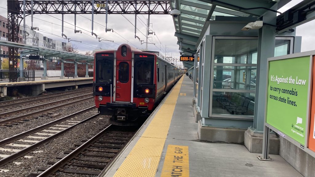
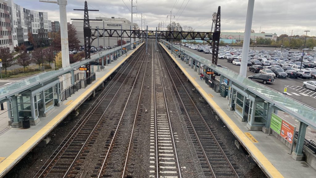
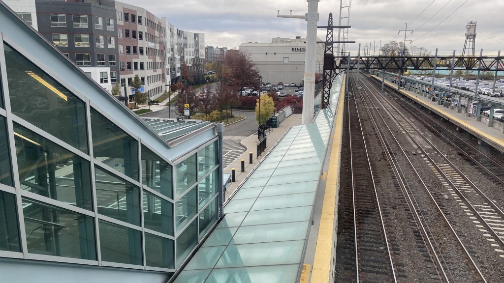
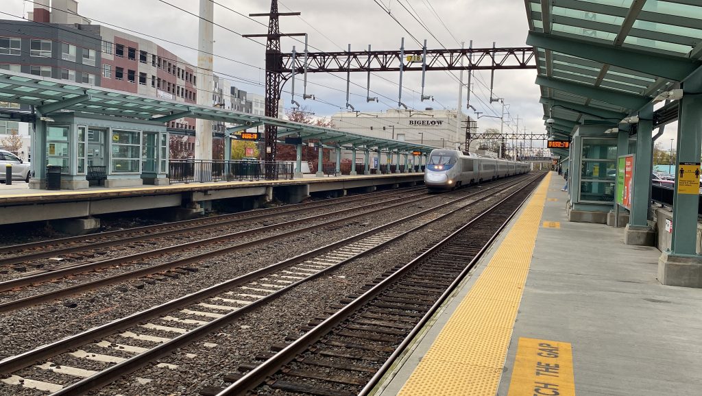
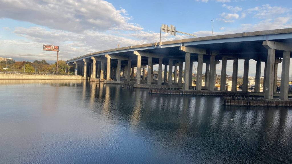
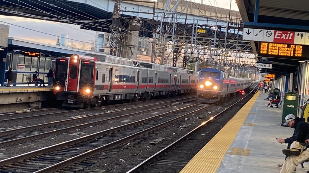
On the other side, you have a much smaller waiting room, with another ticket machine and schedule info. Not much to say here aside from the views of the Pequonnock River (try saying that 5 times over quickly!) and the interstate. Now, the platforms. You’ve got a lot of benches here, and it’s all fully sheltered. Yay! Furthermore, it’s pretty good for railfanning as you have the sharp curve coming from Stratford to the north (it’s like that to avoid the hockey arena), and a significant amount of trains. I was here during rush hour and was taken aback at just the sheer amount of trains within a 10 minute span (at least 7-8!) You still have the view of the river, but with how things are you can’t get too many good shots of trains with the river. Street access to Water St. can also be had from here as well, by way of stairs.
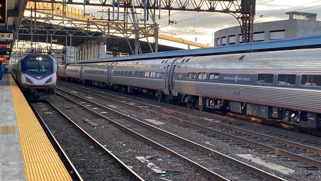
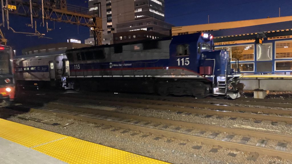
See ya? Nah, not today.High speed my shiny metal ass!See ya!Some more river and I-95 goodnessA southbound Regional stopping hereAnd an M8!Two of them!DIESEL IN DA HOUSE!!!KING TUT, AGAIN?!A tale of two power sourcesThis one ain’t stoppingMore diesel!And my ride home……nice.
The good: It’s got plenty of amenities! Restaurant on-site, ticket machines, the Quik-Trak, bathrooms, a fully sheltered platform, even direct sheltered access to the bus terminal! Furthermore, it’s an amazing station to foam at, with shots of the trains coming around the curve. Plus, the fact the inbound waiting area is above Water St. is a cool thing as well, along with the shots of the river and I-95.
The bad: Why isn’t there a layover track for Waterbury trains? That’s probably the worst thing about this station.
Nearby points of interest: Downtown Bridgeport and the hockey arena!
Transit connections: Amtrak (Northeast Regional, Vermonter) Metro-North (New Haven, Waterbury Lines) Port Jefferson Ferry GBT (all) Coastal Link Various intercity buses Prison (via MTA police)
Overall, it’s not a bad station. Probably among the best I’ve checked out so far. It’s like someone took the foamability of Canton Junction and gave it the amenities of Route 128 and the transit accessibility of Forest Hills, and threw it into Connecticut. This is, quite possibly, among my favorite stations.