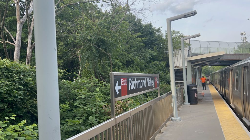
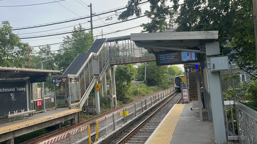
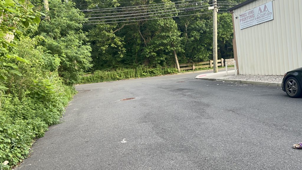
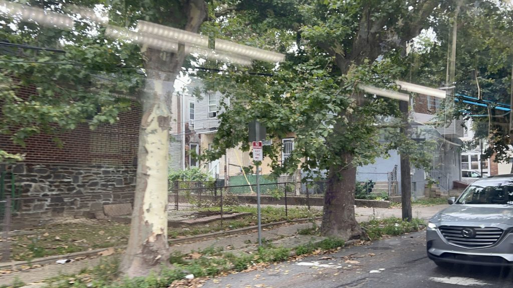
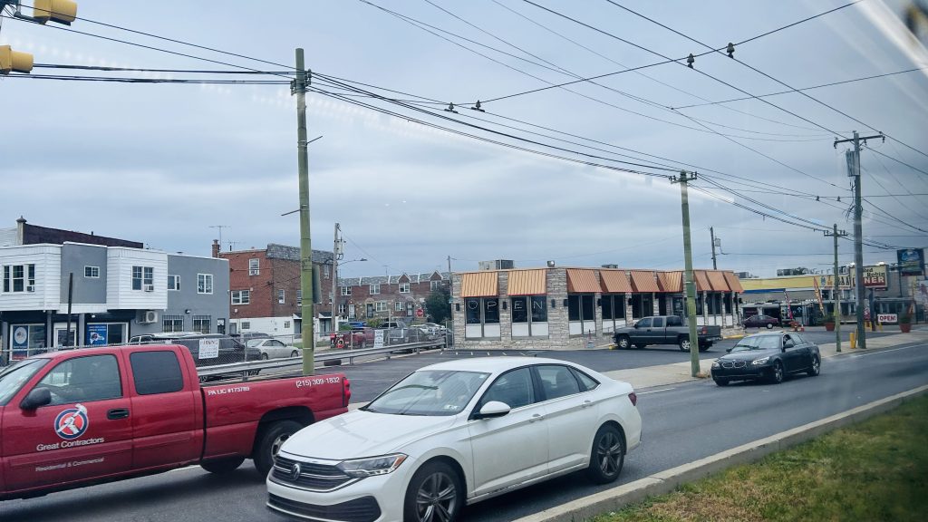
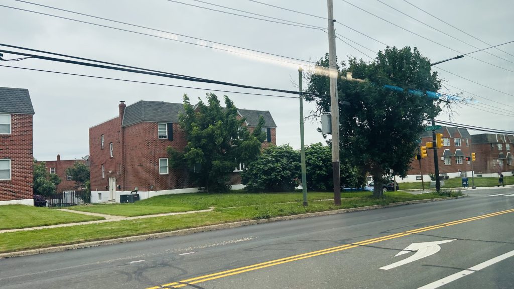
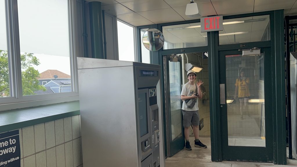
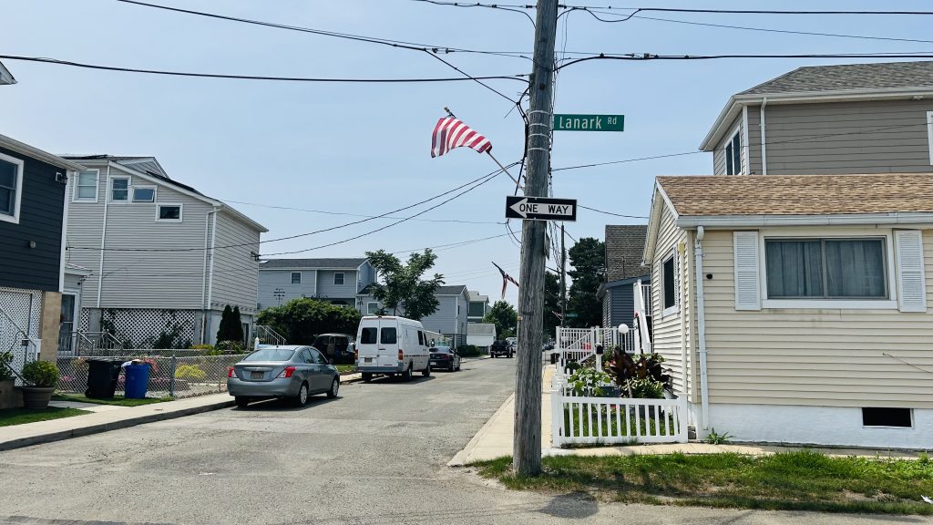
Ah, the Staten Island Railway…..what a weird line. Well, the 20 someodd stations located on Staten Island are all contained to a singular line isolated from the rest of the system. Richmond Valley happens to be no exception. Without further ado, here’s the first SI Railway entry on this blog.
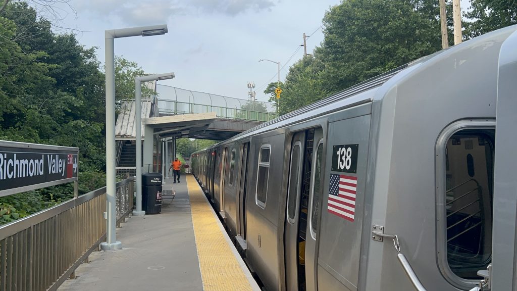
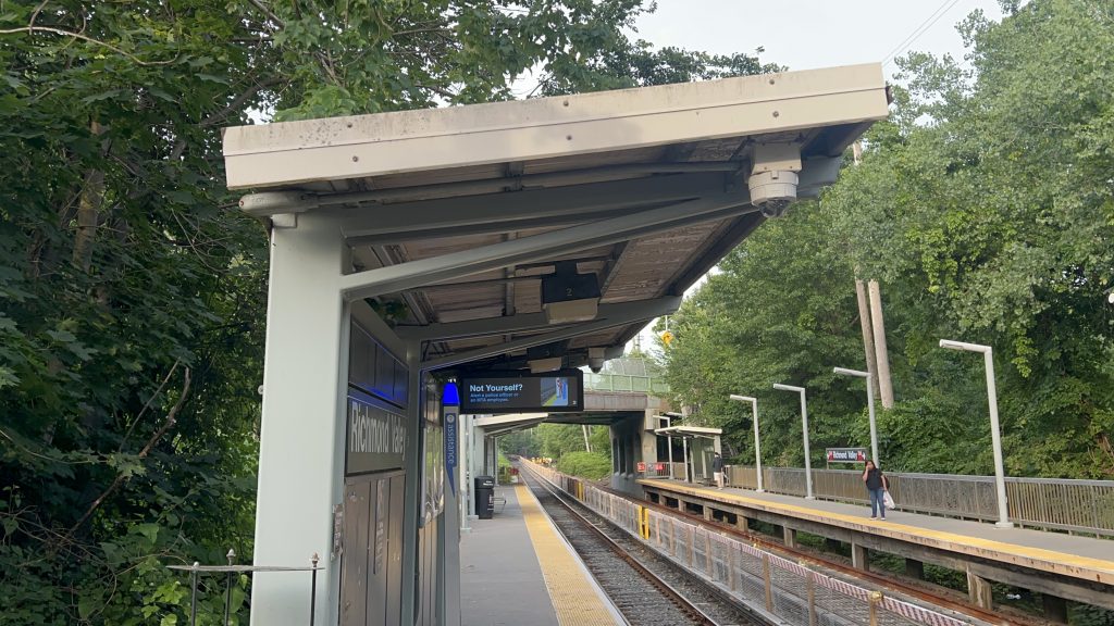
Signage!And an R211S!
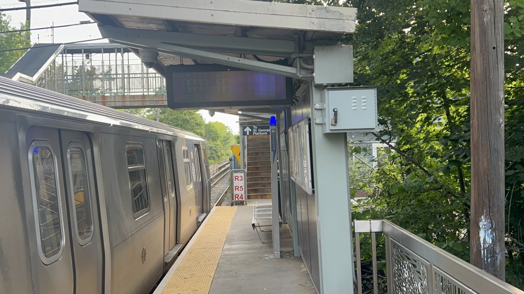
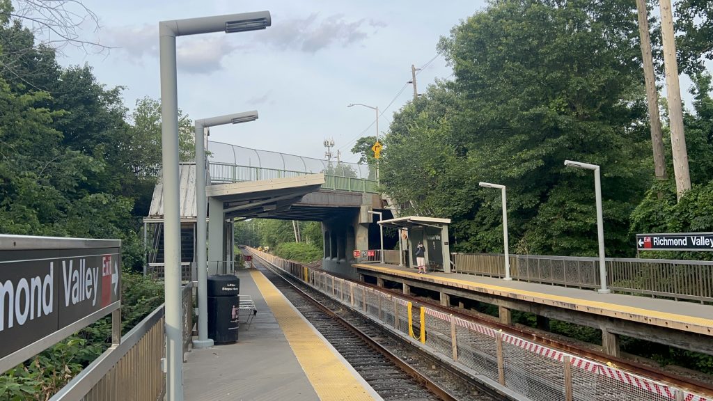
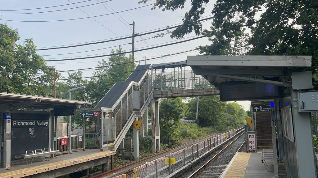
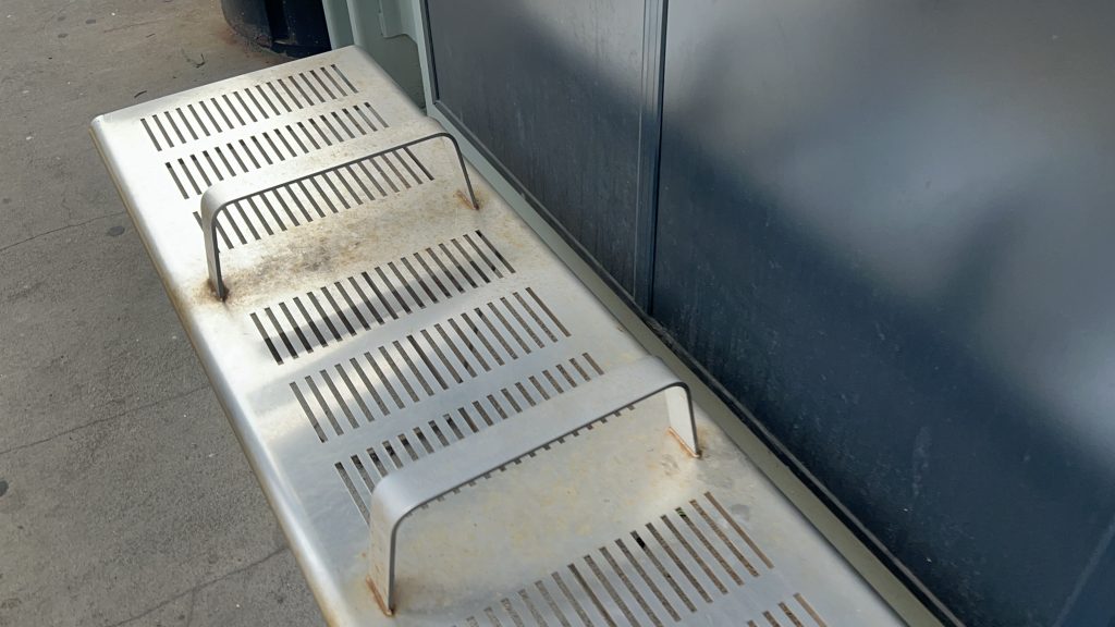
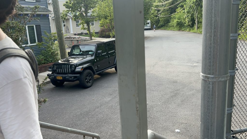
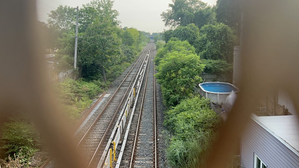
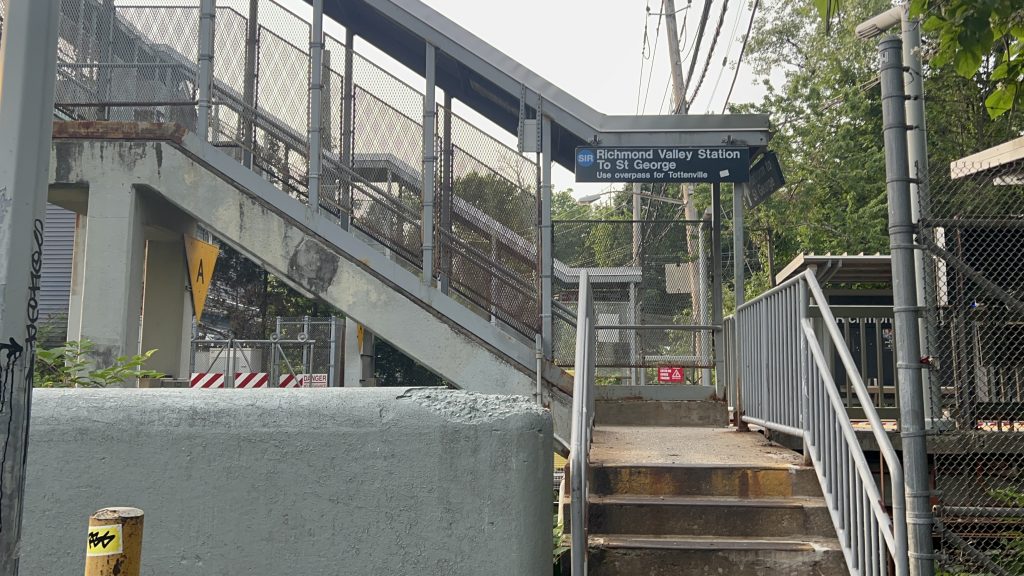
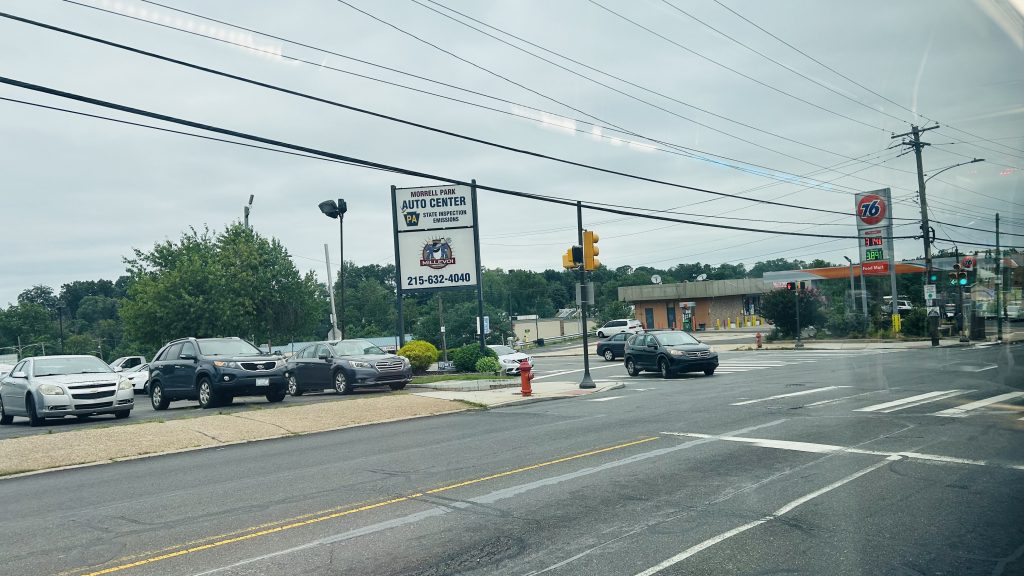
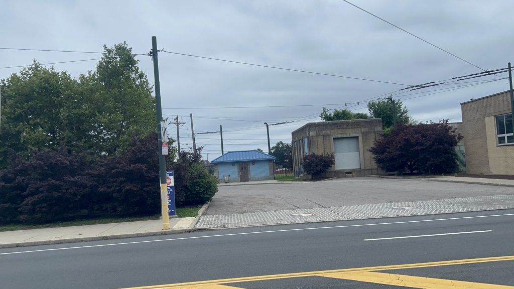
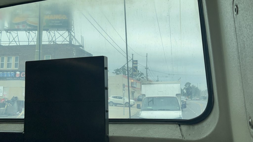
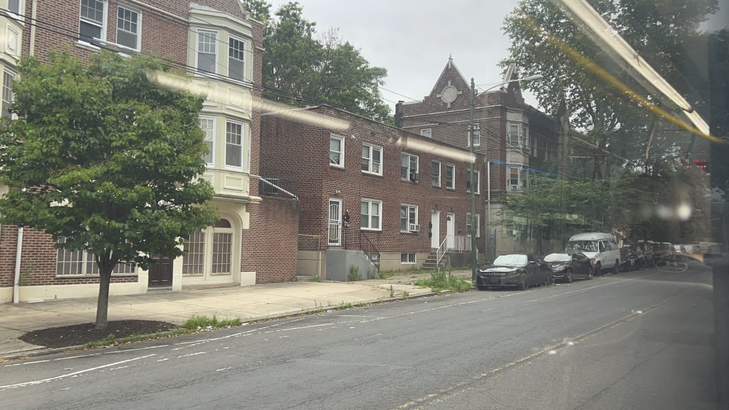
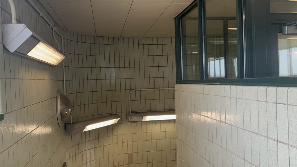
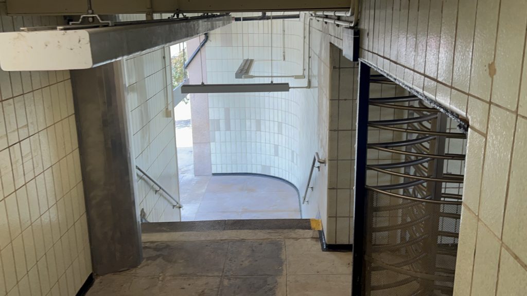
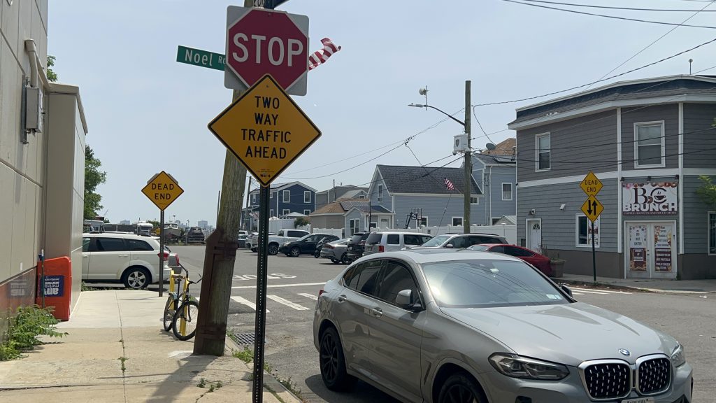
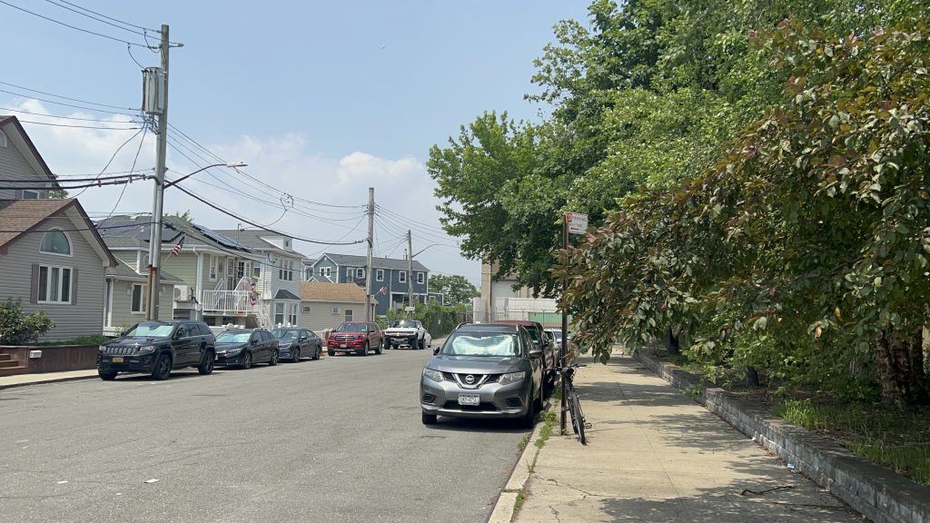
The station is famous for one thing – and it is not a good one: THE LAST CAR OF THE TRAIN DOESN’T PLATFORM!!! Yeah…. Ah well, that aside, it’s pretty standard – albeit for more of a commuter railroad station. There’s wastebaskets and benches. Stairs provide access to the other side of the tracks as well as to Richmond Valley Road. Furthermore, there’s neighborhood access without using the stairs to each side as well. It also looks like there may have been a grade crossing here many moons ago? Not sure though. As for the surroundings, there’s a bus connection to the SIM26 on Amboy Road, a house or two, a printing company, a smoothie shop, and not much else. This has got to be one of the most rural-feeling subway stations I’ve ever seen.
Onwards!Looking towards St. George. (& a railfan is present as well it seems)Overpass!And without the trainWhat.HOSTILE BENCHESNeighborhood exitCanopyOverpass shot!StairsRather unassumingOne such local spot – and Honaj?!AHH TWO ELEVEN!!!…an R44?!
The good: It serves the local area! It’s also rather vibey, even if unassuming. Although, that could easily apply to the entire SI Railway outside the northernmost bits.
The bad: No accessibility, and the last car doesn’t platform. Yuck.
Nearby points of interest: There’s a smoothie shop!
Transit connections: SI Railway MTA bus (SIM26)
Overall, as I said earlier, this has got to be one of, if not THE single most remote-feeling stations on a subway system that I’ve ever seen and been to.
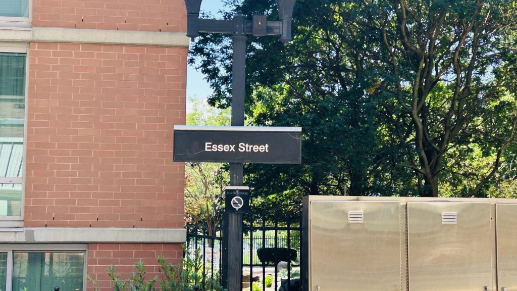
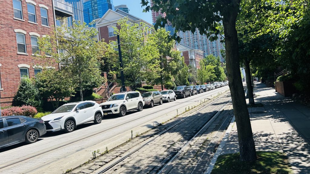
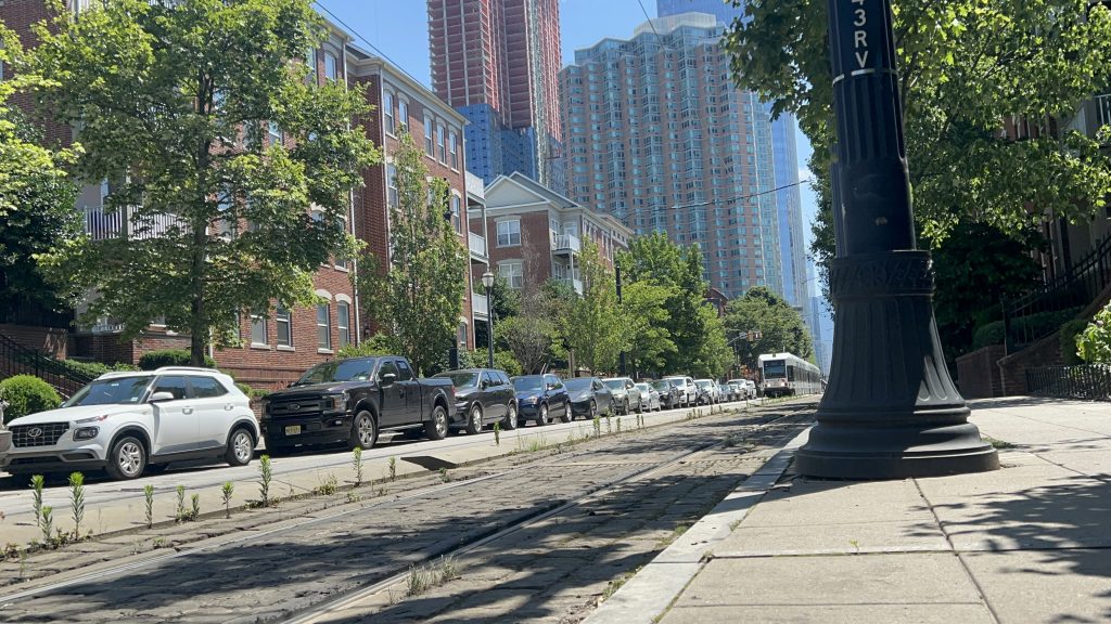
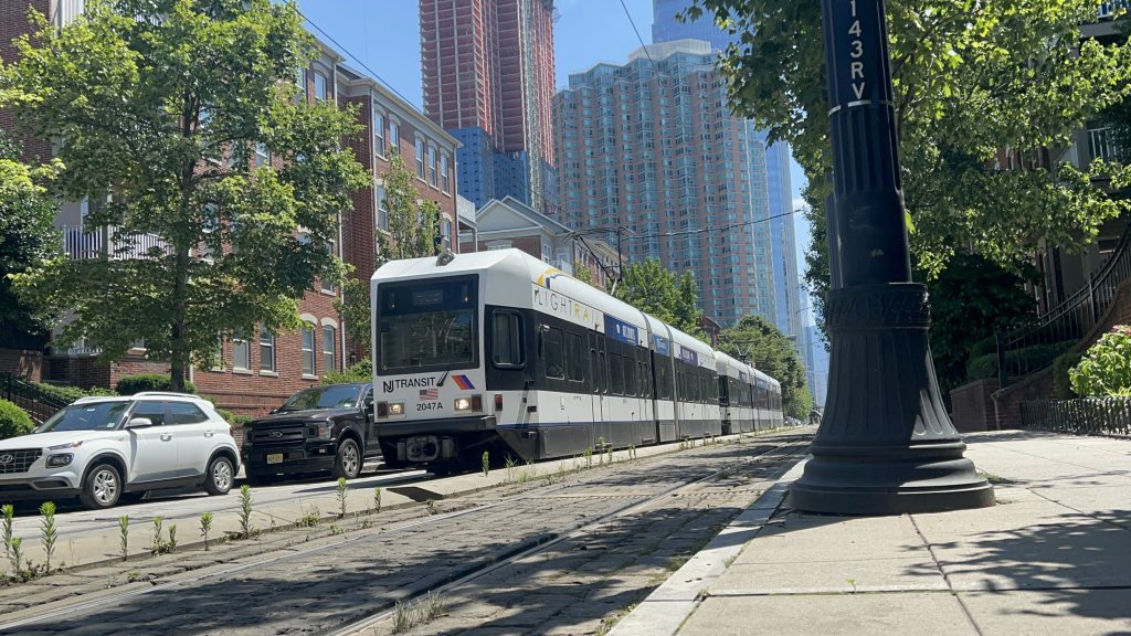
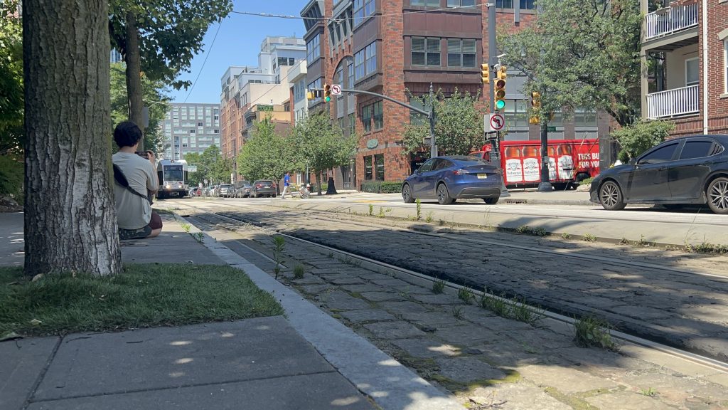
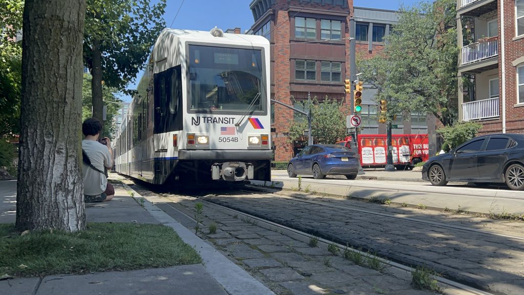
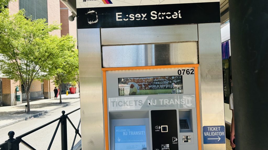
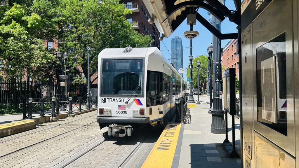
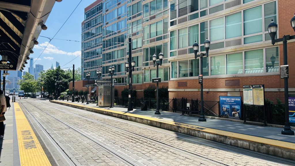
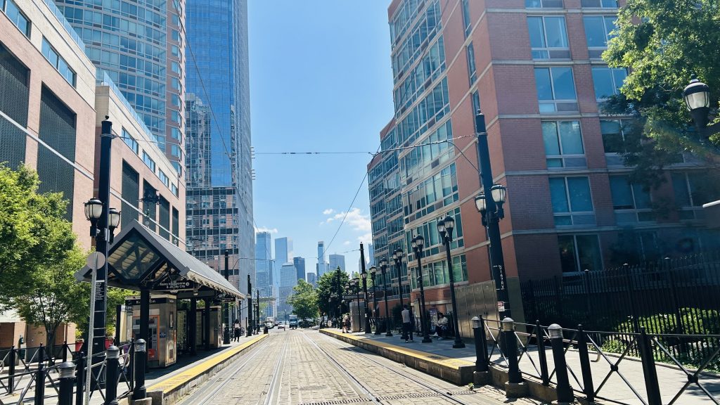
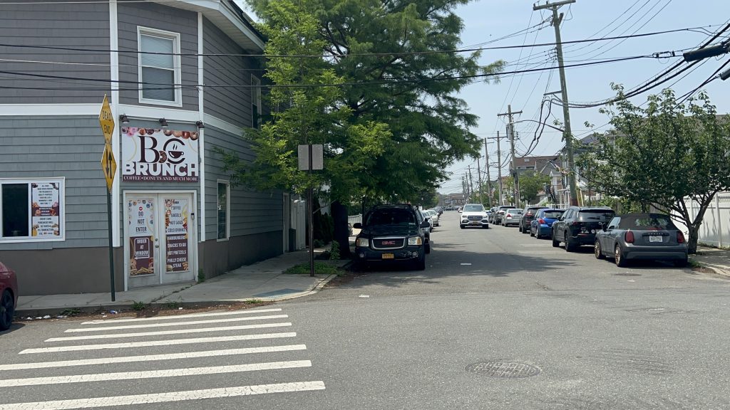
Essex St. Station is a station located in Jersey City, served by the Hudson-Bergen Light Rail, and opened in April 2000 as one of the HBLR’s original stations. Let’s take a look.
Signage!
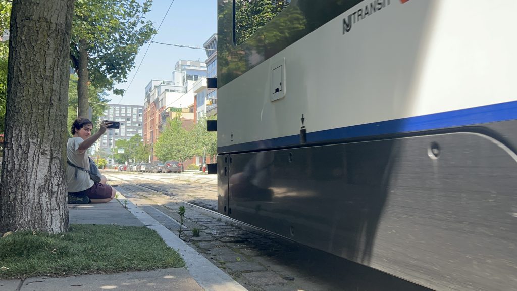
The platform is rather normal, being low-level and featuring level boarding with the Kinkisharyo streetcars that are used. There’s some benches and a ticket vending machine and……a ticket reader????? Yeah, I’m not exactly sure why they need machines to read the tickets or what “validating” it does – isn’t buying the ticket good enough?! Unfortunately, when I first rode the HBLR a couple of days prior to coming here, I didn’t know this and may have accidentally fare evaded – and experienced culture shock when I found out that the HBLR runs on the honor system alone, rather than have fareboxes at either/both ends of the car. Yeah, I was bewildered. Whoops. Anyways, there’s also some shelter from the elements, but it’s not exactly enclosed. As for land use around the station, it’s actually pretty dense and pretty good, given it’s Jersey City. There’s also a park nearby, neat! Lastly, this area is also a decent place to railfan the HBLR.
yuck. street parking. goddammit, Steve Fulop!FOAMER SHOTHBLR streetcar!And heading towards Marin Boulevard – and hi, Honaj!waowHONAJ FOAMS REALLY WELLTicketing machineAnother trolleyThe other platformILLEGAL? (no, this was legal)I spy lower Manhattan…Park!
The good: It’s in a dense area! (the station came first, as far as I’m aware) Furthermore, there’s the standard amenities you’d expect – plus ticketing machines. Where I’m from (the Boston area), you’d be LUCKY to have a TVM on a surface-level station. Lastly, the land use is actually really good around here.
The bad: Do the countdown clocks work properly? Actually, I don’t even recall seeing one. There’s also not a proper enclosed shelter, but whatever. There’s also no real bus connection here, but also not a dealbreaker with how short a walk it is to the nearest real connection.
Nearby points of interest: The Colgate clock is nearby! There’s also some green spaces and a few restaurants and shops.
shh, the rich republican nimbys are asleep, i gotta be quiet here. anyhow, welcome to the least-used port washington line station: plandome.
’tis a bit dark
plandome station consists of a singular side platform and a singular track, going above stonytown road and is next door to a country club. it’s got your usual station amenities, including a bus shelter on one end of the platform, a ticketing machine, a waiting room (surprisingly – but it was locked) which has a restroom(!!!), a ramp, stairs, and some parking. the station house also happens to house the local post office, which is pretty cool in its own right! as for other connections, it’s got nothing. the nearest connection is a rather dicey walk to nice’s n23 bus to manorhaven and mineola, on port washington boulevard, over a mile away. no thanks. overall though, it’s not a terrible station, even though i felt out of place in one of the most affluent (& rather republican) parts of the entire northeast (that i’ve been to so far). overall though, not a terrible station, but 0/10 for affordability and i’d presume nimbyism is at an all-time high.
parkingtrainstation houselooking towards woodside and manhattanand towards the next/last stop: port washingtonaccessibility!bus shelter, but larger. also, what’s with the uv lighting further up?the streetstairsthe lot at street levelthe post officeliminal!the overpassi spy a ticketing machineand a tad closerinside (it was locked)
the good: it’s accessible! furthermore, there’s a modest amount of parking, and it’s primarily here to serve the local neighborhood. there’s also a post office in the waiting room, and the fact there’s even a waiting room open during daytime hours at all is nice!
the bad: the land use, but this is a super rich and super nimby area. also no bus connections, which again is likely nimbyism at play.
nearby points of interest: that country club, if you’re rich. if you’re working class like i am, absolutely nothing.
transit connections: lirr (port washington)
overall, it’s not a bad station, and actually kinda vibey at night! it’s just really, really affluent and republican though.
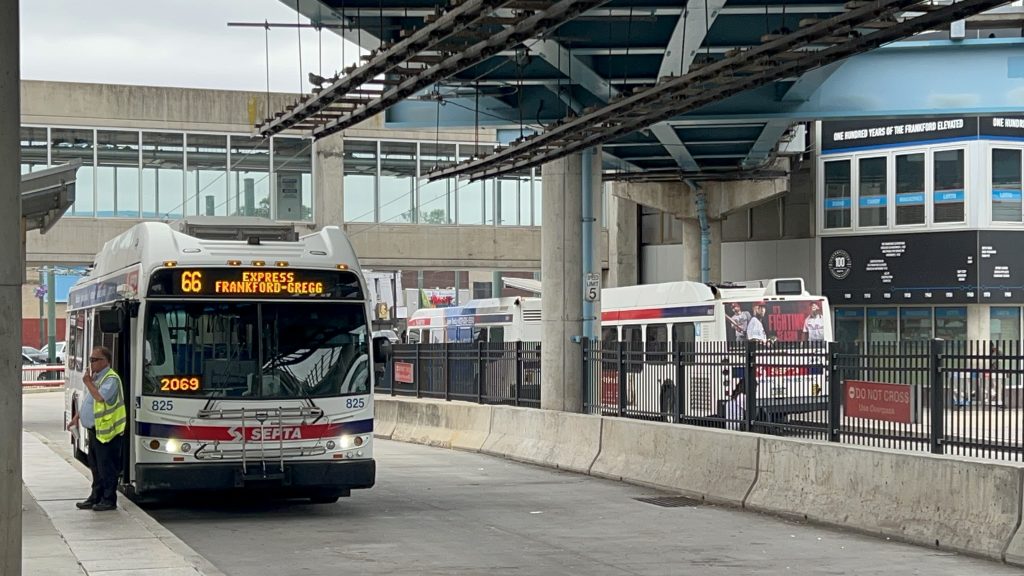
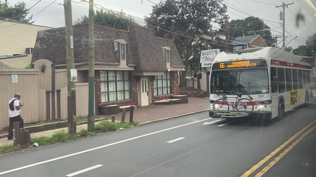
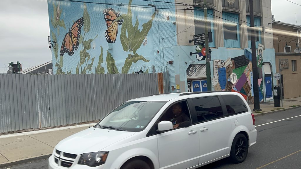
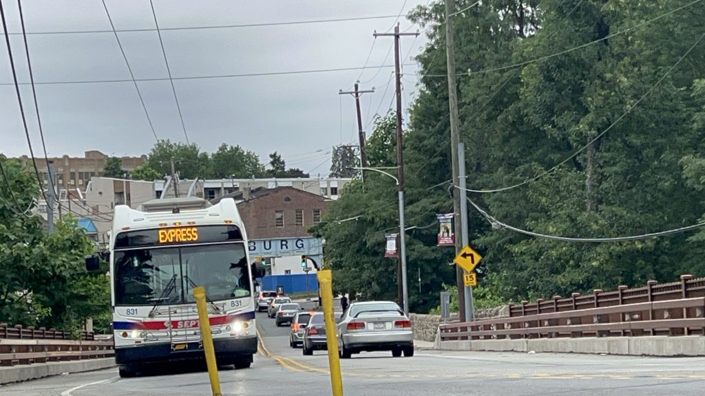
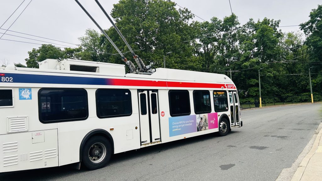
So, after a quick hop on the L line from Arrott to Frankford, Honaj (& Ranya – go check out her blog!) and I ended up at Frankford’s busway. So, why the hell am I doing a blog entry about a bus that goes all the way out to the city line and almost into Bensalem Township (but doesn’t leave Philly)? Well, I’ll tell you why: much like the 59, it uses trolleybuses instead of normal buses!
…express?!
Wait, what’s this? EXPRESS?! You mean to tell me they put catenary on I-95?!
…no, not quite. While that would be quite funny to see a trolleybus on overhead wires running down I-95 at the legal max speed (55 miles an hour), that isn’t what’s happening here. Allow me to explain.
There’s actually two ways a bus can run “express”, so to say. The first is the obvious answer: use the damn highway. RIPTA does this for a number of routes that run express for at least part of the run. The MBTA does this for routes like the 111, the Silver Line, the 501/504/505, the 354, among others. CTtransit does this mainly with their commuter coach routes (in the 900s), but some (such as the 201) do have limited highway running. And, lastly, the MTA does this with their commuter buses and things like the M60-SBS and Q70-SBS to get in/out of LaGuardia Airport. The other way…….is to just use the inner lanes of traffic. I guess this is more “limited stop” than a true express, if anything. RIPTA’s QX and 24L are the only other examples I can think of, where in parts of it, it’s a local route on paper, but in practice it makes zero stops. The 66 does this for its “express” runs.
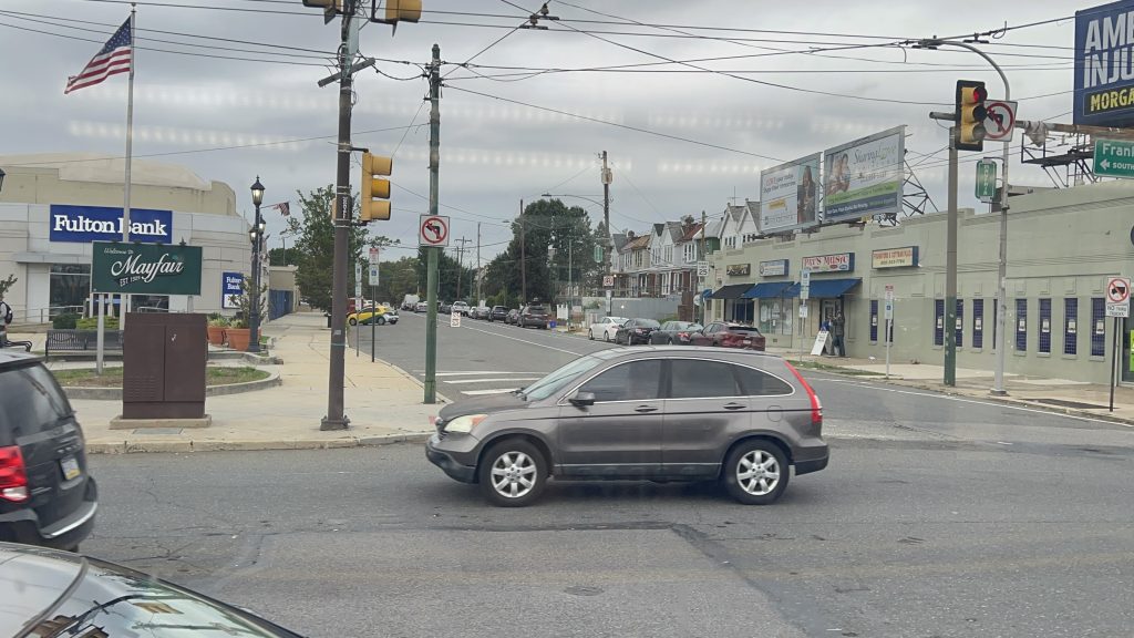
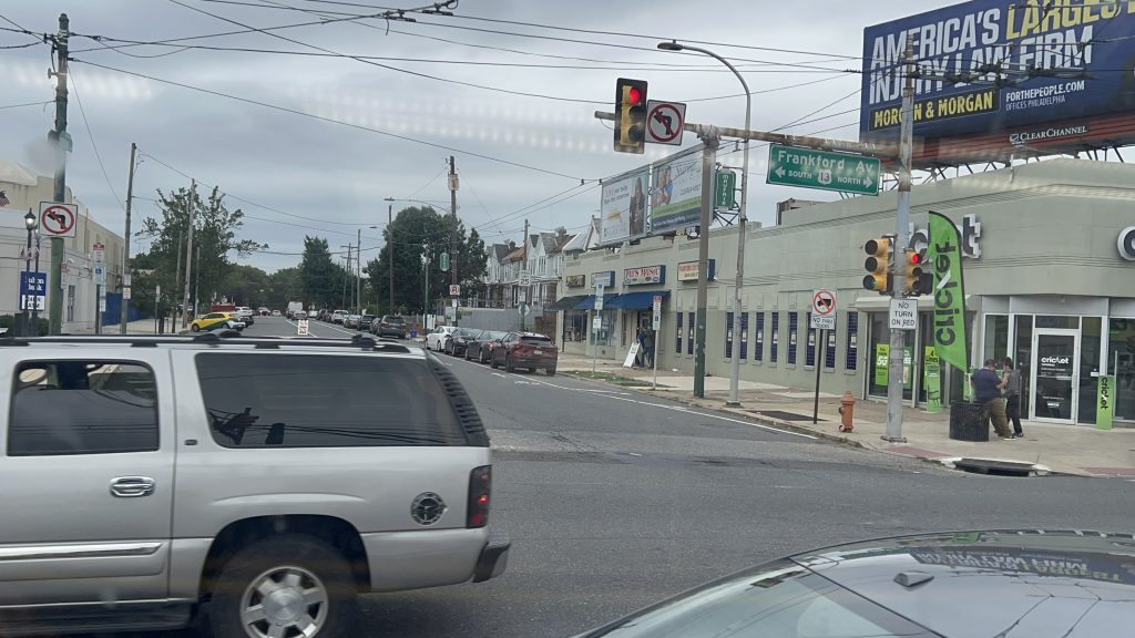
Ok, now that that’s out of the way, how the hell do trolleybuses overtake each other then?! That’s literally one of the biggest downsides of trolleybuses, is that they can’t overtake one another. Well, the Philadelphia Transportation Corporation (SEPTA’s predecessor) thought about this and did the “well no shit, Sherlock!” solution: just install a second pair of wires in the same direction each way. And thus, for a section of Frankford Ave., you have 4 sets of catenary: one for each lane. Anyways, let’s check out the route itself!
Onwards!
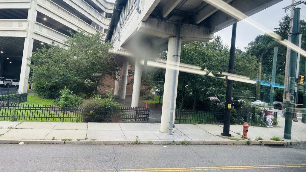
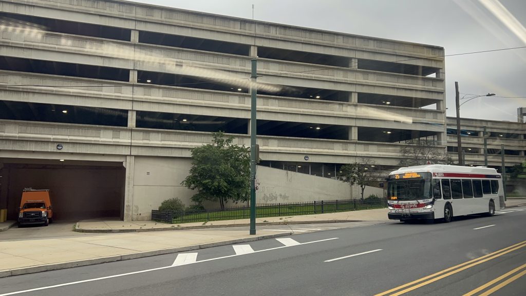
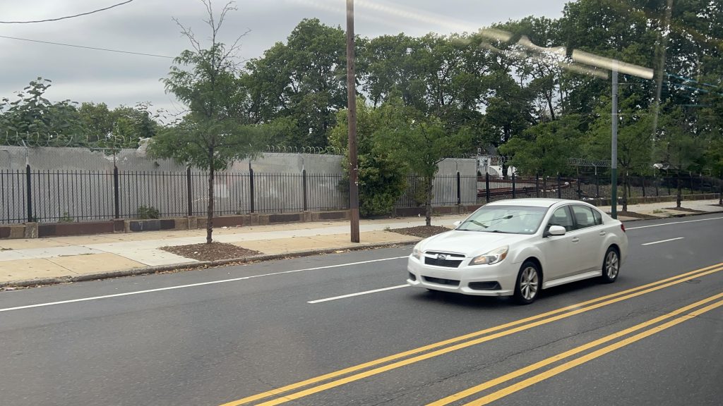
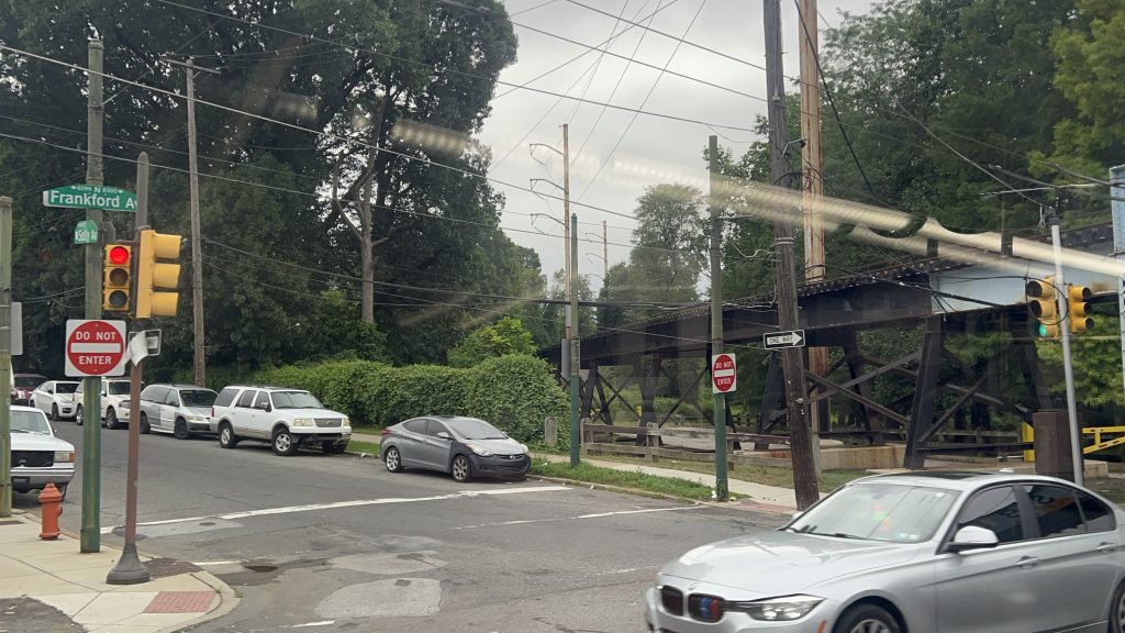
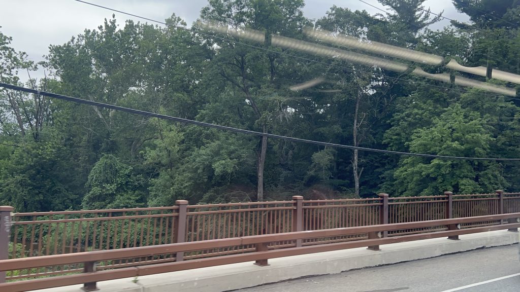
The route itself is largely relatively unremarkable other than the equipment it uses, being a straight shot down Frankford Avenue to either the Gregg St. loop, or the City Line loop on the Philly/Bensalem Township border. Trips heading towards either bus turnaround have to do a weird maneuver to get out of the Frankford TC’s general vicinity, though. Other than that, all is pretty normal. The road is rather stroady, though, but there’s also some degree of density to be had. In fact, some of the areas even seem rather nice at face value. Hell, the closer you get to Bensalem Township, the more suburban things get. I’m not sure how to make of it, though. But, there IS something cool along this route: Pennypack Creek! One of the oldest bridges in the country – and it has overhead catenary for the trolleybuses. Neat! Moving along, Gregg Street is where some runs will short-turn, while others will continue on to City Line Loop. The rest of the way there, however, is largely unremarkable – and gave off increasingly suburban vibes. NIMBY vibes too? Maybe? The fact a trolleybus even runs out here throws the vibe detector off. Either way, we pass a strip mall with a Dunks, what looks like cookie cutter housing, and enter the City Line loop short of the Bensalem Township boundary. And with that, concludes the 2nd of 3 trolleybus routes. (yeah, sorry, I didn’t ride the 75 on this trip)
A garageThe yardHousing!This street feels rather narrow…Something feels a tad off here…I WALKED TO BURGER KING…More stuffWe have Red Robin at home.More housing over yonderoh my more stuffA side streetAnd another – with signage for US-13HURT AT WORK?treeartwork!LEASING!WOAHOLDEST BRIDGE?!PENNYPACK CREEK!!!OH NO, DOTS!!!A tad more fancyA strip mallD I N E R (as famously seen in the Miles in Transit Philly Diner Video)THE HOLY LANDEXPRESS (diamond 66?)ANOTHER TROLLEYBUSGot the Midas Touch?AND ANOTHER TRAMBUS!!!fieldWelcome to Torresdale, Philly?cookie cutter housing?ugh…Another intersectionTROLLEYBUS RAAAAAAAAAAAAAAA!!!!!!!!!!!!!!!!BUS CONNECTION.
The good: It’s frequent! (every 7-12 minutes during peak hours, every 15 otherwise, and every half-hour overnights!!!!!!!) Furthermore, it serves some somewhat dense areas, goes all the way to almost Bensalem Township, and isn’t even noticeably loud. Furthermore on top of that, did I mention it runs 24/7? Yeah. It also runs “express” service!
The bad: I…..genuinely don’t have much to say that suggests this is bad.
Nearby points of interest: Housing. A diner. If you’re willing to walk a mile or so, Four Seasons Total Landscaping (if ya know, ya know). Some churches and cemetaries. A golf club. Torresdale’s Regional Rail station, and the Frankford TC.
Overall, it’s not that bad. If anything, dare I suggest it’s possibly even a 10/10 route?! Because, truthfully, this has the makings for a 10/10 route.
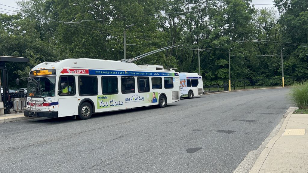
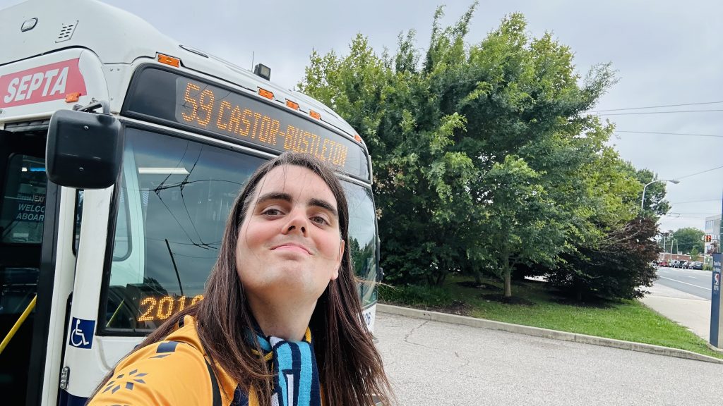
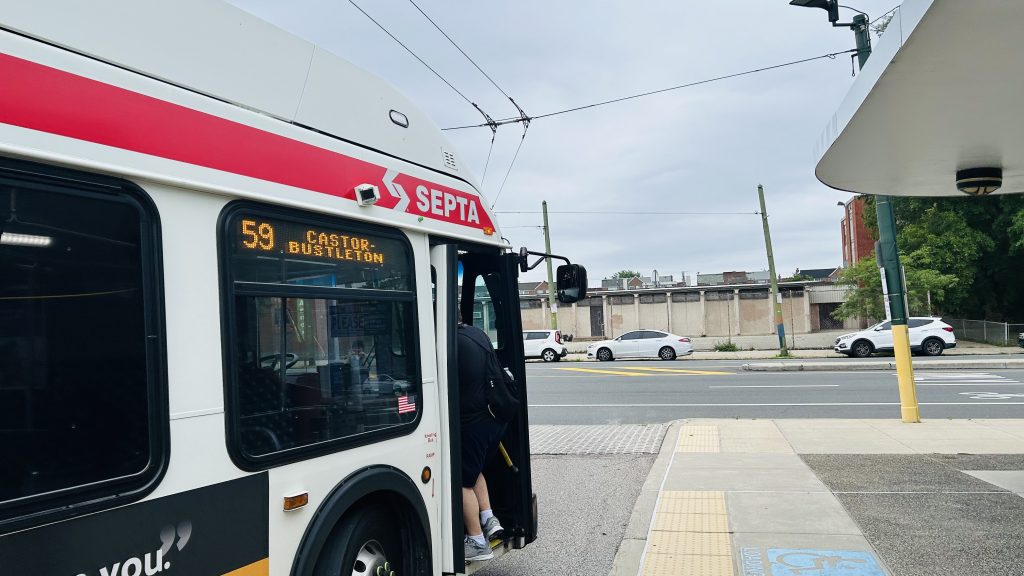
Ah, golly, a SEPTA bus route review! Well, Honaj dragged me all the way to the Bells Corner bus loop at Castor & Bustleton Avenues, after taking a ride down the Fox Chase Line (entry on Fox Chase Station coming at some point!), going to a Wawa (THE HOLY LAND), and a quick ride to Castor & Rhawn, and we got off and walked the half-mile to the Bells Corner Loop. Wait a second, what the hell?!
AAAAAAAAAAAAAAAAAAAAAAAAAAAAAAAAAAAAA NO NO NO NO NO NO NO NO GOD NO
NO. NO. NO. NO. NO. DAMN YOU, HONAJ!!!!!!!!!!! WHY WOULD YOU LEAD ME RIGHT INTO A TRAP?! NOT THE GODDAMN TROLLEYBUSES!!!!!!!!!
HONAJ: “TROLLEYBUS! TROLLEYBUS! TROLLEYBUS!!!” ME: *stares in horror*
*sighs, blinks twice for help*
Okay, okay, I guess I have to answer the call of duty here with these shit buses. Well, rather than being garbage Neoplans, at least we have….let’s see…..New Flyer E40LFRs. Well, maybe New Flyer actually knew what they were doing. The buses…….were largely dead silent, even moreso than RIPTA’s BEBs (which were already pretty much dead silent to begin with!!!), these suckers REALLY took off when given a chain of green lights and negligible requested stops/boardings (which is not too common seemingly given the REALLY, REALLY TIGHT stop spacing on SEPTA – every single block!), and furthermore it……….actually didn’t crawl like absolute dogshite. But, before I continue, I have to review the route itself.
VS. them trolleybuses (ft. Honaj & co., offcamera)
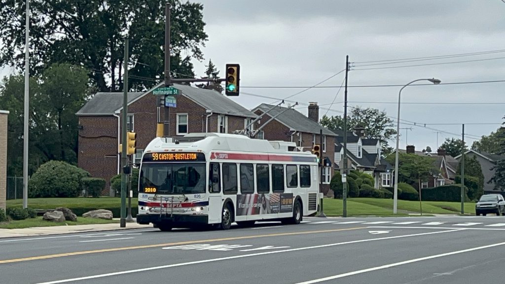
The 59 originates at the Bells Corner bus loop, at Castor & Bustleton Avenues, and is largely a straight shot down Castor Avenue. Running through northeastern Philadelphia, it goes through the Rhawnhurst and Oxford Circle, before negotiating the rather oversized rotary bisected by U.S. Route 1 (Roosevelt Boulevard locally), and going down Oxford Avenue. Ultimately, the route then terminates rather unceremoniously at the Arrott Transit Center, with the interchange to the L (aka the MFL, Market-Frankford Line, or if you’re weird the Blue Line – this blog will be calling it the L as that’s what SEPTA calls it nowadays). Overall, in terms of scenery, there’s really not a lot exciting going on other than Roosevelt Boulevard. In terms of vibes, though these neighborhoods, I get some Boston vibes, some south Providence vibes, but ultimately I really couldn’t pin anything specific down – Philly is kinda its own thing vibe-wise. In terms of headways, it’s about every 20 minutes for much of the day offpeak, with weekend and night service being half hourly to every 40 minutes (it is not a 24 hour route). Overall, not bad!
I think that’s Ranya boarding the bus?See ya later, Bells Corner!H O U S I N G S T O C KAn elementary school!A Catholic Church!More housingeven moreA Citizens Bank w/ some catenaryDUNKIESSSSSS!!!!!!!!!One nice things about these suckers is you can look out the rear windowTROLLEYBUS VS. ROTARY: WHO WILL WIN?!Some local businessesSEPTAMORE HOUSING!!!AND EVEN MORENear the endEnd of the route w/ Honaj
The good: It serves a rather dense (if not highrise-ridden) neighborhood! The buses themselves, too! (I’ll elaborate soon) The headways are also okay, for weekday service! It’s also got connections to the L via Arrott!
The bad: Weekend headways could be better. The bus loop terminus does seem kinda weird at face value too, but I’ll save rambling on about that for the entry specifically for Bells Corner (whenever that comes out)
Nearby points of interest: Bells Corner has a shopping center nearby, there’s a Wawa, a few schools and churches along the route, a LOT of housing, and a decent amount of local businesses lining both Castor and Oxford Avenues
Overall, not a bad route!!!
Rating: 8/10
Wait, wait, wait just a hot flippin’ moment… did……did I find a GOOD piece of trolleybus equipment?! You mean to tell me it’s NOT utter and complete dogshit, is pretty much silent, and actually isn’t horrifically slow?! And my life was a lie!!! Or, at the least, my life was all in misguided anger?! IT’S NOT SHIT?! IT’S NOT SHIT! IT’S NOOOOOOOOT SHIIIIIIIIIIIIIIIIIT!!!!!!!!!!!! Y’ALL FOOLED THE PUBLIC AND TOLD THEM TROLLEYBUSES COULDN’T BE GOOD AS THE WAY OF THE FUTURE, MR. STEVE POFTAK!!! YOUR LEADERSHIP LED THE FREAKIN’ MBTA DOWN THE WRONG PIPELINE, WHY WOULD YOU REPLACE SOMETHING THAT WAS PERFECTLY FUNCTIONAL AND VERY MUCH NOT GARBAGE WITH SPARKY SPARKY BOOM MACHINES?! WHAT WERE Y’ALL SMOKING?! WHO IN THEIR RIGHT MIND THOUGHT IT WAS A GOOD IDEA TO MISLEAD PUBLIC OPINION AND THE OPINIONS OF EXECS TOWARDS “let’s dismantle them trolleybuses!!!”?! YA KNOW, MAYBE IF YOU NEED AN EXEMPTION TO BUY AMERICA, THAT’S A BAD SIGN, TO PUT IT LIGHTLY! And with that, I am hereby proposing “throw them wires up at Logan Airport, the Seaport, and in the Chelsea busway – and do NOT let Neoplan rise from the dead to do the deed”
I guess…….my disdain for trolleybuses, should’ve been more “fuck Neoplan” in particular and was horrifically misguided. I hereby retract all the ranting about how garbage they were, in the Harvard Square blog entry. Although, I’ll still keep it and not edit it for old time’s sake and in the name of keeping it as a museum piece of a bygone era of the Chelsea’s Corner blog.
A MFL train, but heading towards Upper Darby, rather than to Frankford (next entry…)
*cries in a corner realizing all the hate for trolleybuses since the birth of this blog is actually all misguided and should’ve been directed towards Neoplan instead*
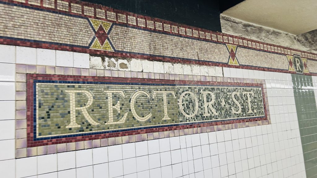
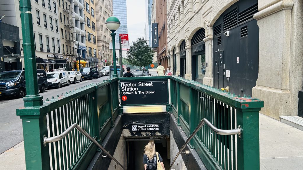
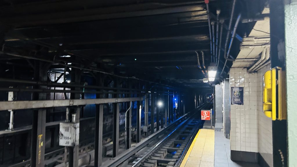
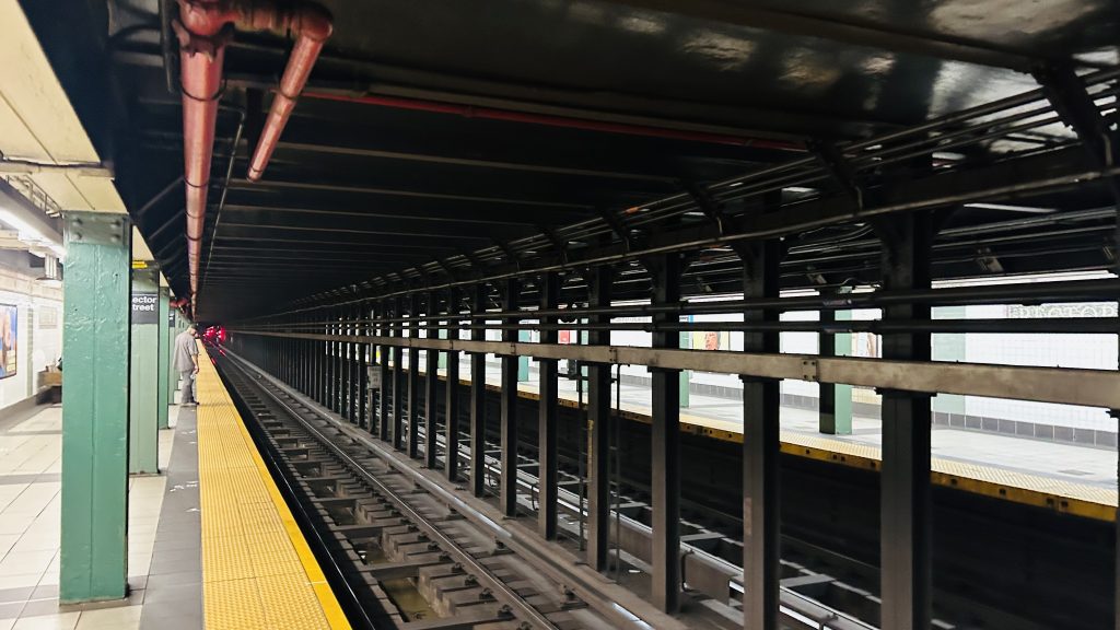
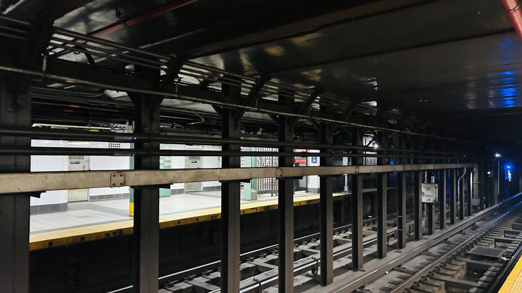
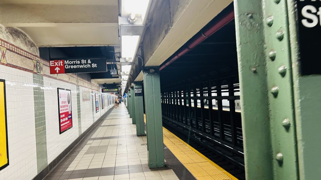
There are two Rector Streets, and don’t worry, we’ll cover both of them on this blog. But, firstly, we’ll cover the #1 line (ex-IRT) station. For a hot minute after Hurricane Sandy, this was the end of the #1 line. Let’s look at this station.
Mosaic!
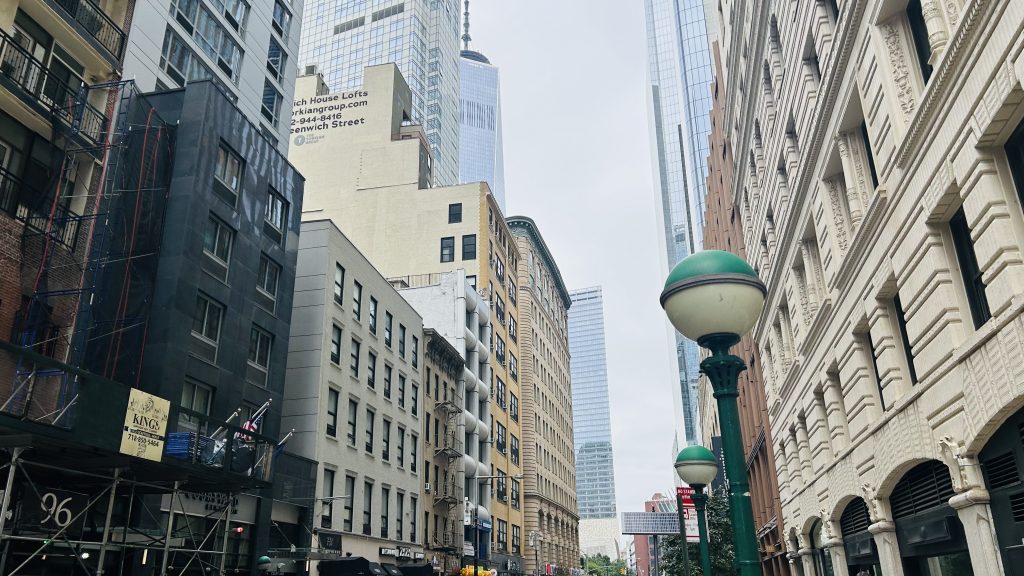
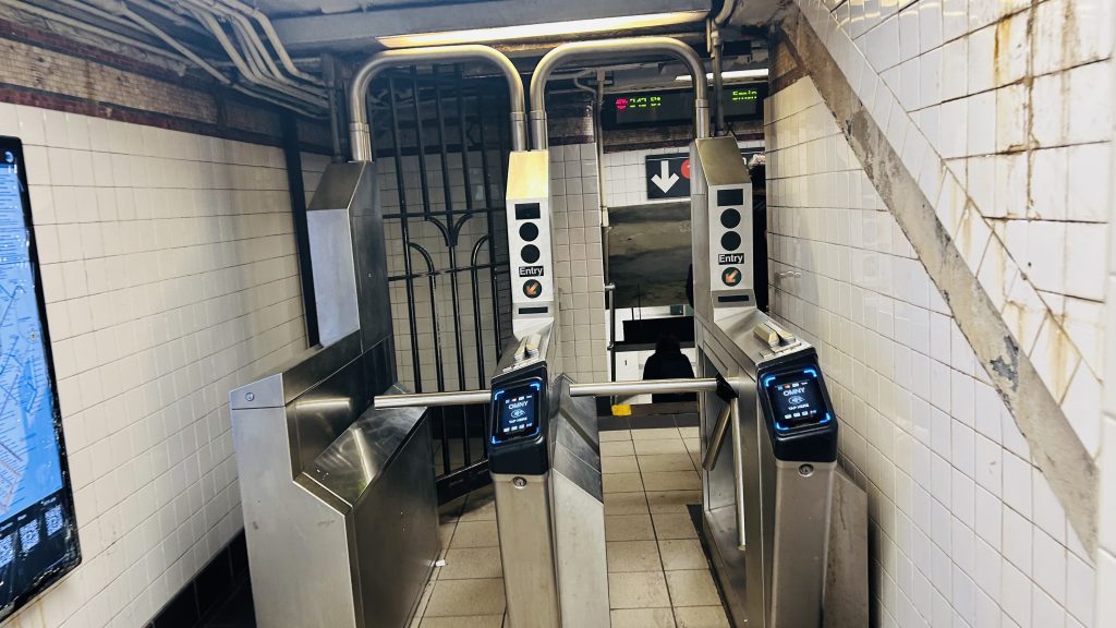
The station consists of two side platforms, no crossover, a REALLY SMALL fare control mezzanine (possibly the world’s smallest?!), and your usual subway station platform amenities. The IRT mosaic work looks pretty nice, if basic. At street level, it’s lower Manhattan so it’s pretty busy. Overall though, it’s not a terrible station, but as far as local-only stations go, I’ve still seen some better.
Street levelClassic NYC staircaseTHAT’S IT – THAT’S THE FARE CONTROL!!! JUST TWO TOTAL TURNSTILES!!!Next stop: Courtlandt Street!!!Looking to the other side and towards South FerryAnother look at the other sidePlatform shotNext stop: Courtlandt St.-World Trade Center!
The good: It serves the local area, and is one of the closest stops to Battery Park City (& the western waterfront). It, operationally, can also be used as a terminal in a pinch by redirecting trains into the old South Ferry balloon loop.
The bad: The tiny as hell mezzanine and the fact it isn’t accessible! Also, it’s kinda close to the World Trade Center station complex, but whatever.
Nearby points of interest: Battery Park City and the western waterfront, along with Trinity Church! There’s also some luxury (read: for the REALLY wealthy) housing, some shopping, among other things down here.
Transit connections: 7th Ave. Lines (1) MTA bus (At Trinity Pl/Thames St.: M55, BxM18, QM25, QM65, SIM15) NJT bus (120, at Trinity & Thames)
Overall, it’s a more quiet local station, as far as they go, but it’s still near some cool stuff. It’s just that hot DAMN is that fare control tiny
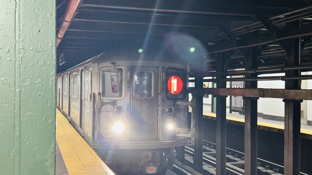
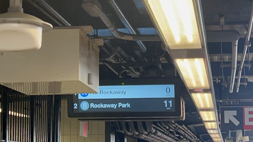
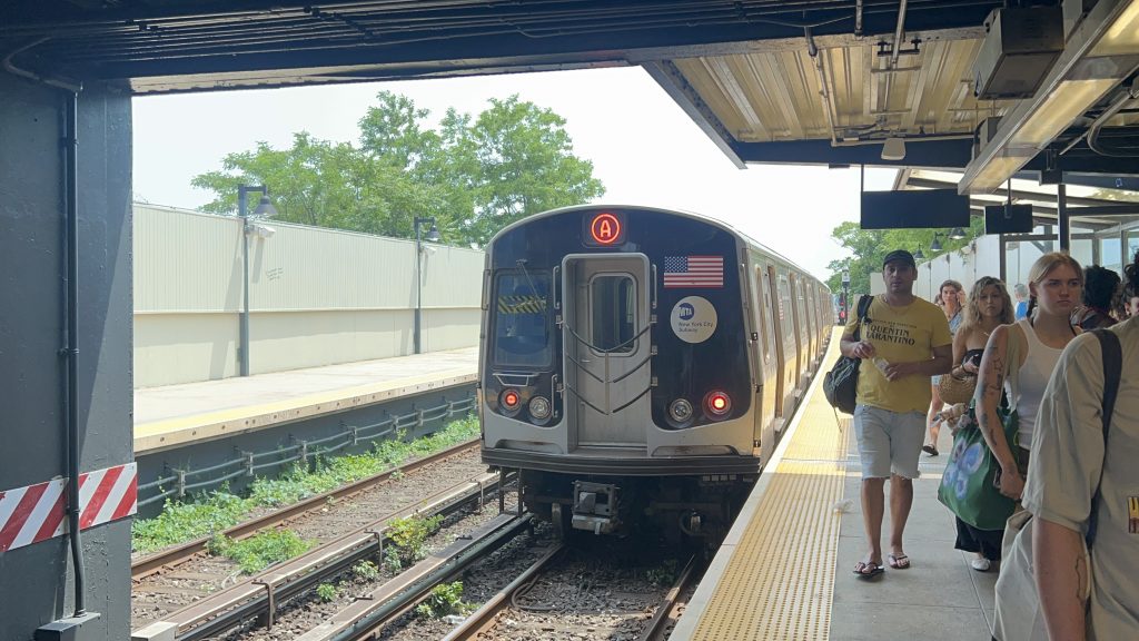
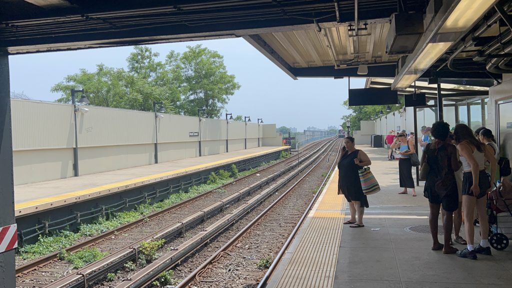
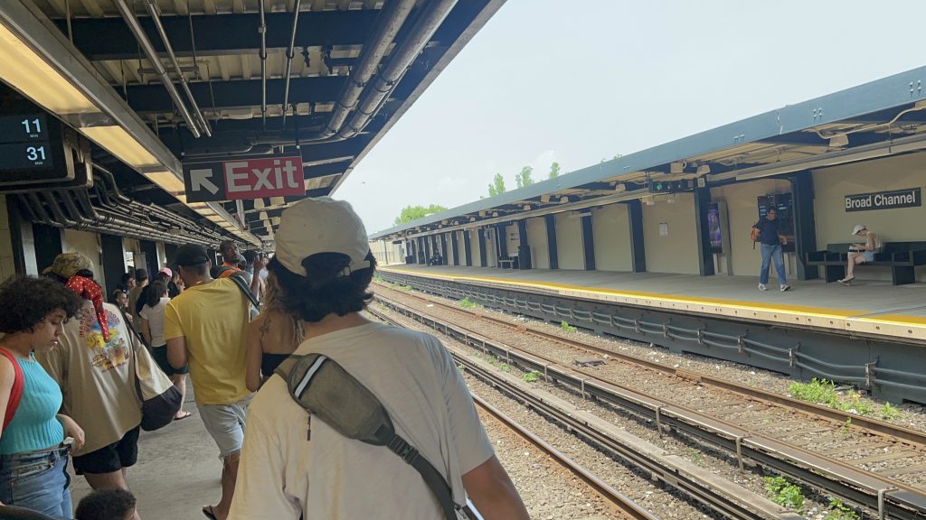
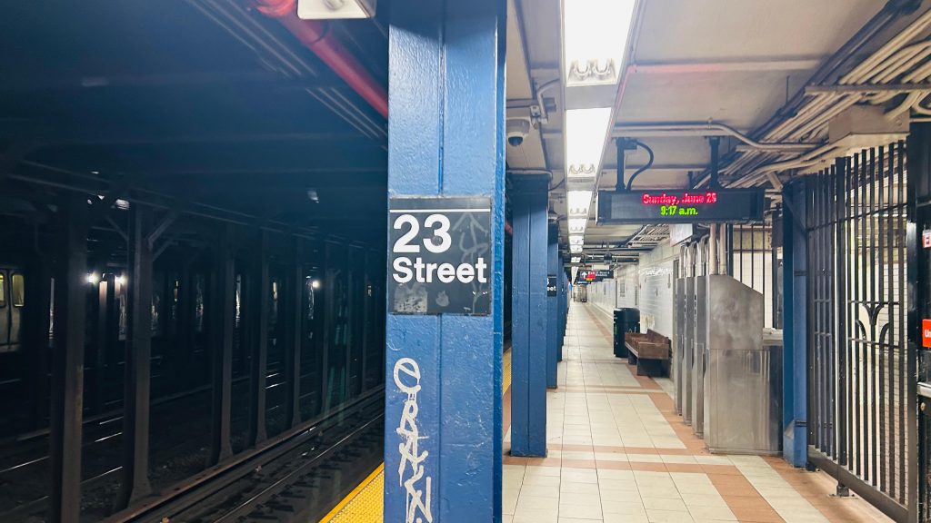
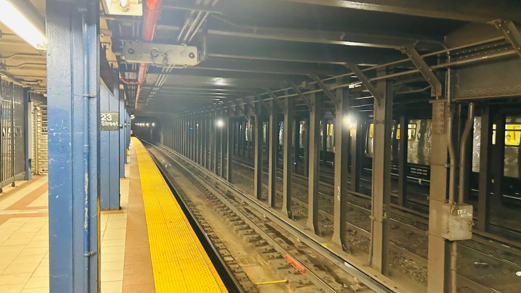
By some metrics, this station is the least-used station on the entire system. Located in the neighborhood of the same name, Broad Channel is the transfer point between the A line (to Mott Ave.) and the Rockaway Shuttle (to Rockaway Park-Beach 116th St.), and is one of the weirdest neighborhoods in the entire city.
holy headways…
The station, and the entire section of the subway in the Rockaways, is all ex-LIRR territory, and was handed over to the IND in the 1950s as, at the time, the LIRR had a small problem known as “bankruptcy”. Service was killed initially because of a fire on one of the bridges over Jamaica Bay. But, in 1956, the IND restored service to the Rockaways as an extension of what’s now the A line. With the history out of the way, Broad Channel is relatively pretty normal but also unique. The neighborhood is more or less what you’d expect from a summer getaway village rather than in NYC proper. The station isn’t accessible though, as there’s no ramp or elevator from the platforms to the mezzanine, or a step-free way in or out of the station. Also interestingly, despite being a major transfer station, the station’s actually not located on the main road through the area. As for the platforms, it’s standard with benches and countdown clocks. There’s also a station agent (whom yelled at myself and Honaj for filming and photographing), and OMNY machines in the station mezzanine. In terms of vibes, I’d say it’s like if Narragansett densified and got a subway station, but the subway station was wildly out of place. The station itself though? It’s okay.
This is a Far Rockaway-Mott Ave.-bound A train. The next stop is Beach 67th St.Towards the Rockaways itselfit’s crowded alrightStairs……and HonajThe mezzanine within fare controlChanging sidesOMNY – at the least used (by entries) station. Also, a reflection of me!Tiles galoreSTREETBroad Channel, the neighborhood!This feels wildly out of placeA brunch place…park & ride?H O U S I N G S T O C KSuburban for sureThe station over yonderAnd zoomed in
The good: It’s the only subway station in this part of Queens – furthermore, it’s the only chance to transfer between the Rockaway Shuttle and the A line.
The bad: Power-tripping station agents aside, it’s not an accessible station. The bus connection to the Q52 and Q53 are a short walk away, but still. And, while not a major issue with the station itself, the headways on the subway out here are BRUTAL. It can also get particularly crowded, especially with summer beachgoers on hot days (where the Rockaways can oftentimes be 15-20 degrees COOLER than Midtown!), so there’s that.
Nearby points of interest: Well, you have a couple of parks and the ocean! There’s also a number of restaurants and the Broad Channel Library as well. Really, most of the things of interest are either parks/beaches on the far ends of the neighborhood, or along Cross Bay Boulevard.
Transit connections: 8th Ave. (A Line) Rockaway Shuttle MTA bus (Q52 & Q53 on Cross Bay Boulevard)
Overall, it’s not a terrible station. Am I salty about being yelled at? Yeah, a little. I’m more surprised it happened here rather than on PATH. But, whatever. The area does give off some modest NIMBY vibes, but even then it’s not a bad station whatsoever.
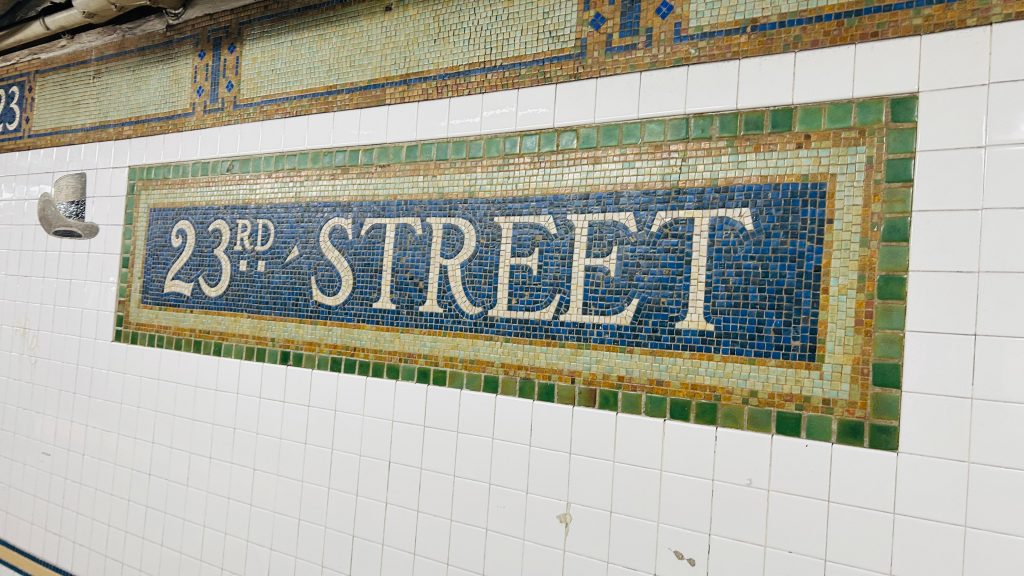
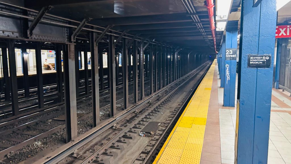
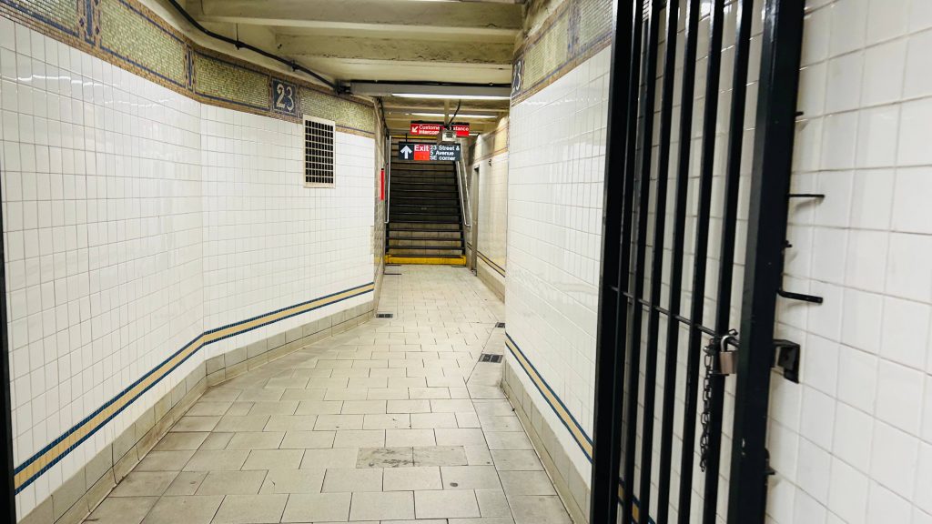
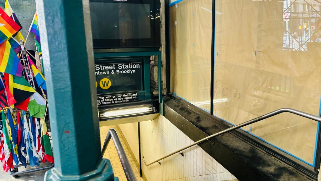
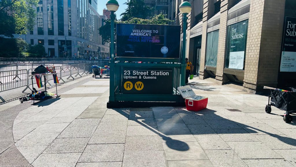
Whelp, we’re back in NYC. And, today’s entry is a rather modest, if boring, station. Welcome to 23rd/Broadway, located in the Flatiron District (hence the title, to differentiate it from other 23rd St.’s).
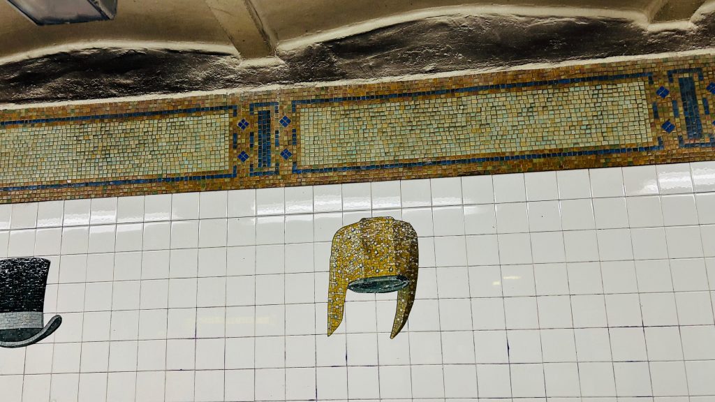
Mosaic in lieu of signage
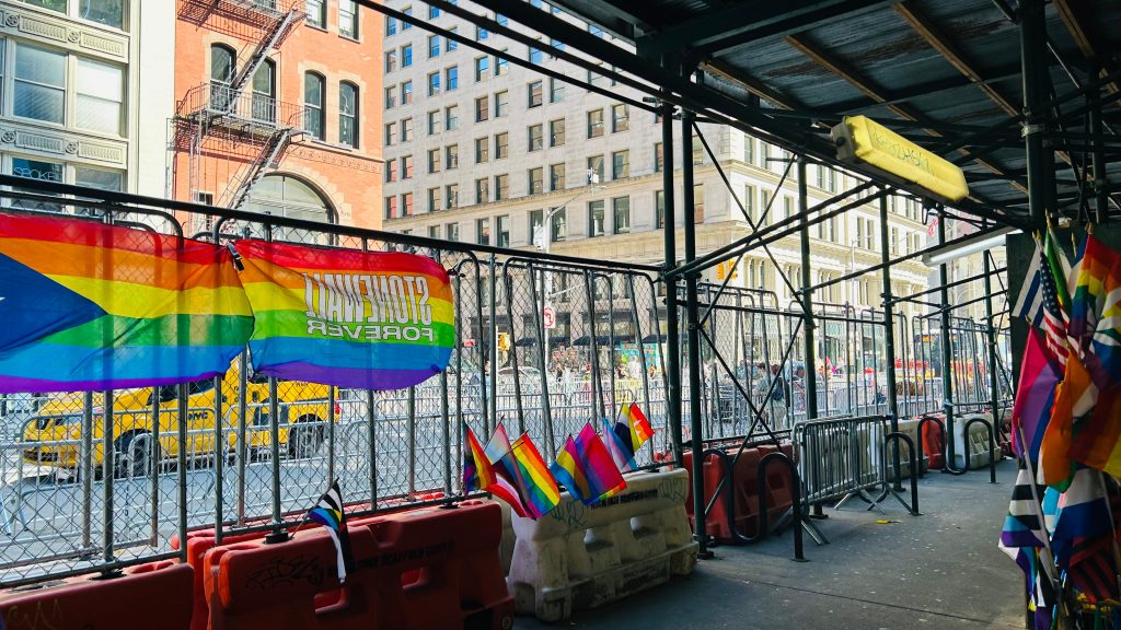
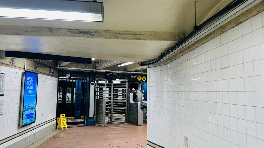
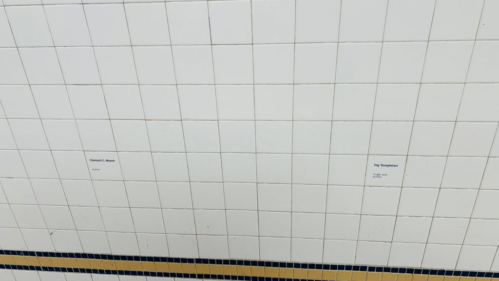
23rd St., or rather this particular one, is located on Broadway at, well, 23rd Street, in Manhattan’s Flatiron District. It’s a local station served by the R and W lines, with the N serving it on weekends in lieu of the W. It’s pretty average, with countdown clocks lining the platform, BMT mosaics, and the usual with vending machines in the station mezzanine. However, there is no free crossover, and it’s not an accessible station (the nearest ones are Union and Herald Squares). There’s also hats depicted on the station walls, which are pretty cool. Overall, though, not a good station, but also nothing offensively bad.
HATS!We stan the venerable SMEEs (until their HVAC die, anyways)The other sideOMNY machine outside fare controlLooking downtown!idk why but there’s just something cool about thisPole signageUptown ft. another NNot very accessible…GOOD MORNING AND HAPPY PRIDE.Classic NYC staircaseThe Flatiron Building!The other side’s headhouseTurnstiles and HEETs!names?
The good: It exists! Furthermore, 23rd St.’s an important road, with a Select Bus connection. It also gets pretty modest to somewhat decent service as well. The art is pretty cool as well!
The bad: Mainly accessibility. If you need an accessible way to this area, just take the M23-SBS or another, non-SBS bus.
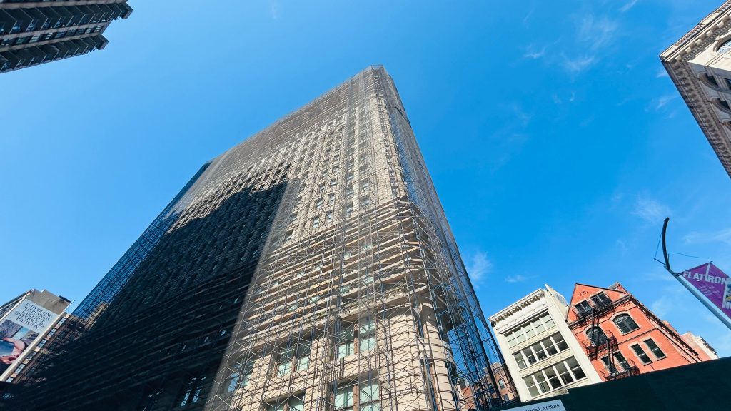
Nearby points of interest: To this station specifically, the Flatiron Building and Madison Square Park are the big ones.
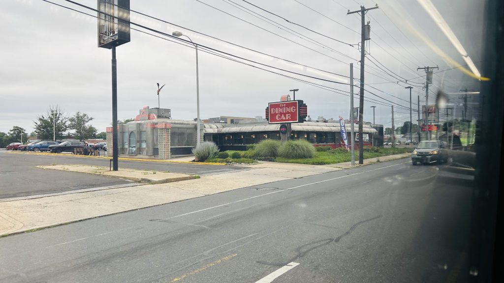
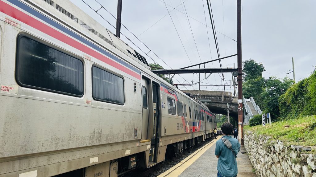
Wait, wait, wait…SEPTA?!?!?!??!? Did we seriously just backwards long jump past the ENTIRITY OF NJT TERRITORY?! Nah, this ain’t Mario 64. And even then, I still have NJT in the (as of writing this, very VERY large) backlog. Without further ado, here’s the first SEPTA Regional Rail(TM), first SEPTA (systemwide), and first blog entry anywhere beyond New York or the far Northeastern US.
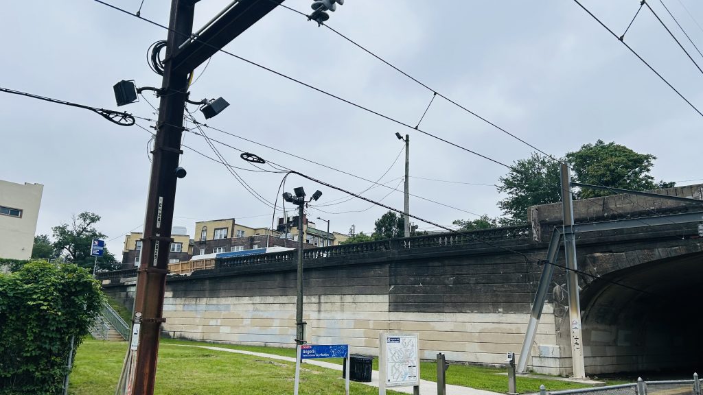
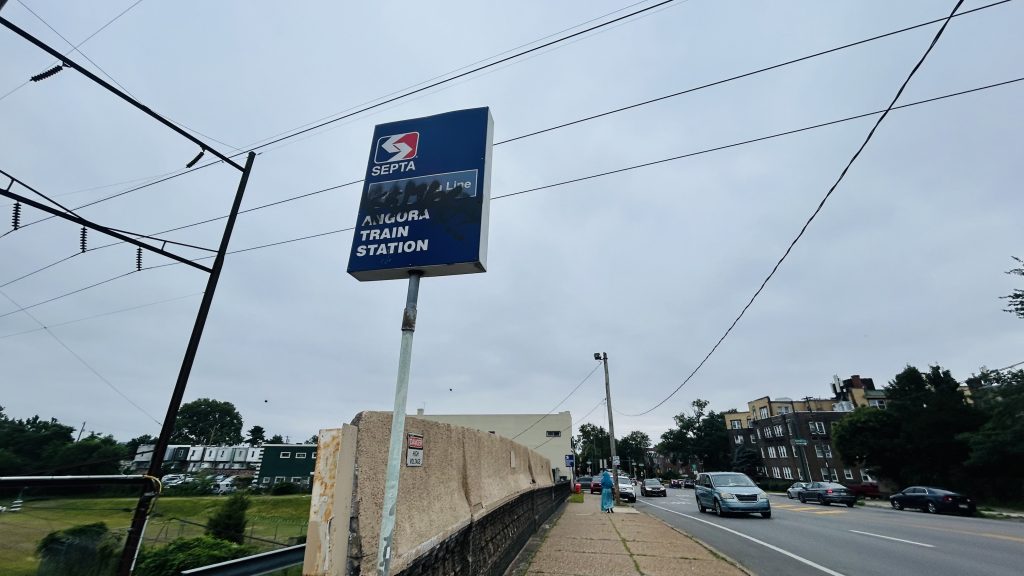
Signage!
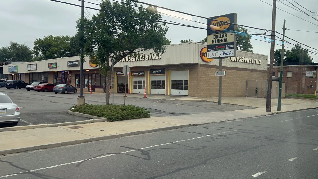
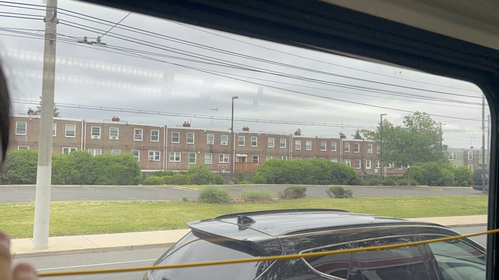
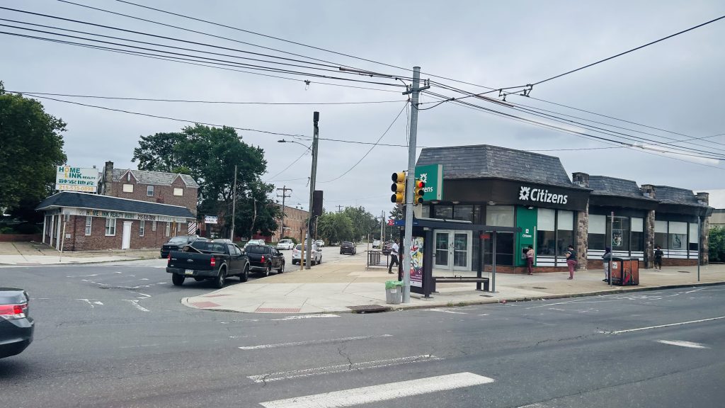
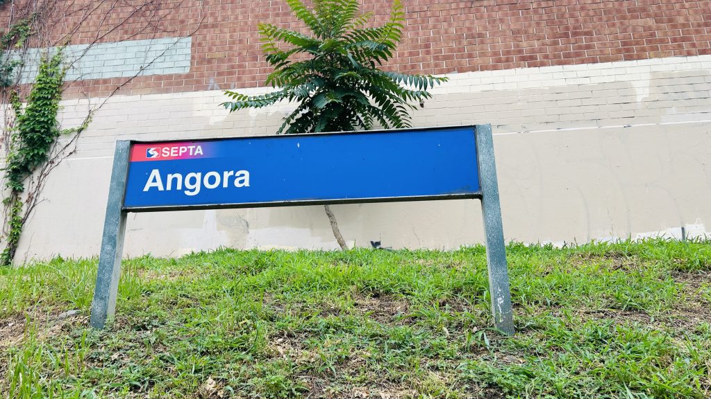
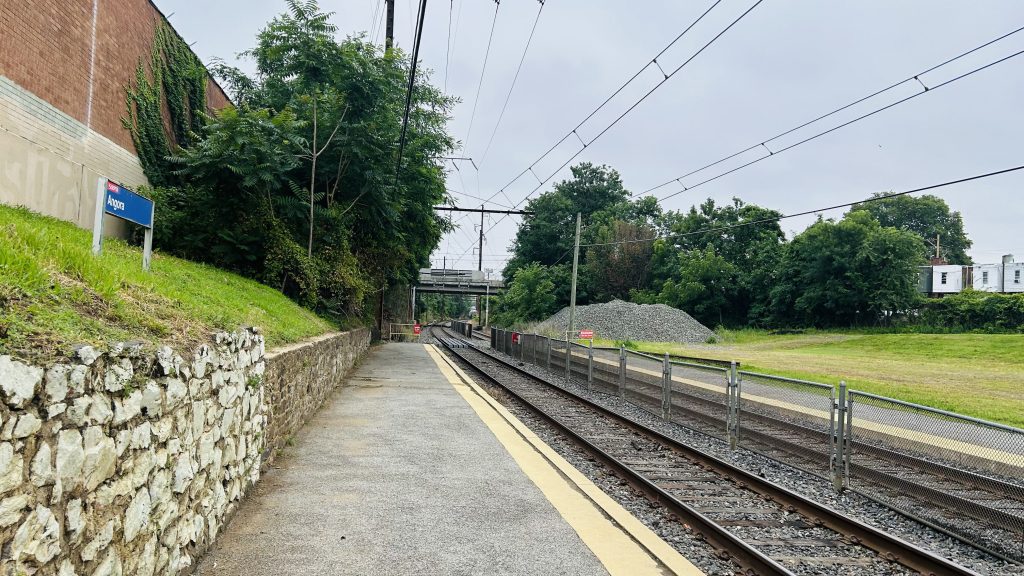
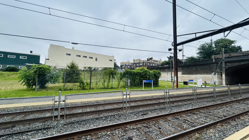
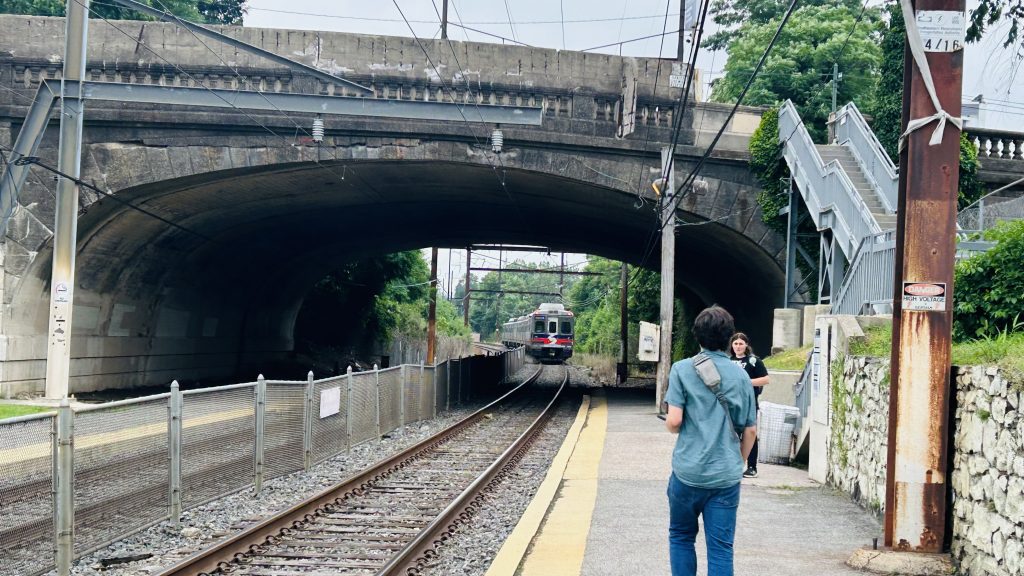
Angora Station is located on the outer fringes of southwestern Philadelphia, on SEPTA’s Media/Wawa commuter rail line, in the namesake neighborhood of Angora. It consists of rather little in the way of amenities (not even seating or a bus shelter?!), and even less in the way of accessibility. In fact, the only thing remotely ADA accessible about this (quite bluntly: shitty!) station is the bus connections, being the 46 between 63rd/Malvern and this station (where it turns!), and the 63 between Overbrook Station and Columbus Commons in South Philly. You might get a transit-accessible pile of rocks, if you’re lucky! As for inaccessible connections, you have the T2 trolley line on Baltimore Ave., of course. And, what amenities DOES this station have? …a Key Card machine. But, it’s not just any ordinary Key Card machine – because unlike, say, the ticketing machines on the LIRR, NJT, or Metro-North, these DON’T EVEN DISPENSE PAPER TICKETS! WAY TO GO, SEPTA!!! But, it’s also SEPTA. Of course they’ll do things in a rather weird and esoteric way. And, I think that’ll become abundantly clear in some coming entries within SEPTA territory… *wink wink, nudge nudge*
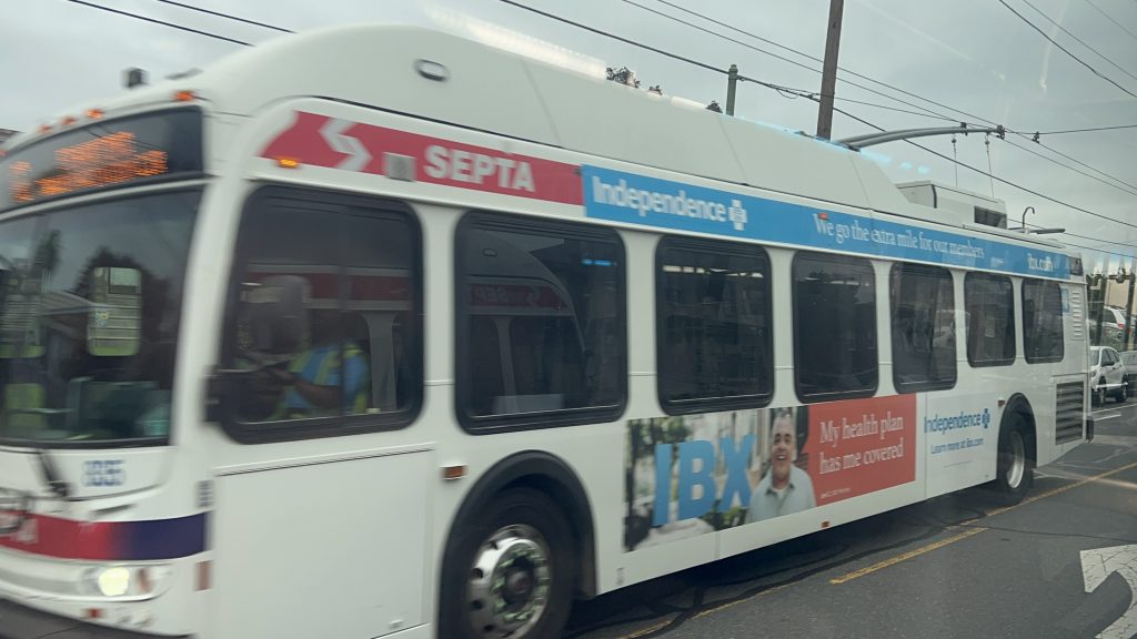
hmm i wonder who’s filming the Silverliner V…And looking towards downtown- er, Center City Philadelphia.ABSOLUTELY NOTHING!!!!!!And onwards to Wawa Station with you!An exit and the street – and lighting, I guessGraffitied lollipopThe T2 streetcar line
The good: …it exists, I guess??? You might see a pile of rocks if you’re lucky!
The bad: Why? Just, why? There is no station house or even amenities. It’s like they forgot the station itself. It’s like it’s just a point on a map where Silverliners stop. What kind of illicit substances were they smoking??? Even the Newton trio is better, because even THOSE had amenities.
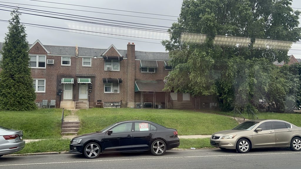
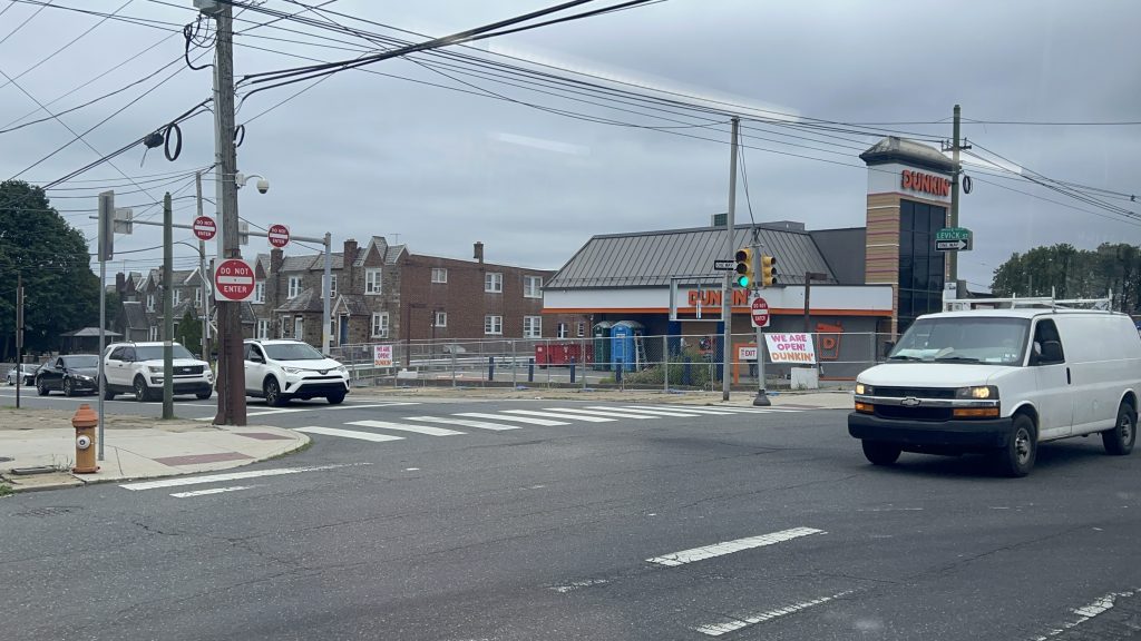
Nearby points of interest: A number of churches and mosques, a shopping plaza (w/ a Dunks!), and A LOT OF HOUSING.
Transit connections: SEPTA Regional Rail (Media/Wawa) SEPTA bus (46, 63 – both at Baltimore & 58th) SEPTA Metro (T2 – at Baltimore & 58th)
Overall, just…..why??????? What were they smoking? This is easily among the most “what the hell?” stations I’ve ever used. Just use fucking 46/63 (or the T2, if able-bodied) instead, if possible.
Rating: 0.2/10
Stay tuned, as A LOT more SEPTA (& NYC, and even some NJT) content is coming up in the coming weeks and months!
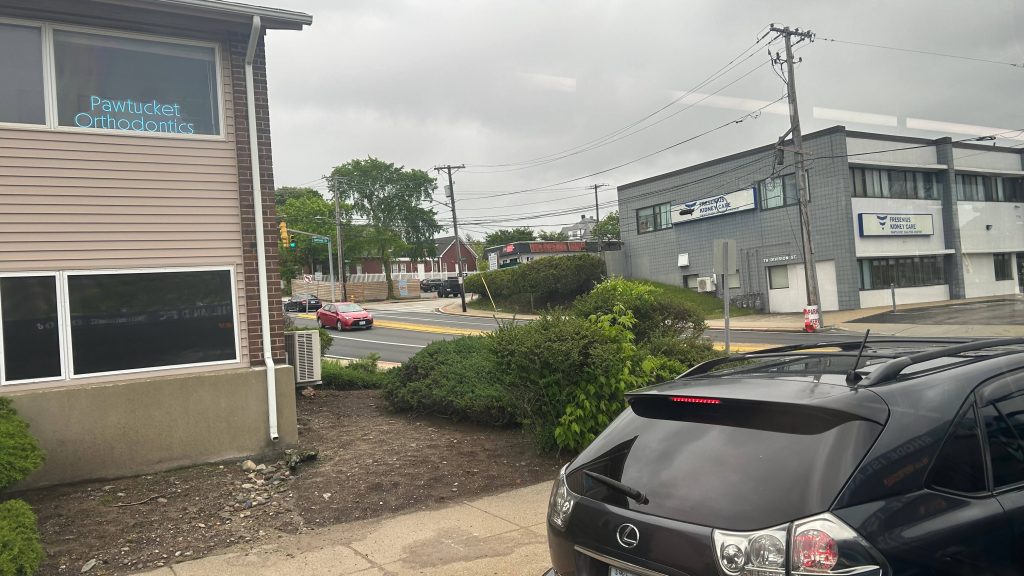
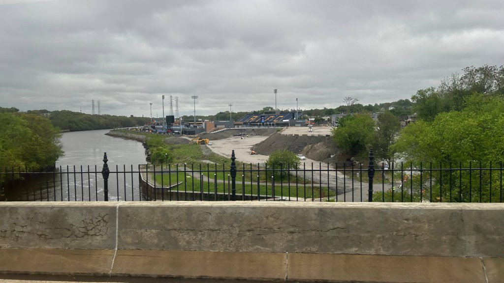
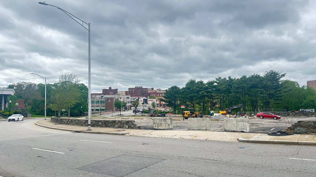
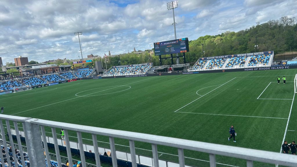
Rhode Island FC is a men’s pro soccer team based out of, as the name suggests, Rhode Island. Historically, their base of operation was Bryant University in Smithfield, however as of May 3rd, 2025, with the home opener against San Antonio FC, they will be playing home games out of Centreville Bank Stadium in Pawtucket. Most of their games will be pitting them against USL teams, as a USL Championship team themselves. However, sometimes, there are situations where a MLS team will be in town, such as the May 7th US Open Cup match vs. the Revs (at which they lost 1-2). Ironically, despite the fact the team has only existed in play since……the 2024 season (damn, they really started AFTER I began this blog?!), they STILL managed to get their own soccer-specific stadium before the Revs. Take that, Bobby Kraft! With all that in mind, y’all might have a pressing question….
Now what the HELL does a USL Championship soccer team have to do with anything I write about?!
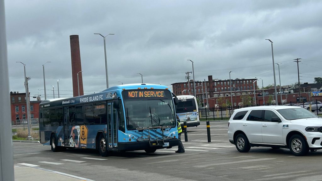
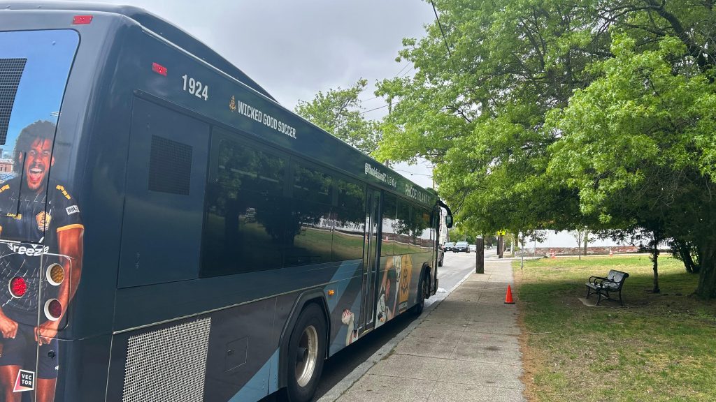
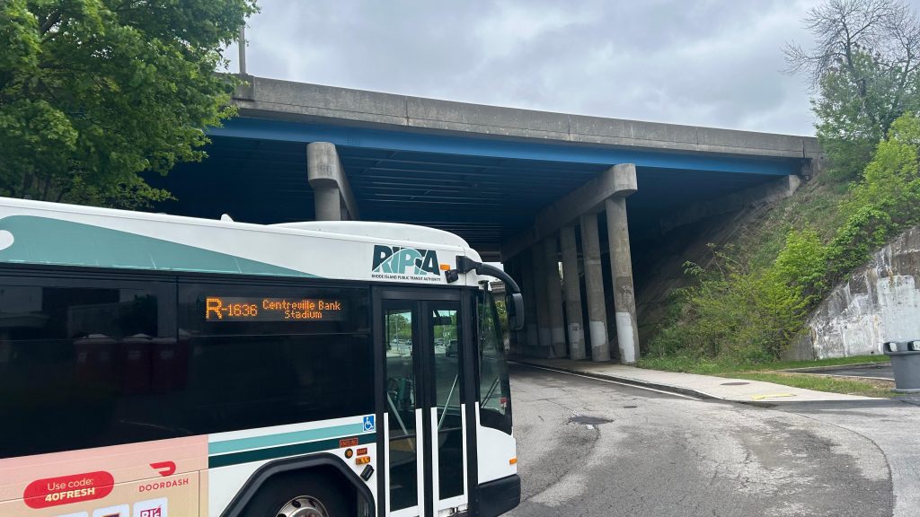
Well, I’ll tell you what: they paid RIPTA to run game day bus service! So, without further ado, here’s what’s in store, after riding the game day service route before the May 10th game vs. Monterey Bay FC – from the Commuter Rail to the stadium via the Apex lot (M7). Let’s look at this, and let’s see how this game goes. I really hope it’s not another draw or another loss…
On-site super talking to the driver. Also, that’s a pretty sick livery, to be real.
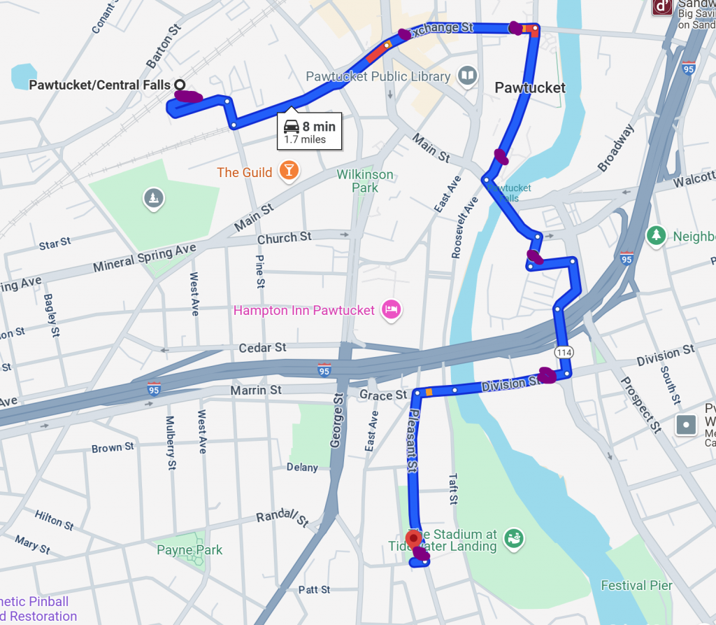
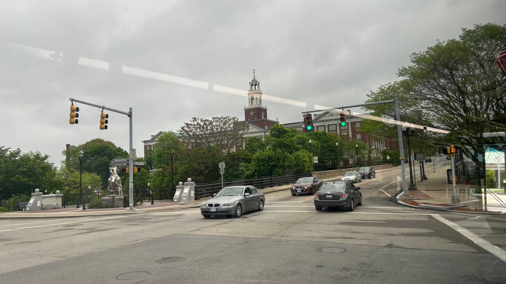
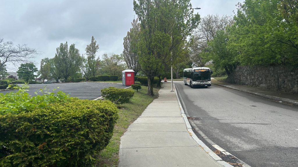
So, after waiting 15 minutes for a bus to even show up, the first bus shows up at the Pawtucket train station. Of course, this also comes after the driver and the on-site supervisor talk a bit, presumably with the super handling headway management to make sure buses actually leave every 8-10 minutes as prescribed. Annoyingly, though, the routes taken were not as what RIPTA’s public material has suggested (which suggested two loops). Instead, what happened, was that the bus did one big loop hitting all the lots in relatively close proximity to the stadium. Here it is mapped out.
The actual route taken
The purple dots are the stops made (all stops are made, no requesting needed). You have stops at Exchange & Broad, Exchange & Roosevelt (lot M16), at the visitors center (lot M12), the Apex lot (lot M7, the designated tailgating lot), and at Division St. near School St. (lots D4/D5/D6). In terms of what it hits, it hits pretty much all the important places. Furthermore, given the high frequency of the route, you don’t have to worry too much about timing the bus with the Commuter Rail (which means, yes, you can take the train to the game!!! Just…..keep in mind the time of the train departures for the return trip.). As for the usefulness of the route, it really is useful. It fulfils the intended use pretty well, and even though my trip to the stadium was low ridership (it begins running 3 hours prior to the event, while the gates don’t open until 2 hours prior), my trip BACK was PACKED. Like, it was less than standing room kind of packed. I don’t think I’ve ever seen a RIPTA bus that packed. Also, annoyingly, the route taken for the return was different, but whatever. So, with that out of the way, let’s get into the conclusion. In conclusion: GATRA and Bobby Kraft could probably learn a few things with better service to Gillette. RIPTA and RIFC know what they’re doing (mostly) here. Now, the good, bad, and all that fun stuff. Also, shoutout to the driver for letting me know that the pick-up spot is at the park where he dropped me off. Very much appreciated!
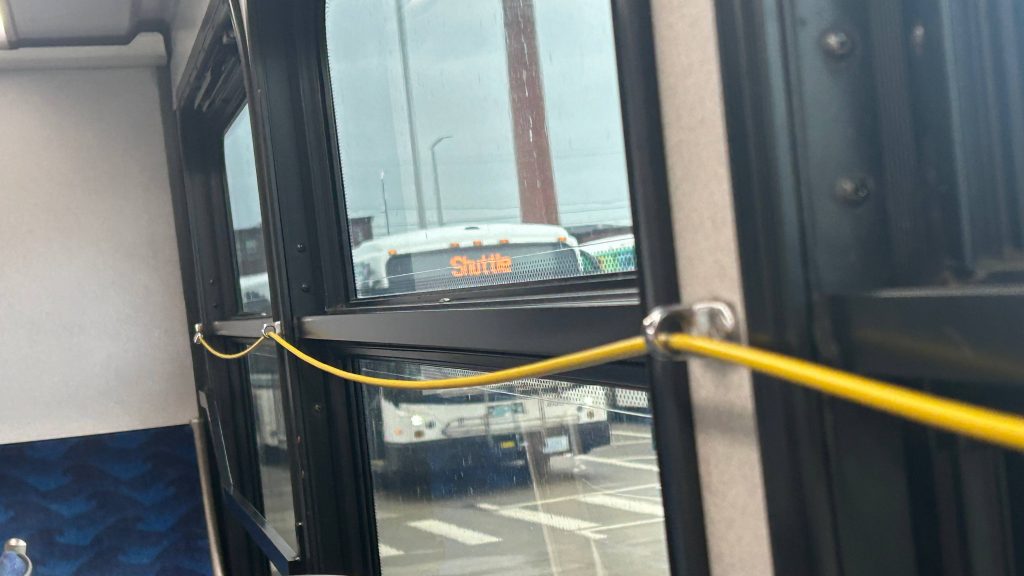
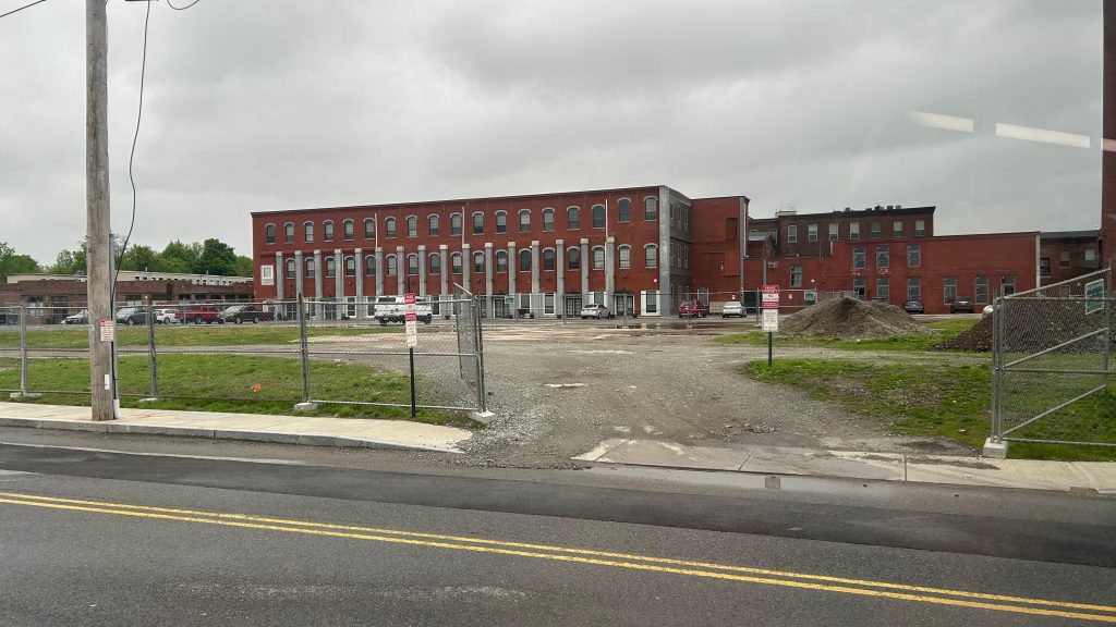
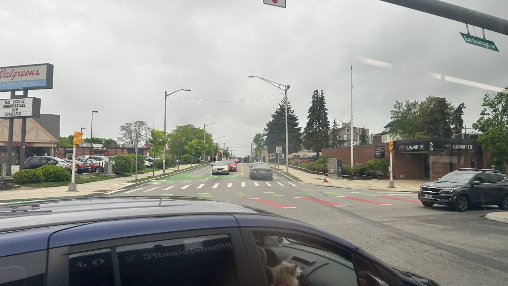
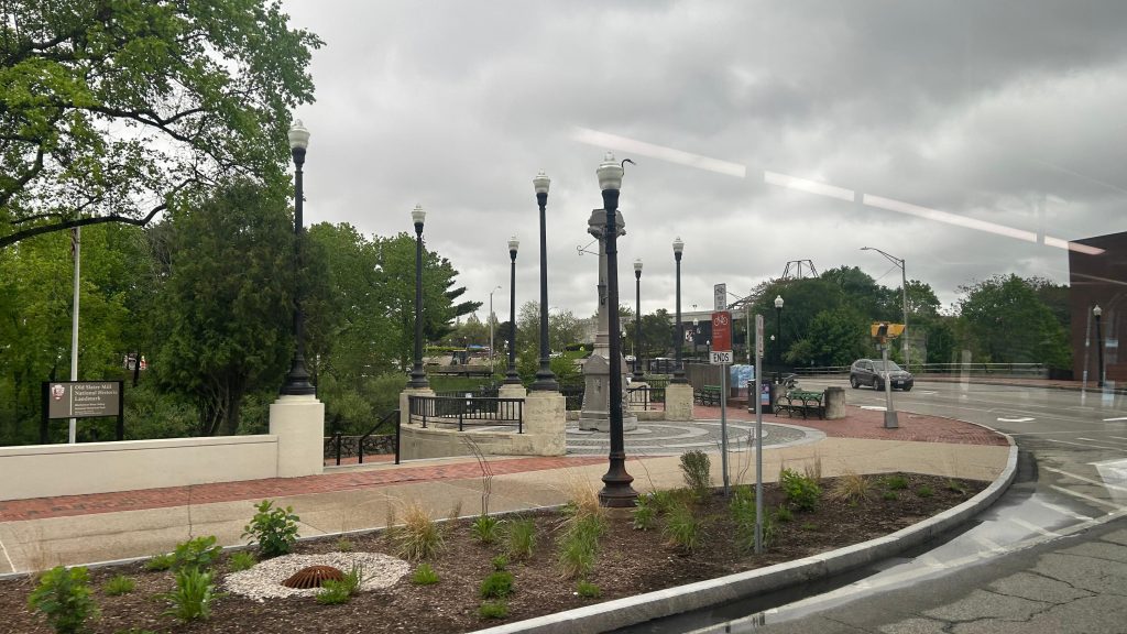
ShuttleBye to the train station!First stop: Exchange & BroadNext stop: Exchange & Main. Also, City Hall!Slater Mill and the dismantled Apex PyramidThe tailgating lot deviation!Defiance 1636!!!Division St. – last stop before the stadiumShe’s beautiful…Rather narrow side streetsEnd of the run at Ivan Perez Memorial ParkAnother bus!R-1636
The good: It’s very frequent and serves most of the lots, with the other unserved lots being a VERY short walk away (5 minutes max). It gets the job done, and pretty well at that (it’s also fare-free, so passengers who PROBABLY never rode RIPTA before don’t have to fiddle around for a $2 fare). Essentially, it has one job and it does that one job VERY, VERY WELL.
The bad: Inconsistent routing vs. the information published online. That’s probably my only real issue, but I’m sure this’ll be rectified as time progresses – as this is the first season of RIFC playing at Centreville Stadium.
Nearby points of interest: This one should be obvious. The outlying parking lots, the Commuter Rail station, the visitors center (& RIFC HQ), the stadium, and Apex/tailgating lot.
Overall, it has one job and it does that job very, VERY well. And, from what I can discern, it’s miles ahead of what RIPTA and the PawSox offered for game-day bus service back before, well, before the PawSox moved to Worcester (RIP).
Rating: 10/10
…there’s more, though.
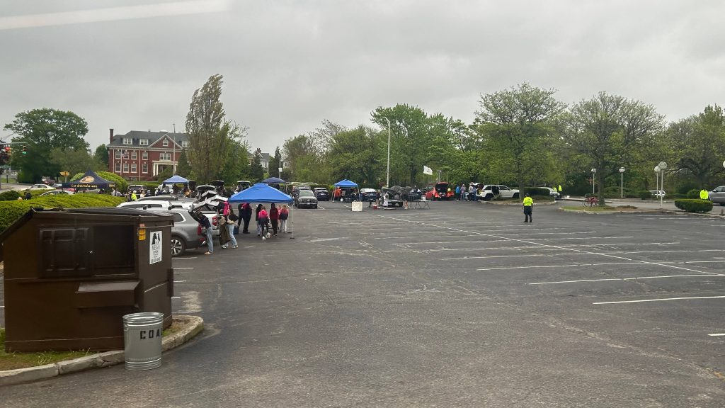
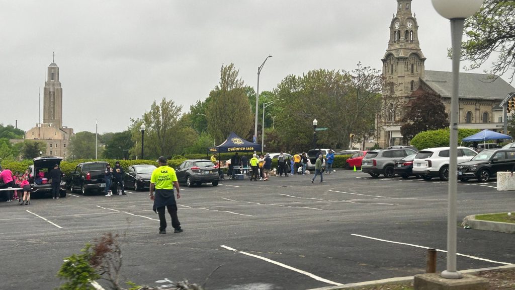
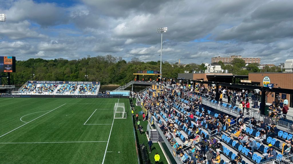
So, you thought that was the end? Well, not quite, actually. This day was actually a bit important, as I also had a bit of interest in giving soccer a chance and doing something new. After riding the route, I walked back to the tailgating lot and met up with the rather lovely (i mean this in a genuine manner) people from Defiance 1636. Of course, I knew some of them from the stadium open house a couple weeks prior, but I met up with them to partake in the tailgate, talked a bit, and the whole nine yards. Overall, they’re legitimately among the most welcoming people I’ve ever met. Now, I just thought from here, it’d be off to the races once the tailgate started being dismantled at 3ish PM. Whelp, I could not be any further from the truth – and perhaps, it might be good that I was no further from the truth. So, we’re all getting ready for the march to the match, and one of the ladies just……outright asked me if I wanted to help with holding a banner (it was VERY windy). And, I said “sure, why not?” And away we went, while sticking to the sidewalk. One left turn to Taft St. later, and we had free reign of the entire road with a police escort. And, on the megaphone…
R.I.!
F.C.!!!
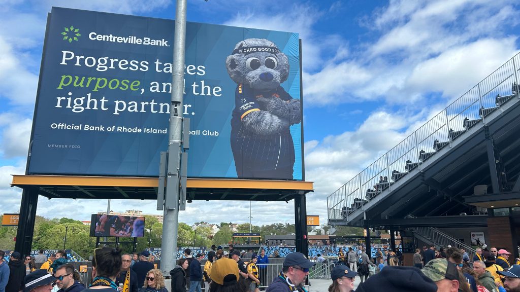
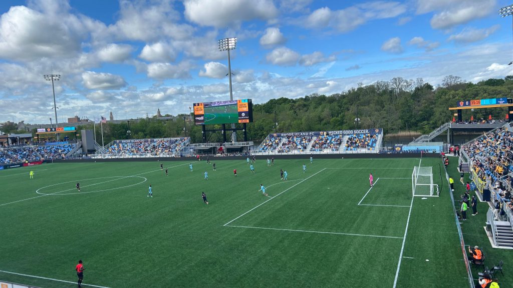
Cue that and a few supporter group chants for the half-mile walk to the stadium, along with trainhorns, then we clear security, and we continued on (albeit without the megaphone) with drums beating towards the supporters section (sections 115-117 at Centreville Stadium). It…..was AMAZING. Would I partake in it again? UHHH, YES! Seriously, shoutout to Defiance 1636 for being very welcoming and also adding to the pregame atmosphere. Of course, from here, it was off to the concessions to pick up, well, concessions ($1 hotdogs?!), and to my seat in section 211. So, I made myself comfortable, enjoyed the game, realized that I……might be an unhinged soccer fan(?!), and ultimately enjoyed and cheered for RIFC, as the game ultimately ended in a 1-1 draw. Damn.
Centreville Bank, AND CHIP?!WHAT’LL IT BE?! GRASS?! OR TURF?!The Seekonk River and Defiance 1636!Didn’t get any photos after this, but the score was 0-1 until about….77 minutes in.
Overall, it was a very good time (hence the lack of photos, I was genuinely enjoying it), and I’d strongly recommend you (the reader) go to a pro soccer game at least once in your life. If nothing else, at least just once. Because, holy SHIT, was it a glorious time.