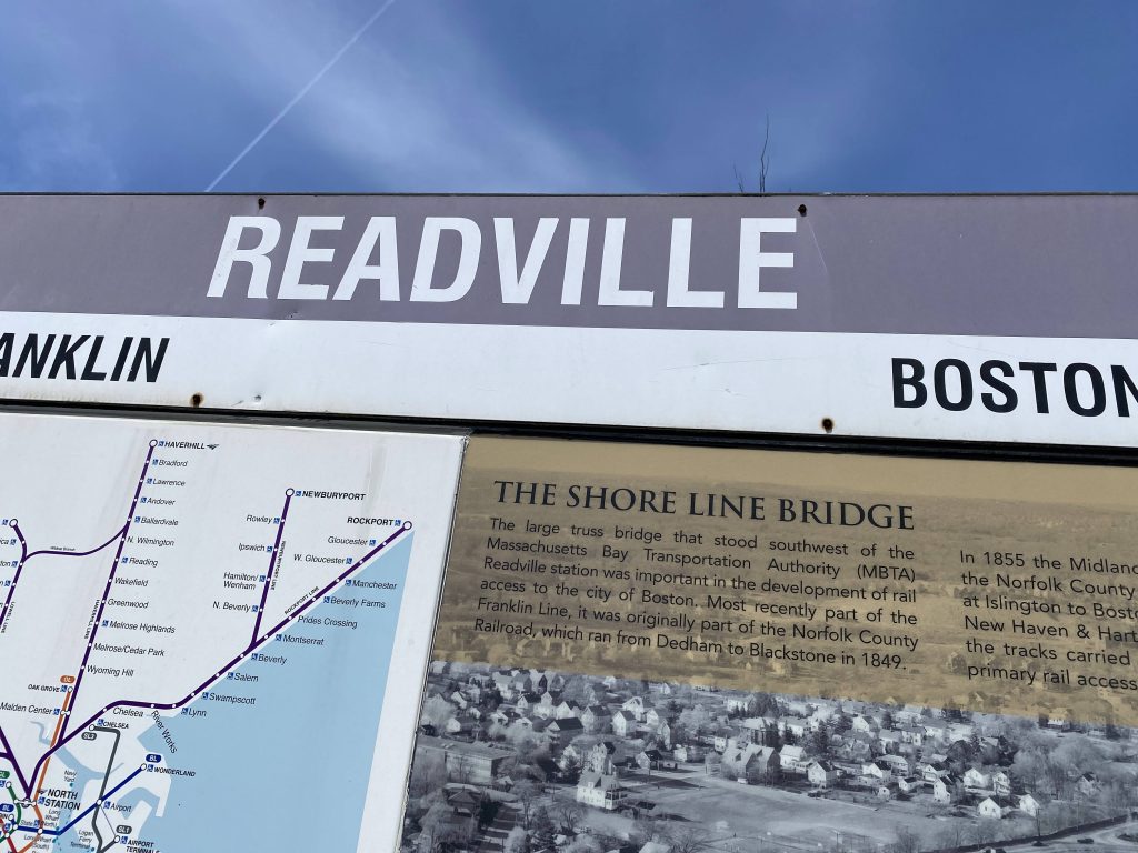
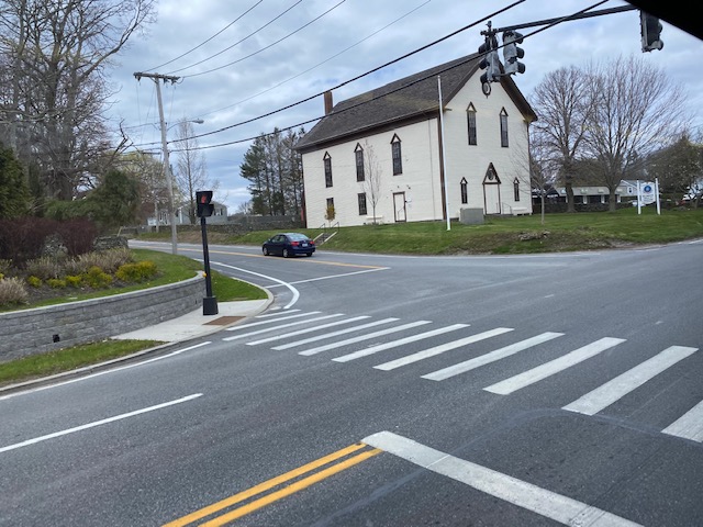
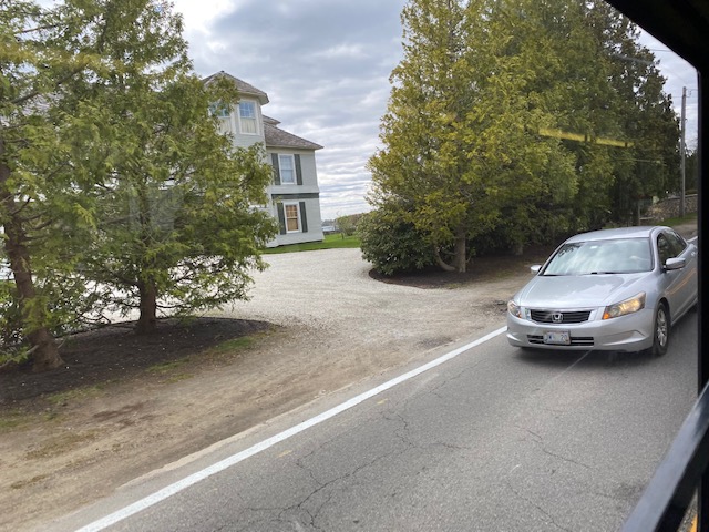
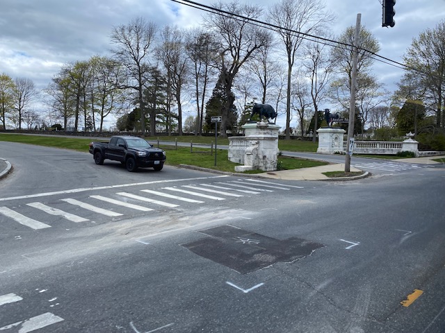
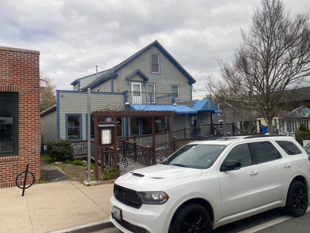
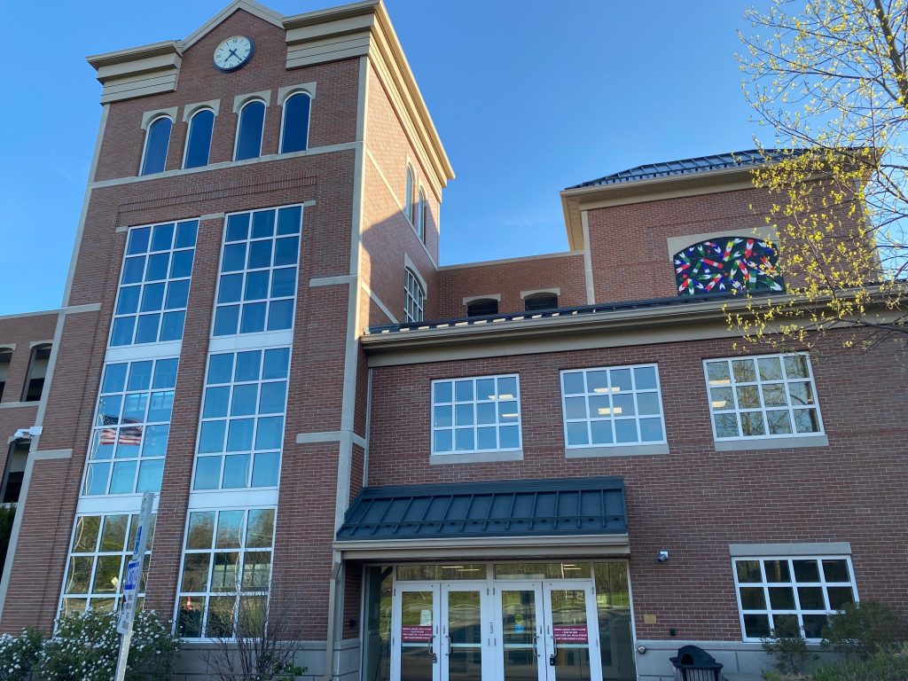
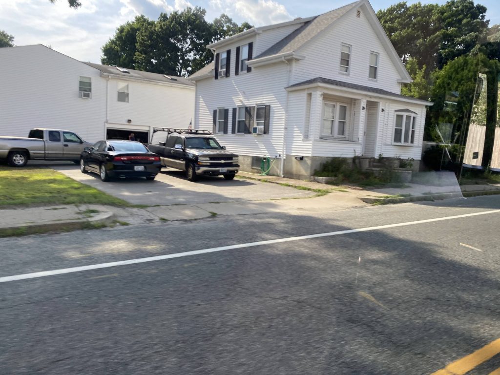
Readville Station. I’ve seen some interesting things about it, but what mostly got my eyes was the relatively unusual track configuration. What does this Commuter Rail station have in store? Let’s find out.
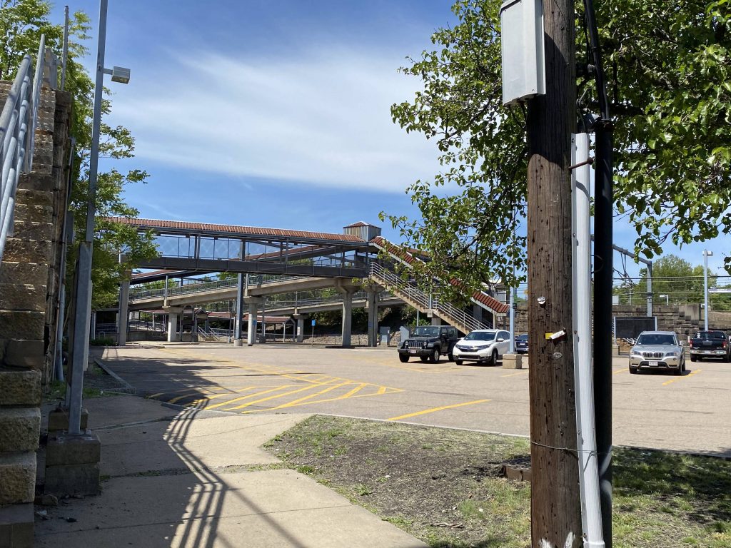
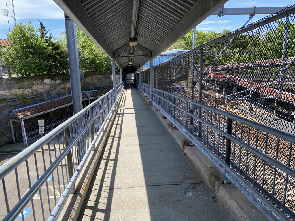
The many bridges and ramps linking the platformsWHERE’S MY HELVETICAL BOLD?!?!Oh, there it is!
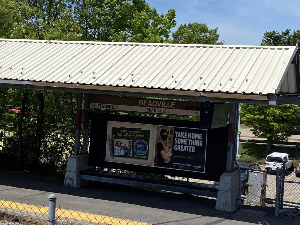
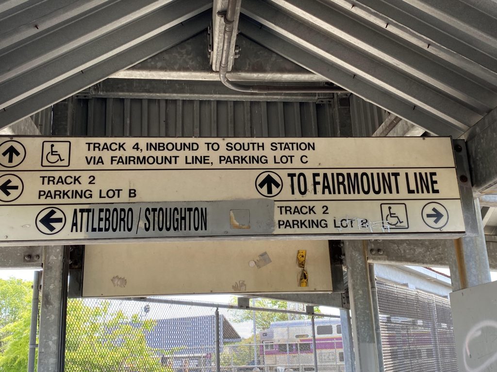
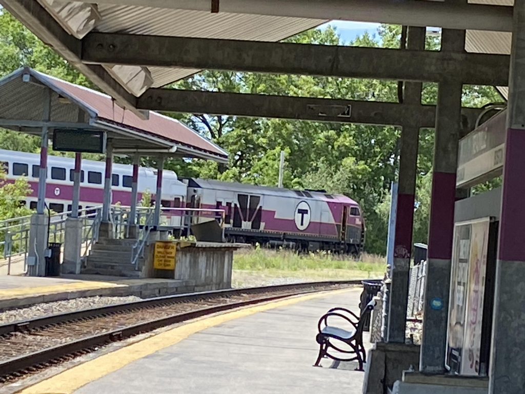
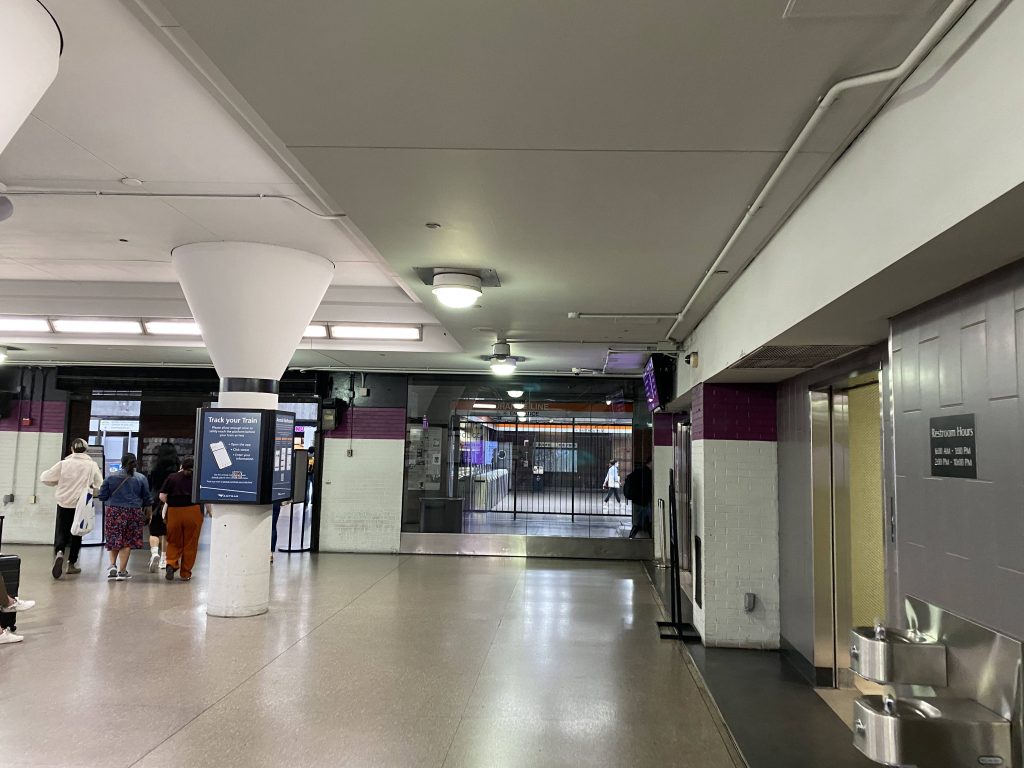
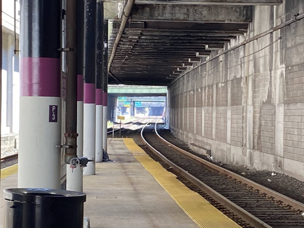
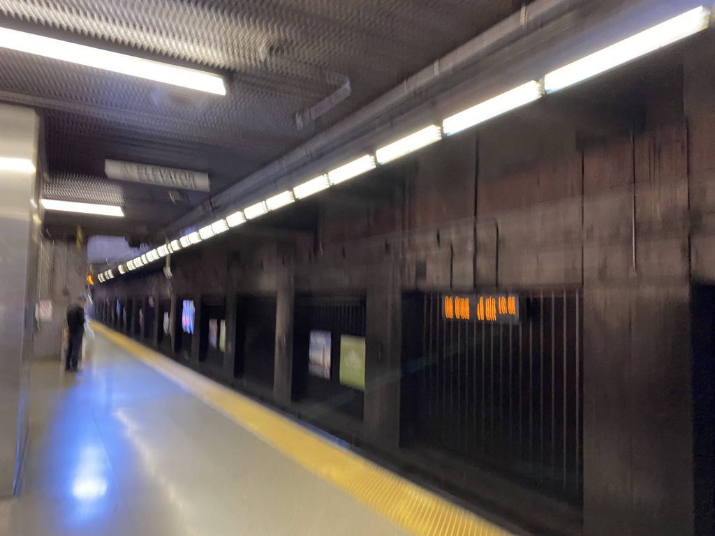
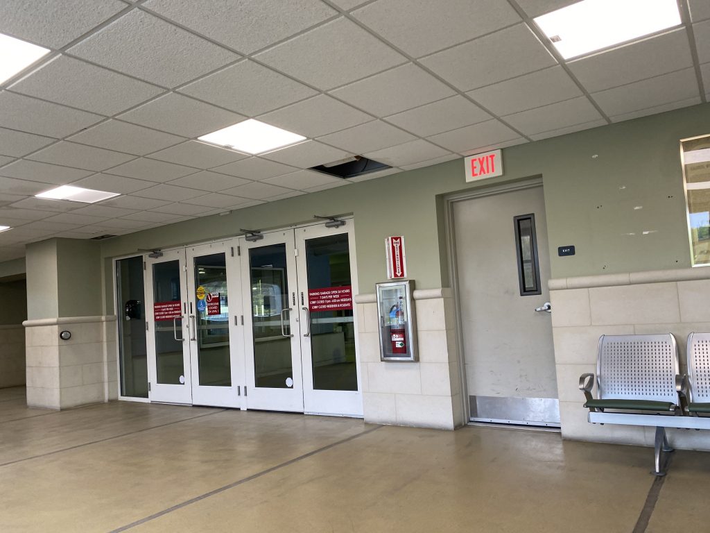
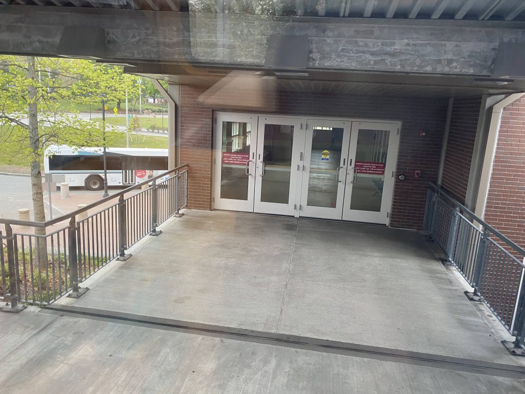
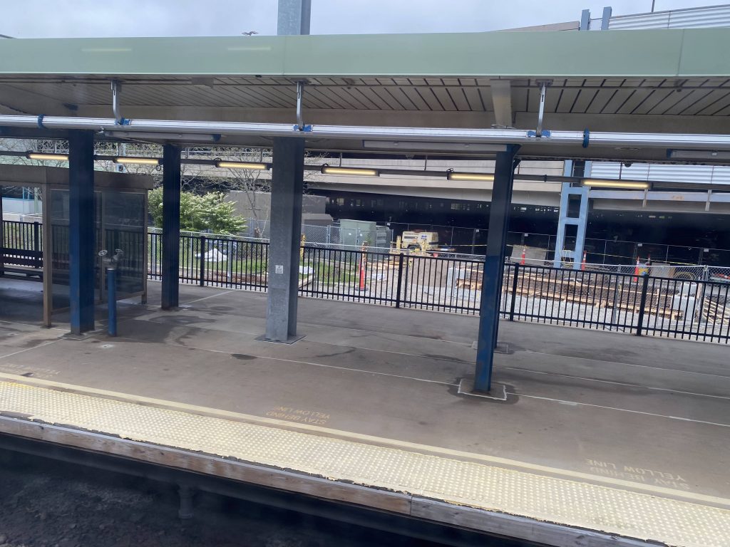
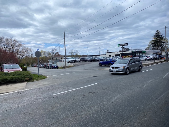
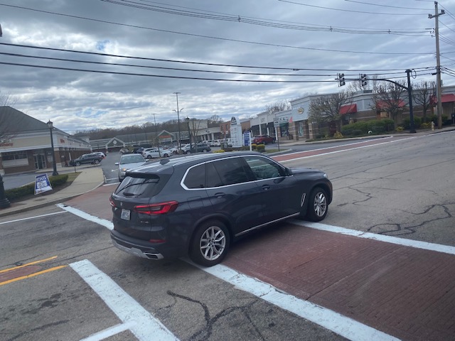
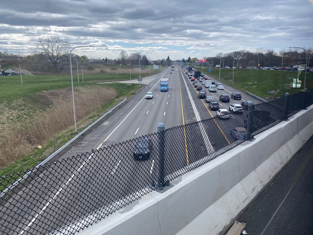
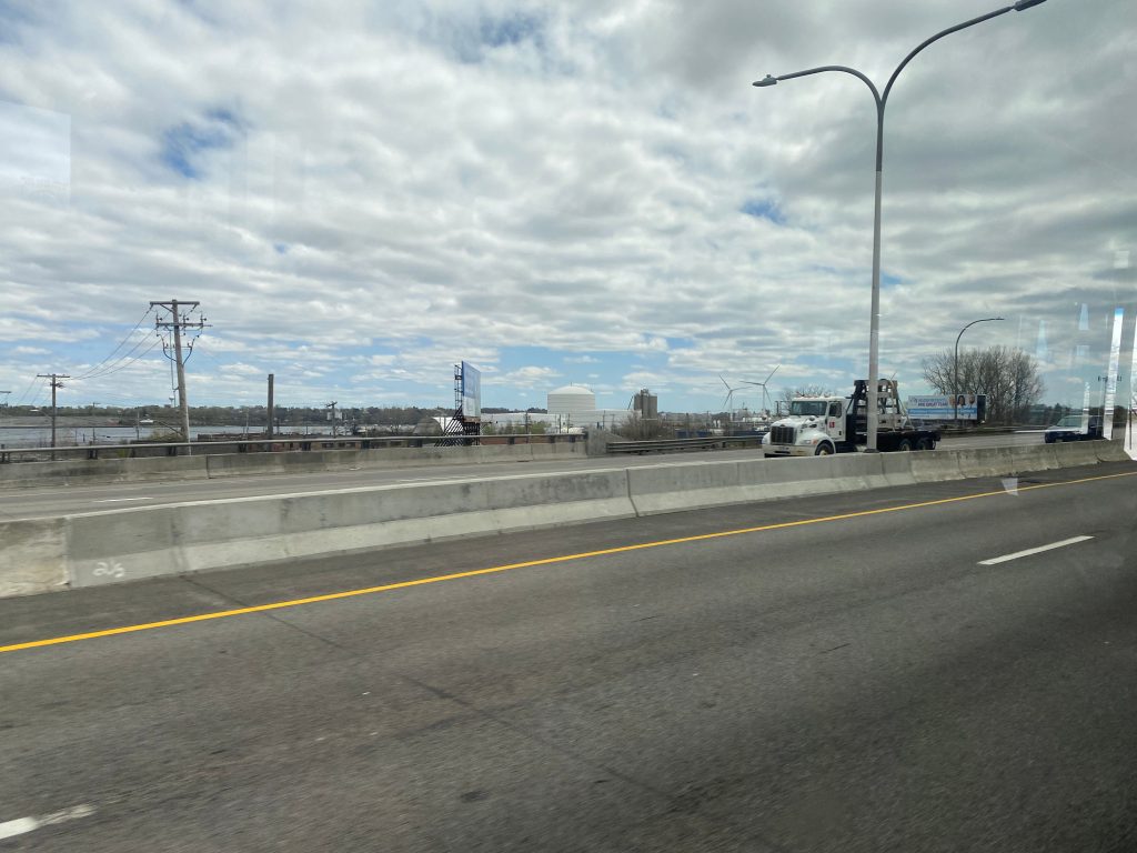
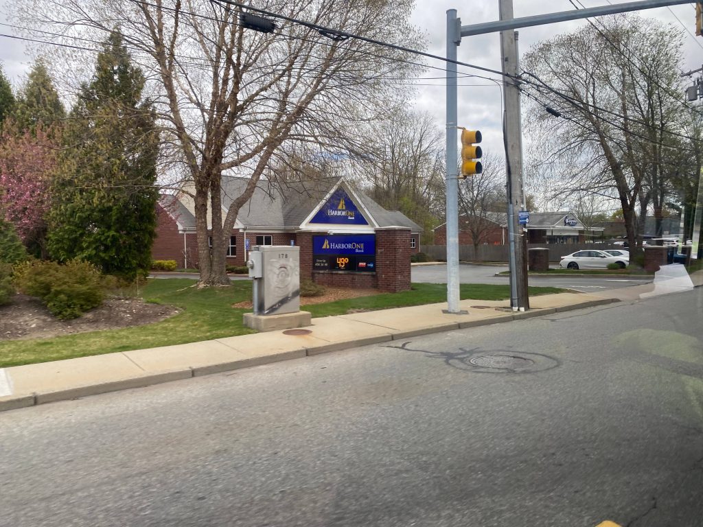
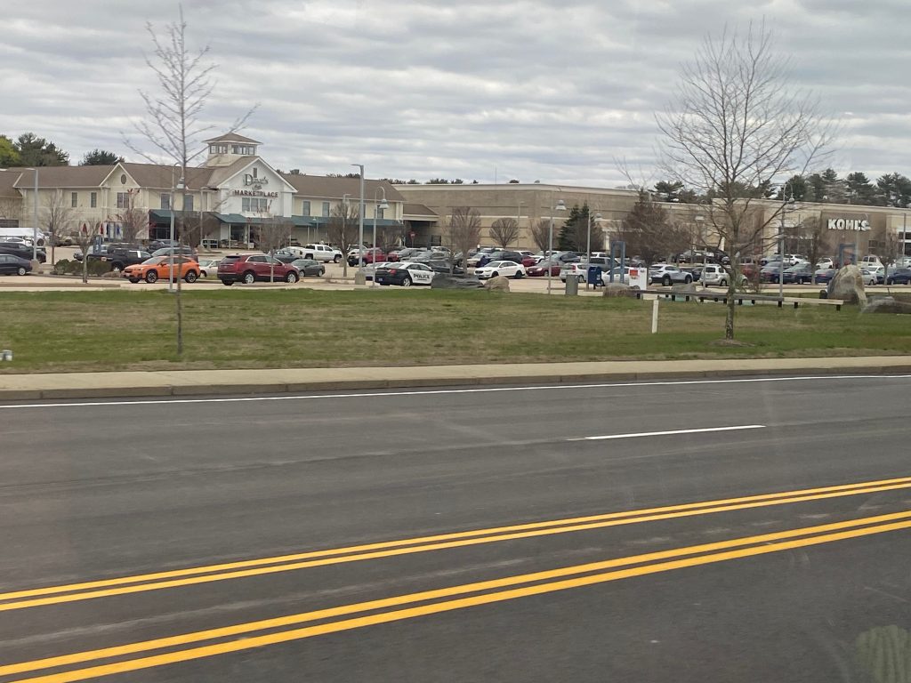
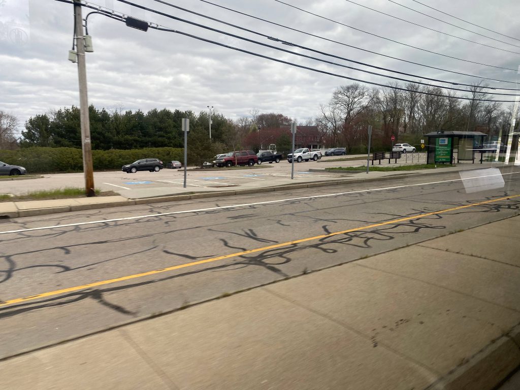
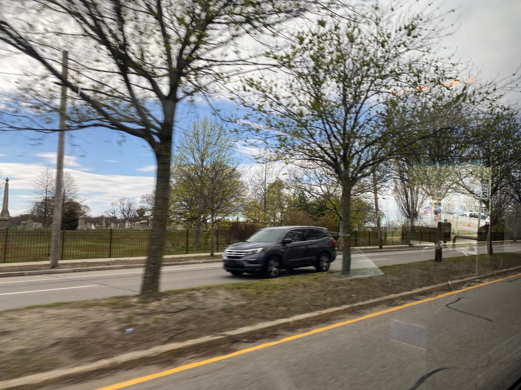
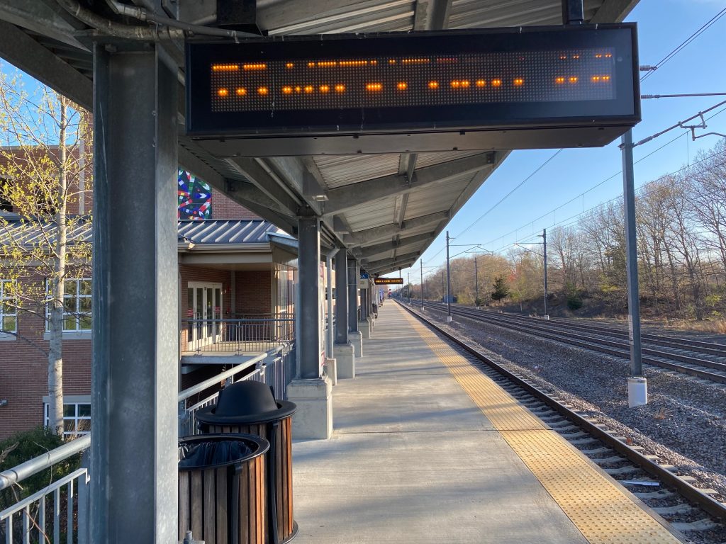
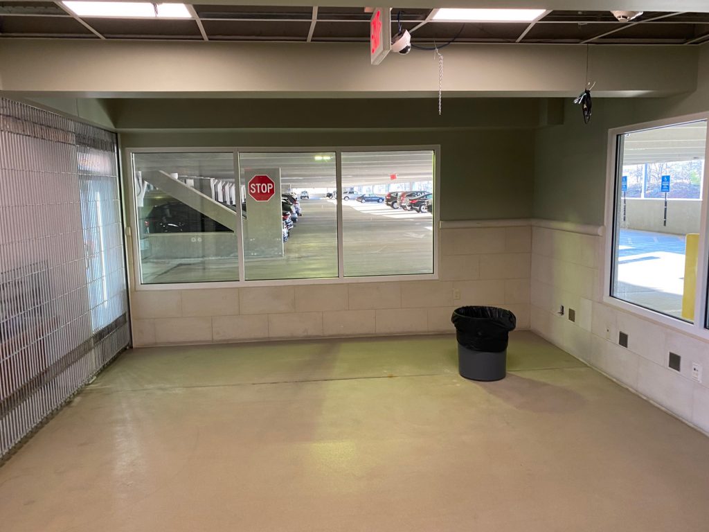
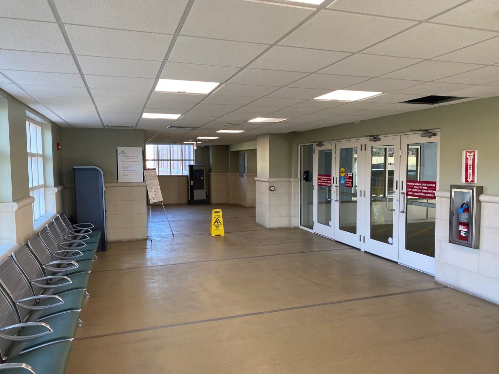
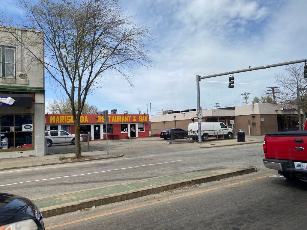
My friend and I took the 32 from Forest Hills to Wolcott Square, which was right outside the station. From here, it was quite evident that Readville was a wide open train station with four platforms. From west to east, they are the Franklin/Foxboro platform, the unused Providence/Stoughton platforms, and the Fairmount platform at the flyover track. In terms of amenities, it’s pretty barebones, but given the sizable parking lot they probably intend on this being a park & ride station. While there’s no bathrooms here, there are some businesses nearby, including a Dunkin’, which may or may not let you use the bathroom.
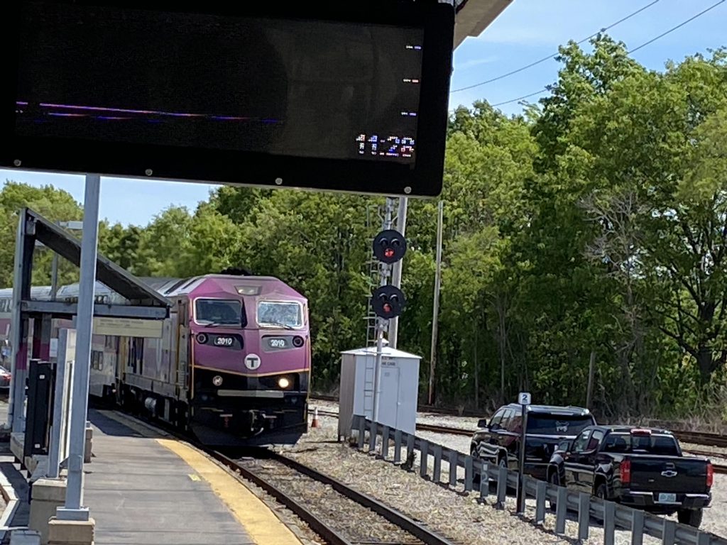
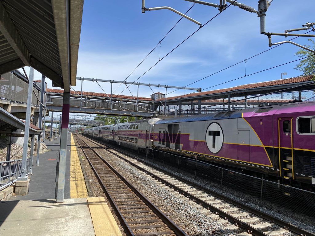
A Fairmount train pulling in
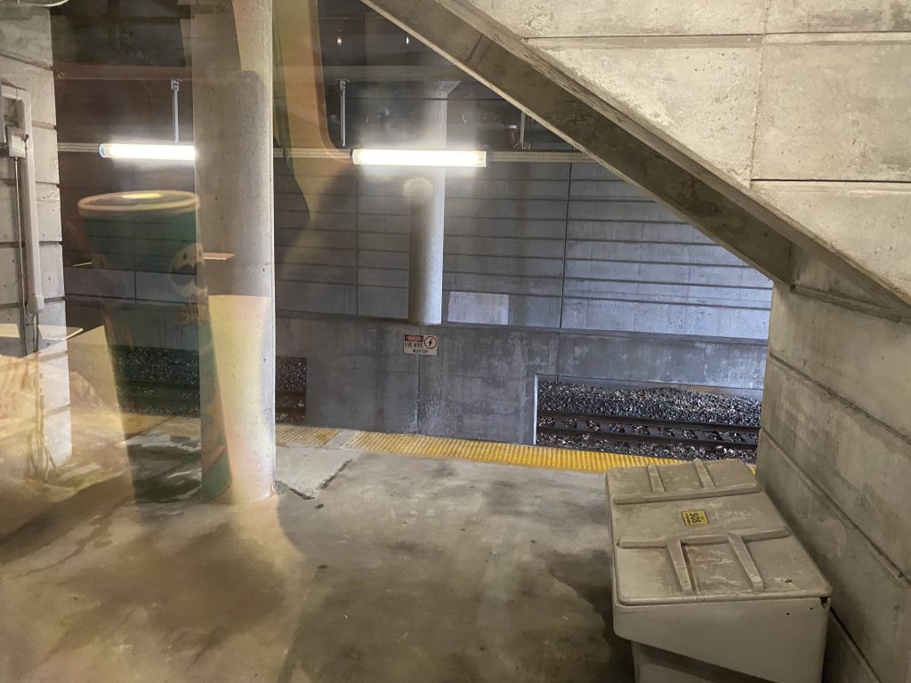
Now, for accessibility. The low platforms, at first glance, may scream “I AM NOT AN ACCESSIBLE STATION!!!”, and that’s technically true. However, unlike Westerly, there’s two major differences: 1. there’s ramps and bridges that aren’t in as bad shape as South Attleboro (because they used concrete instead of all metal) and 2. there’s a mini-high at each platform!
One of the many ramps at Readville
Now that I think of it, it feels kinda like a time capsule. Like, how long has it been since the Providence/Stoughton Line ended at Attleboro? Has to be before I was born, if anything (for context, I was born in ’01).
Attleboro?!The overpass!
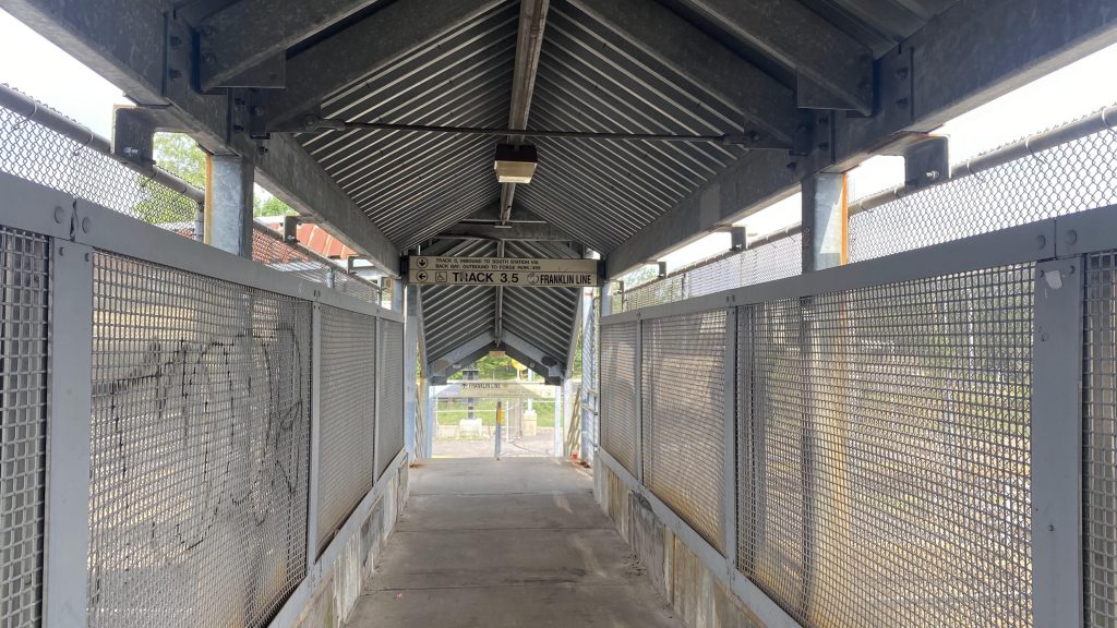
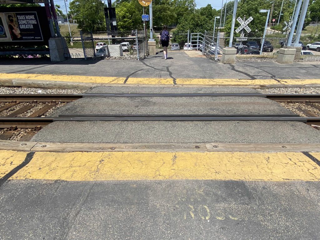
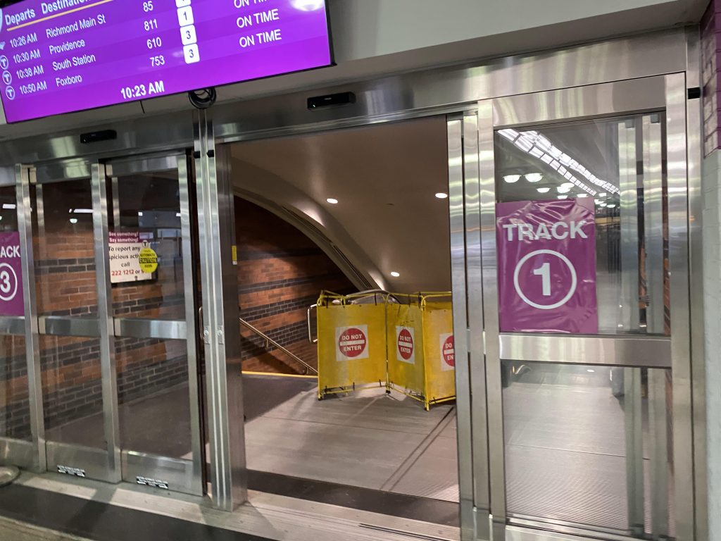
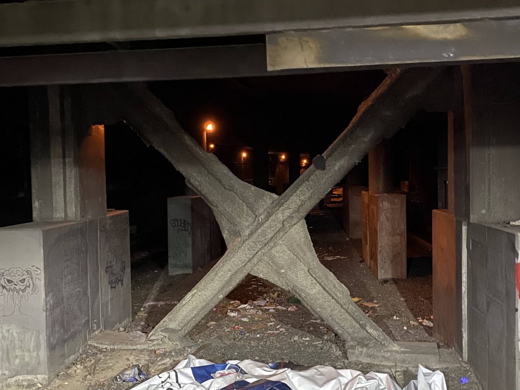
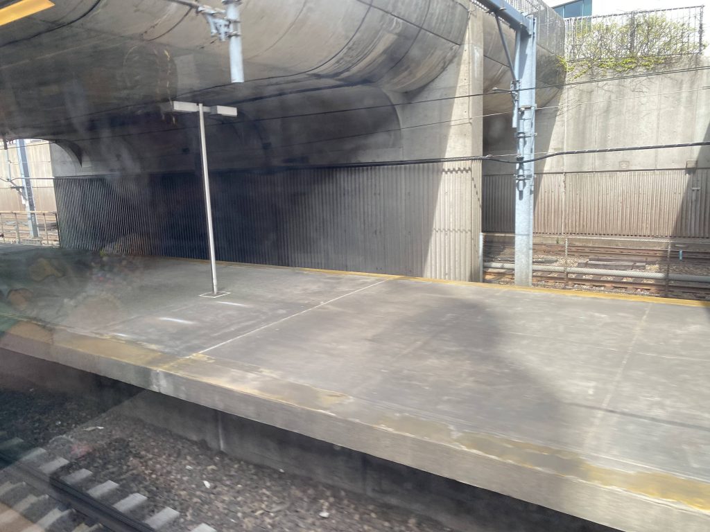
Now, most stations are straightforward and usually safe with getting to the platforms. However, the Franklin Line platform is a bit sketchy. Take a look.
Yikes.
Why they couldn’t put everything on the other side, is beyond me. But, whatever. At least it’s better than Back Bay’s ventilation issue. At least for railfanning, it’s also a pretty good spot. There’s the Acela and Regional for one. This station’s also the terminus of the Fairmount line and pretty much every Franklin/Foxboro train stops here, too. Providence/Stoughton trains also express through here unless a train evacuation is necessary for any reason (e.g. mechanical failiure)
The Fairmount train pictured earlier, laying overLooking up the Northeast Corridor mainlineTrain from Providence passing through, in reverse!
The good: It’s a nice little train station. It serves as a decent park and ride lot as well, with access to two train lines (Franklin and Fairmount), and a third (Providence) and Amtrak service expressing through here. It’s also a good railfanning spot.
The bad: It’s a bit of a maze, and can be a “screw you” station at times, especially if you’re unfamiliar. Also, the fact it’s only mini-highs instead of full highs. Also, what’s with the Franklin Line crossing?
Nearby points of interest: Not much. I mean, there’s a pizzeria nearby, along with the Fairmount layover yard (don’t trespass!).
Overall, for what it is, I’ve certainly seen worse. It’s not bad, but not too good either. Average, if anything. It’s still better than South Attleboro and the sorry state that station is in currently, though. Also, the arch bridge the Fairmount line goes over is kinda nice. There’s also a decent amount of parking, should anyone want to use it as a park and ride. 426 people use this station each day on average, as of 2018, which while it’s nothing to laugh at, is nowhere near the ridership numbers for stops like Forge Park or Norwood. For Fairmount trains, though, it’s among the most used stops outside of downtown.
Oh lordy, I don’t even know where to start with this. For one, it’s my first non-RI post (proper, not the half-assed River Works post that I did without visiting!). Actually, the next five or so posts I do will all be from my trip to Boston (5/26/22), so strap in!
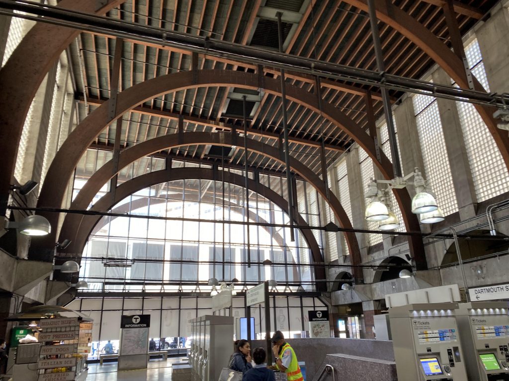
Helvetica Bold!The exterior, from Wikipedia
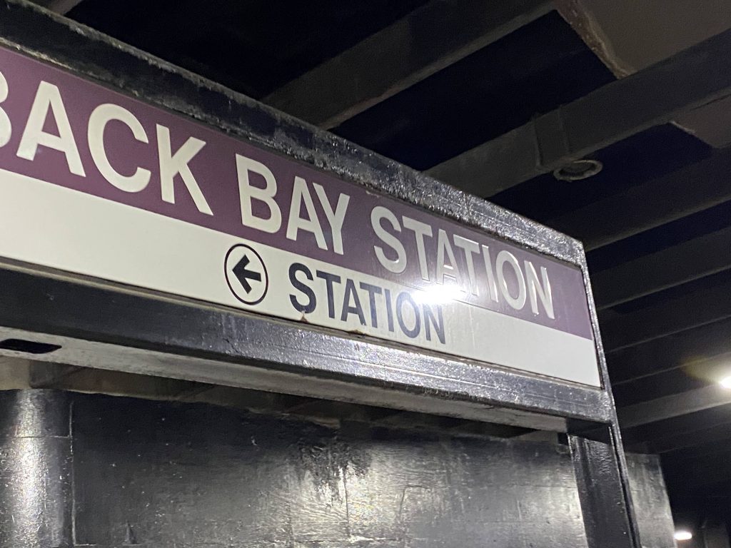
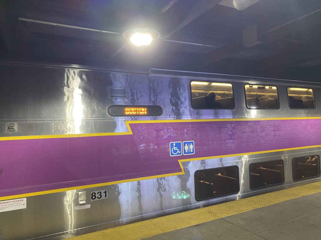
Now, I can’t say much about the exterior as I wasn’t outside, however it’s definitely on the more “upscale” side, to fit with the rest of Back Bay. The station lobby matched. The train platforms, however….. Oh boy. So, getting off the train from T.F. Green Airport, it immediately hit me as to why this station has a bad reputation. The diesel fumes could be smelled all over the platform, and it was bad enough to where one would need a military-grade gas mask if they had breathing issues. I genuinely wish I was exaggerating, but I’m not. So, booking it up the stairs so as to not inhale too many diesel fumes (which I completely disregarded later). I’ll also add as a tidbit, my friend could even smell the fumes in the mid-section of an Acela car at rush hour.
The train my friend and I got off of
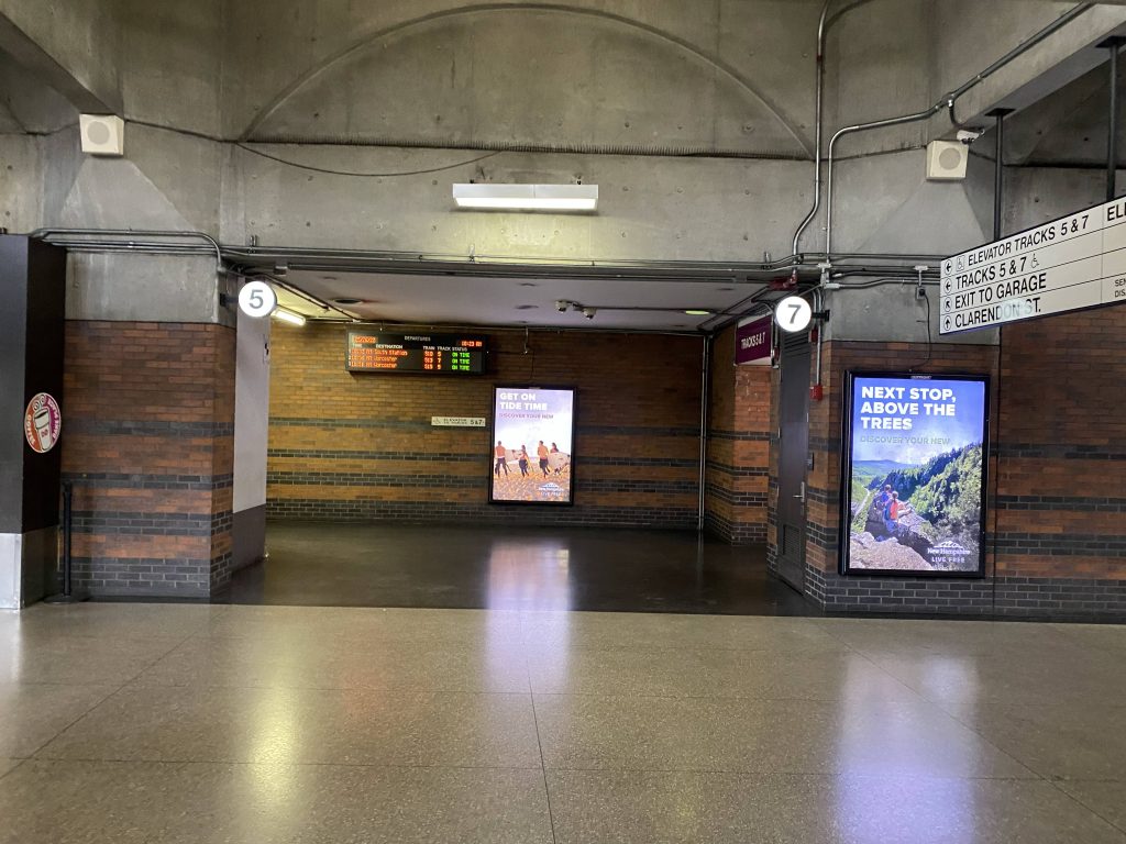
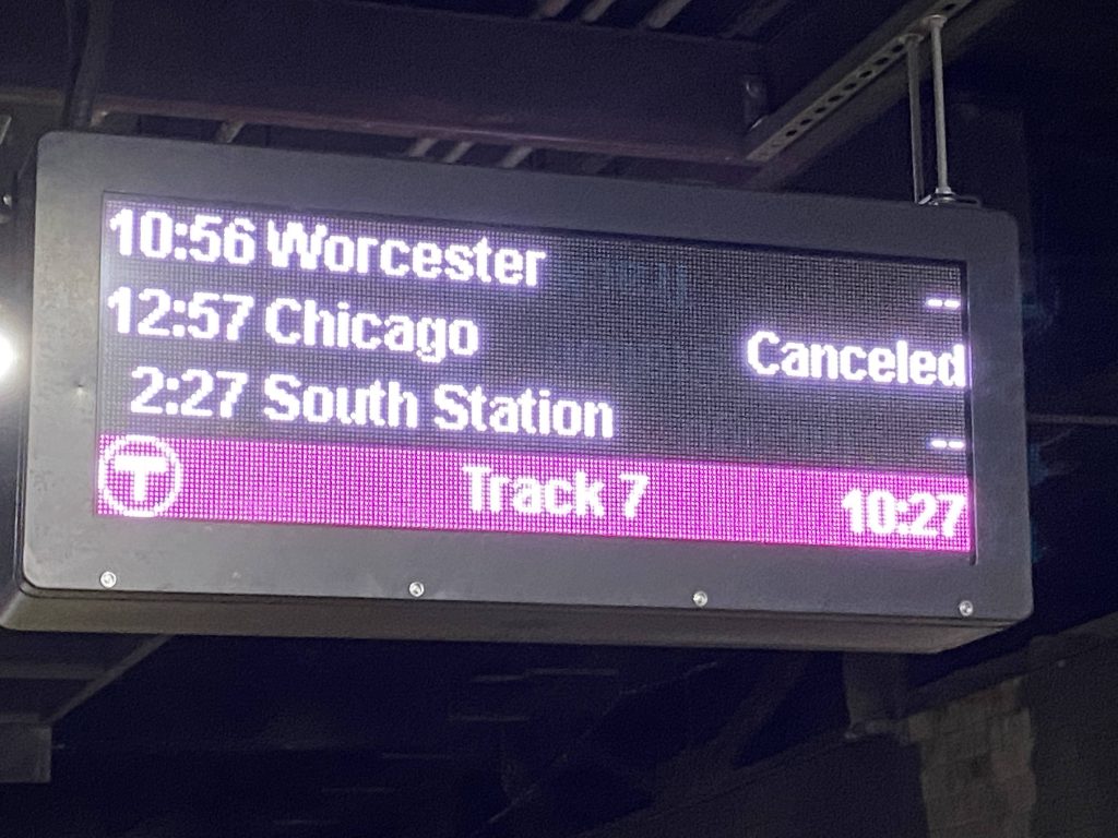
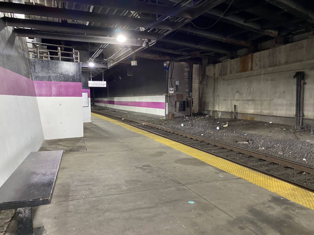
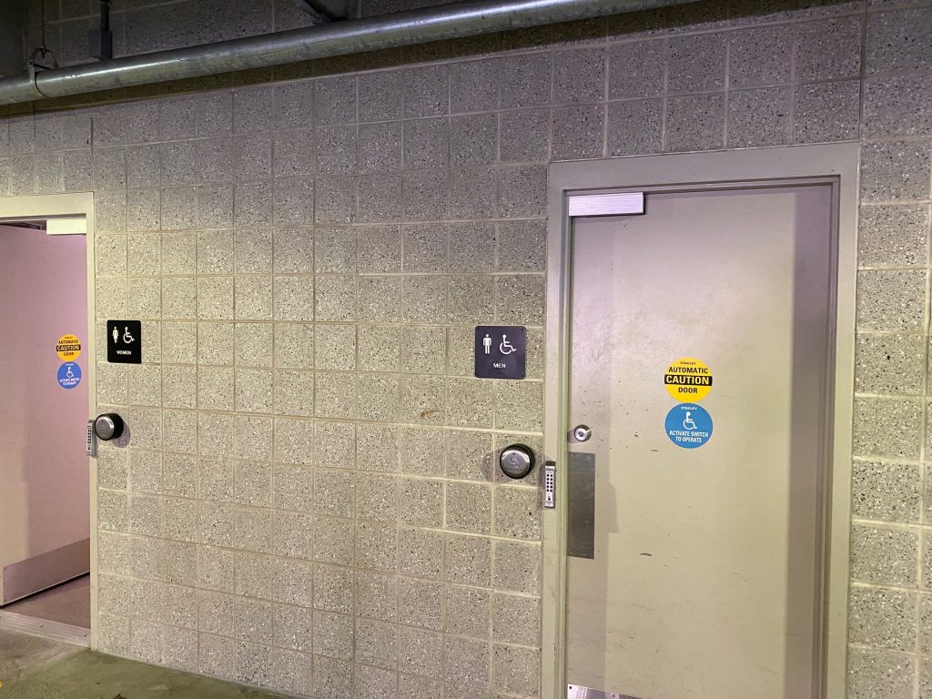
Fortunately, the lobby is much different. After going up a dingy staircase, the air was considerably cleaner. At least one could buy MBTA tickets here, along with Amtrak tickets due to a Quik-Trak machine being present. However, because of the aforementioned air quality issue, Amtrak doesn’t staff the station. As such, it also happens it’s the most used Amtrak station that’s unstaffed, to my awareness. (EDIT: I was wrong. Amtrak staffs the station now.) It’s also up here that the bathrooms can be found. Just remember to flush the toilet, or you might be stabbed numerous times. The building itself feels a lot more “open” than down below, to say the least. There’s also a Dunkin’ (two!) and a CharlieCard vending machine here, as well as fare control for the Orange Line. Further back, by the Dunkin’ is where the stairs to tracks 5 and 7 are. This is where the Worcester-bound trains, being the Framingham/Worcester lines and the Lake Shore Limited all board.
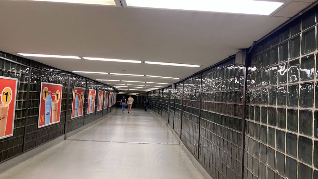
The main lobbyThe doors to tracks 1 and 3The other area of the main lobby, by the CharlieCard machinesThe underpass to Copley Place! Kinda easy to miss if you’re not actively looking for it.Oh no.Oh dear god no.Onwards to BOS!
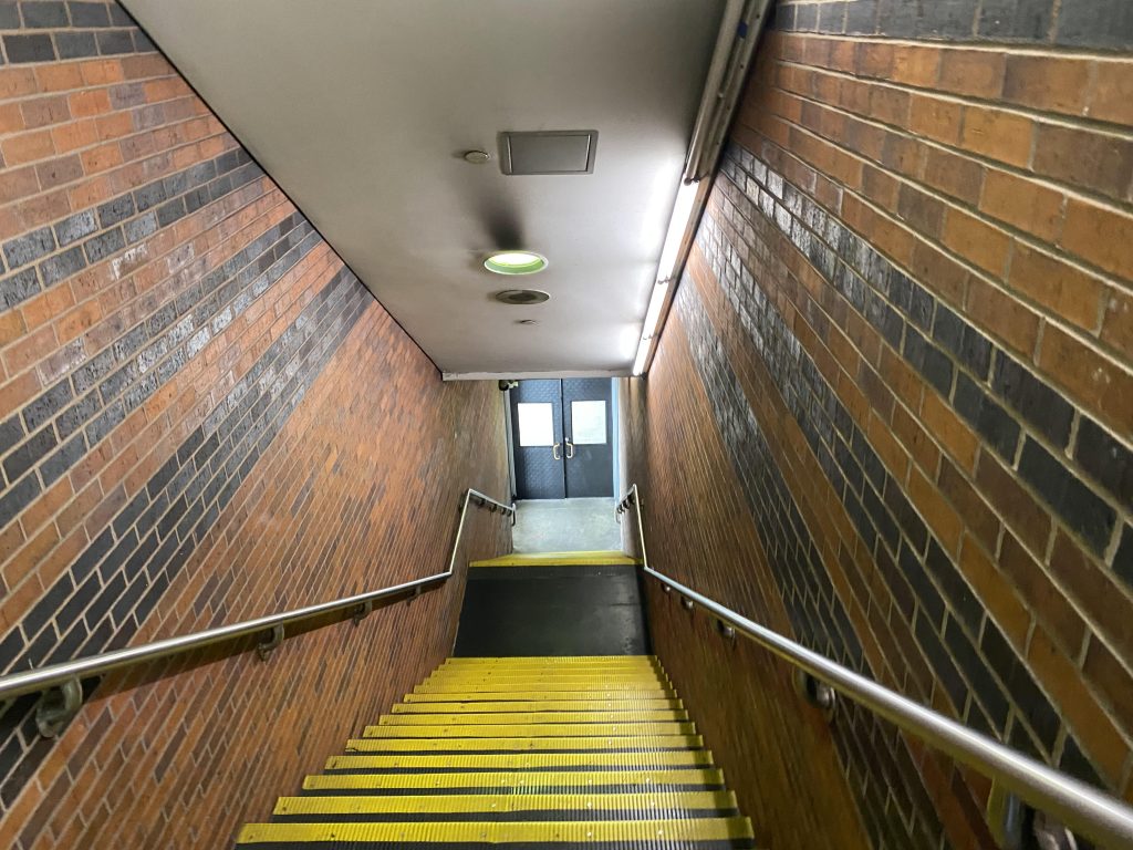
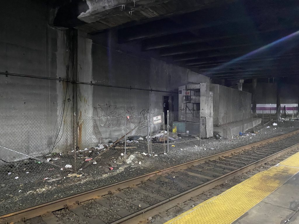
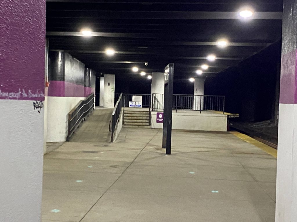
And now, to address the elephant in the room: the island platform for tracks 5 and 7. Oh boy. Let’s just say this is easily the worst part of the station (as if the platforms for tracks 1-3 are bad enough!). So, one end we have a pair of tracks that don’t even run with the rest of the Southwest Corridor but rather run with the Mass Pike. On the other…..just take a look.
Oh dear god please no, NOT A TUNNEL WITH DIESEL LOCOMOTIVES!!!
Yup. There’s a long tunnel, I don’t know how long but it’s long enough to reach all the way past Hynes Convention Center at least. Is Lansdowne like this? I hope not, but I’ll find out when I review that station. It’s also very dark to where it feels like the lighting doesn’t do much, despite being bright. Like, could they have chosen any color other than black? Overall, while the smell of diesel fumes permeated through everything, the worst was yet to come. I notice the countdown clock, and oh god. There was a train scheduled to come in any minute now from Worcester.
QUIZ TIME!!!!!!
What did my friend and I decide to do, knowing there was an inbound train coming in? A: Get the hell out, not wanting black lung B: Film the train, knowing one/both of us could pass out from the diesel fumes being too much C: Nothing.
If you chose option B, you win ABSOLUTELY NOTHING!!!
The countdown clock after the factDear godIt’s so dirty!This….doesn’t feel right.
So, we sat there and filmed the train (of course, it was an HSP engine), and I started feeling dizzy and we were like “yeah, let’s get outta here.” From there, we got up, exited via the stairs we came down on, and got our day passed on our CharlieCards. From here, we went to the Orange Line platform. Now, there was a train ready to depart so I couldn’t get a good look at it, but it was hella better than the Commuter Rail platforms!
Not the best photography job.
The good: It serves a major link between Boston and points south, as well as serving to the closest thing to the southern end of a North/South link, due to the Orange Line serving both here and BON (North Station). It’s also nice that Back Bay is relatively very walkable in nature.
The bad: However…..the fact that they tell people with breathing issues not to use this station, is problem enough. It was bad enough that I, someone WITHOUT known breathing issues, almost fainted from a lone HSP46 locomotive pulling in from Worcester. This enough is a major strike against an otherwise perfect station. If the MBTA electrified their Commuter Rail lines (or at least, used dual-mode locomotives that switch to diesel outside here), then the pollution wouldn’t be as big an issue. But, until then, don’t come here if you have respiratory issues.
Nearby points of interest: Back Bay, the neighborhood! You have Hynes, which hosts conventions like Anime Boston. Copley Place and the Prudential Center are also nearby, if you’re rich enough to afford anything from either. There’s also the Orange Line to points north and south from here, too.
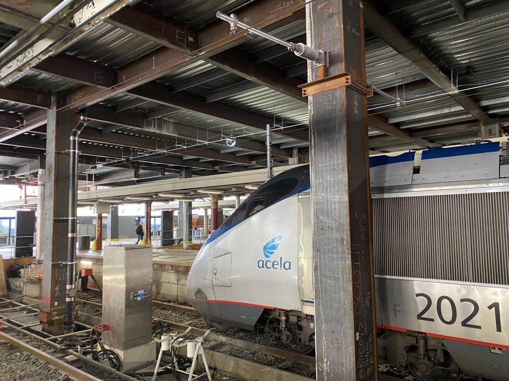
Transit connections: Amtrak (Northeast Regional, Acela, Lake Shore Limited) Commuter Rail (Franklin, Foxboro, Needham, Providence, Stoughton, Worcester) Orange Line MBTA bus (10, 39) Logan Express Green Line (at Copley and Prudential)
Overall, if you forget the Commuter Rail platforms exist, Back Bay would quite truthfully be a 9 or 10. However, the fact that the air quality is bad enough to where Amtrak removed staff from here for health reasons is a big yikes. Yes, it’s improved, but the train platforms are in serious need of ventilation. And until either that happens or the Lake Shore Limited and the Commuter Rail get dual-mode locomotives, I can’t put this station too high up. The Orange Line platforms are leagues better, though. And yet, despite the major health risk, it still has over 15600 Orange Line passengers as of 2019, 8100 Commuter Rail passengers (being #3!), and just under 2000 Amtrak passengers a day in 2019.
Oh, I guess I forgot to mention I’m not just doing RIPTA or RI-based reviews here! Whelp, here we go. First Commuter Rail line, and it’s the most accessible one for me. Let’s get into it.
The waiting area at Wickford Junction
I started my journey at Wickford Junction, bright and early. The ride to Boston South Station would be powered by a MPI HSP46 engine with a top speed of around 80 miles per hour. After boarding, and going to the backmost car, the train started moving. From there, and for the whole journey, the tracks largely follow the Northeast Corridor. The train went through North Kingstown and along Greenwich Bay in East Greenwich and Warwick at near-max speed. However, soon enough we started to slow down for the next stop.
Wickford from aboard the trainA poor-quality picture of T.F. Green, ft. my Gatorade and Pringles.
We eventually came to a halt at T.F. Green and picked a handful of people up. From here, it was a mostly straight shot to Providence. After a few minutes, we started moving again and we largely went parallel to Jefferson Boulevard. It was also largely industrial in nature from here to Providence. However, Jefferson Boulevard turned towards the interstate and we were soon met by Wellington Avenue. The engineer honked the horn several times to alert the workers at the Park Ave. bridge of the oncoming train, and we passed some freight stuff. We then hooked a left, passed an Amazon facility, alerted more crews of our presence, and went through Olneyville. Soon enough, we went under the interstate and Providence Place Mall.
Providence!
After dwelling for about 10 minutes, we departed from Providence Station. From here, we passed some businesses and apartments, the Pawtucket layover yard, and the Pawtucket train station that’s still being built (as of 5/12/22).
The layover yardPawtucket Train Station
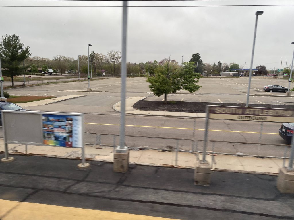
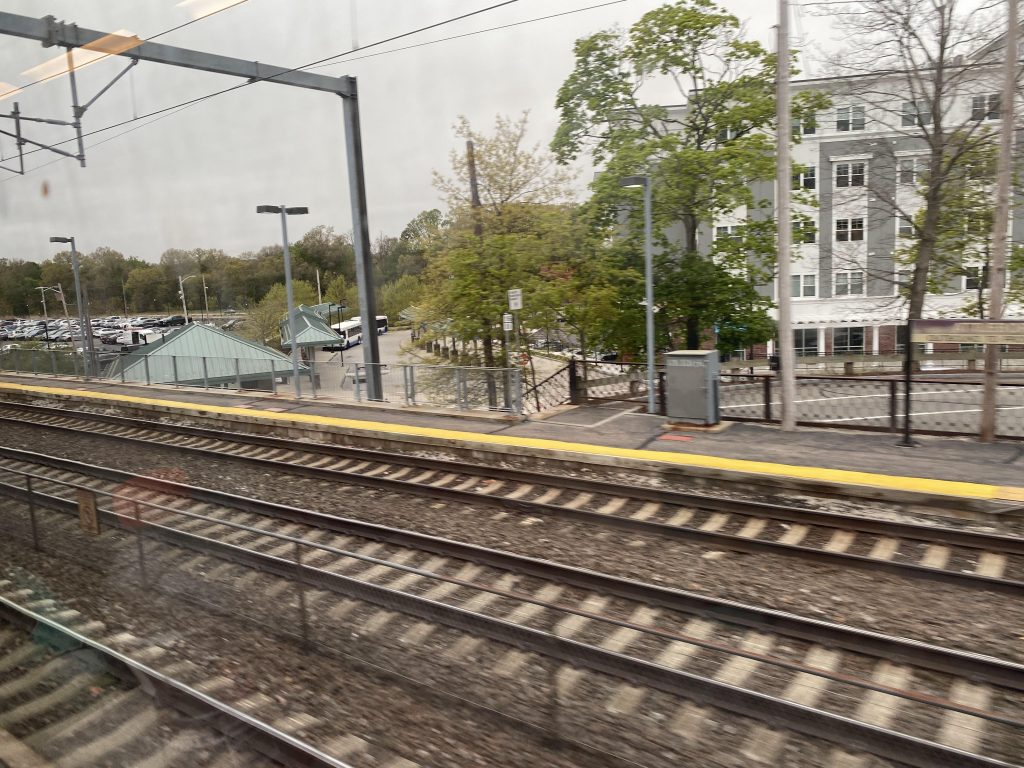
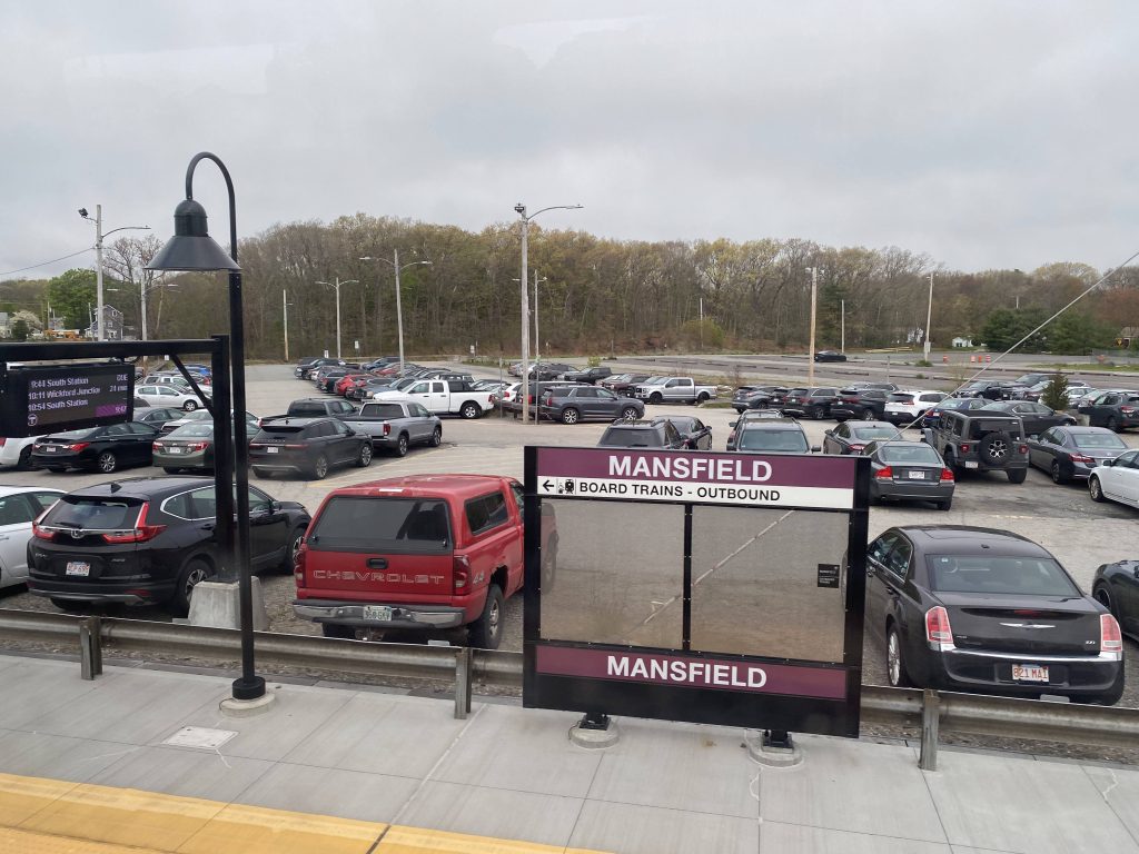
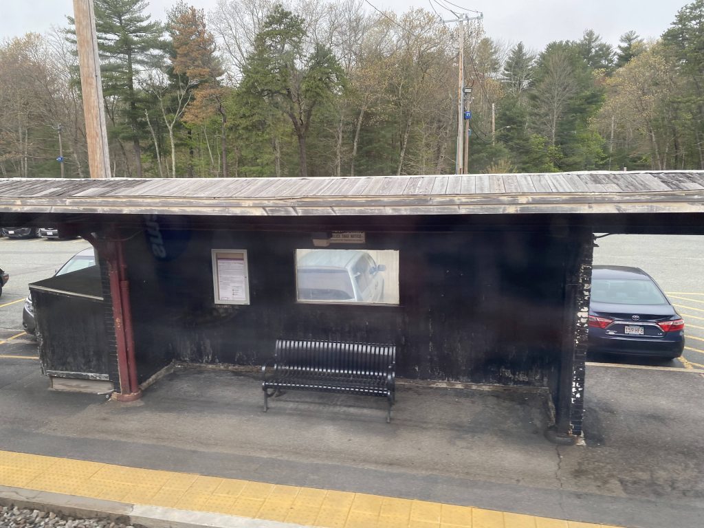
From here, we booked it parallel to the state line, and we passed South Attleboro with no regard because the station was closed. From here, it was largely not scenic as it was mostly trees with the occasional house. We’d pass Attleboro and its town center, and Mansfield, going over Chauncy Street. It would also be here that we split from the Foxboro special event line.
South AttleboroI spy a GATRA bus.Mansfield!
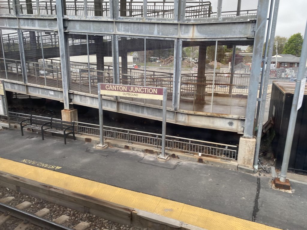
Now that we passed the Mansfield split, we went right towards the next pair of stations. Namely, they were Sharon, and Canton Junction, where the main line splits from the Stoughton branch. It was still largely the same from here.
Sharon!Canton Junction! Change here for Stoughton service.
We kept pressing on past Canton Junction, and eventually we reached a major park & ride. Namely, Route 128/Westwood. Not many people got on though, so after that we pressed into Boston proper.
Westwood P&R
We then entered the Southwest Corridor after trucking through some woodlands and now we were running parallel to the Orange Line. However, we still had one stop from here before downtown Boston, and two before South Station. Our first stop? Ruggles.
Ruggles’ platform
Not many people got on or off here, so we kept going. It was still much of the same, passing various Orange Line stops along the Southwest Corridor. Eventually, however, we reached Back Bay. This station is notorious for bad air quality and smelling like diesel fumes, and it was easy to tell. The smell permeated through the train car quite easily and made both my partner and I gag. A lot of people got off here, while not many got on. After a bit, we went down the final mile and made it to South Station, after two hours of riding.
Mmmmmmm, diesel fumes at BBY….An Acela at BOS
The good: It links up Rhode Island and southeastern Massachusetts in a direct manner. It is also quite affordable relative to driving.
The bad: However, it takes a LONG time if you’re riding the whole route. My trip took two whole hours, while on the Northeast Regional and Acela it would’ve taken around 1 hour at most on the Regional (from KIN), and 40 minutes on the Acela (from PVD). Hell, even TO Providence, it’s still faster to pony up $2 for RIPTA’s bus route 66 – and THAT deviates twice! It’s also got some weirdness with fare zones vs. similarly-distanced stops on lines fully in Massachusetts. Why is Wachusett a zone 8 fare while T.F. Green, being about the same distance, a zone 9 fare?
Nearby points of interest: Well, you have the various towns along the route and whatever they offer. I can’t speak for between South Attleboro and Ruggles, but you have varying things like a Walmart in Wickford, T.F. Green at T.F. Green (duh), and downtown Providence.
Overall, it’s not that bad a route. However, it is annoying South Attleboro is closed (even if for legitimate reasons, as safety is no joke). Also, what’s with the mini-highs everywhere? One thing I’d change here, is to extend the line to Kingston/URI. But overall, not bad despite being the longest Commuter Rail route. Rating: 8/10
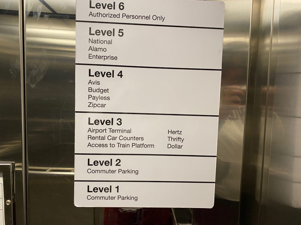
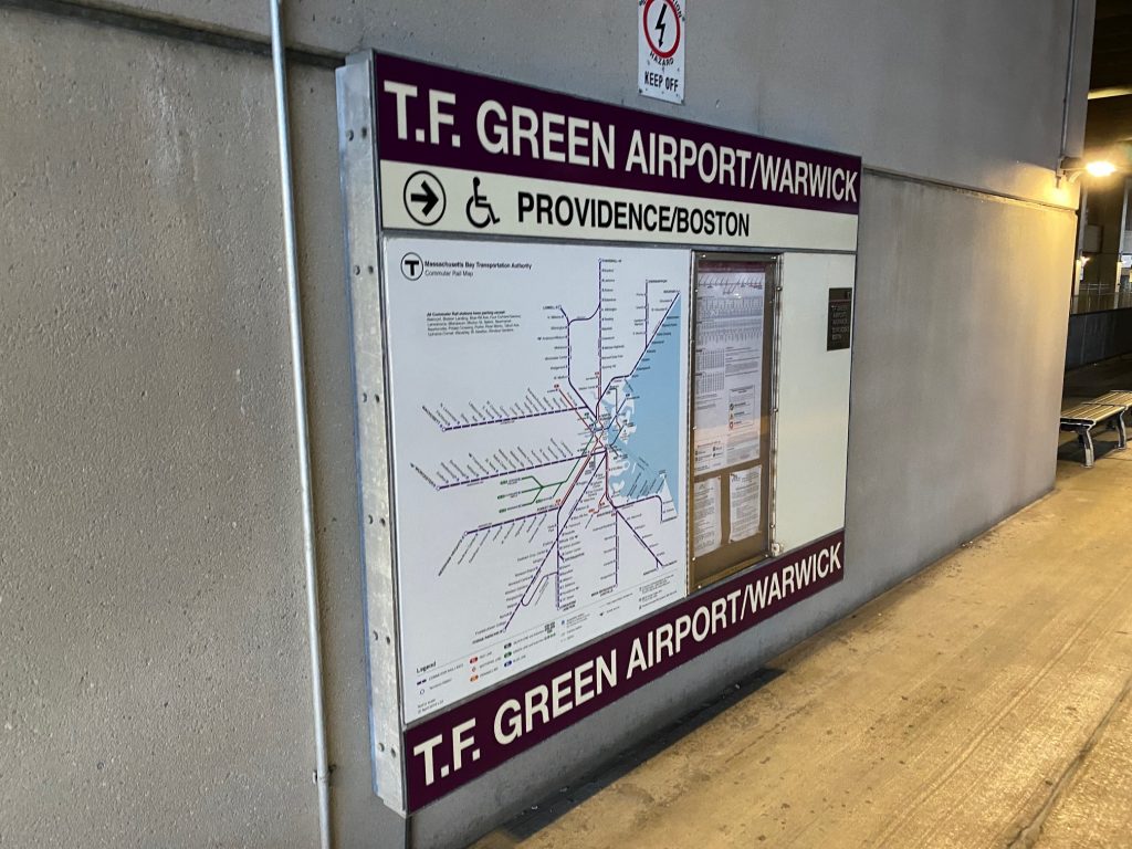
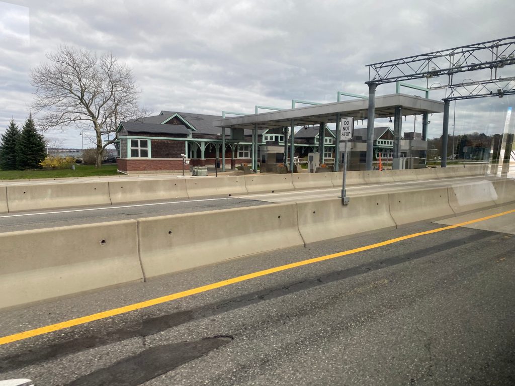
*glances around* I spy with my wee eyes……a MBTA logo in the T.F. Green terminal? Huh. Well, looks like today’s post is going to be a review on the T.F. Green MBTA station. Just to get the elephant in the room out of the way, though, for the purpose of this post “the station” is referring to everything in the parking garage and the skybridge beyond Post Road. No review on the terminal itself (too many DHS officials around and I’d look suspicious), although I’ll mention it here and there.
So this is how we get to the platform from the terminal, eh?LOADING…
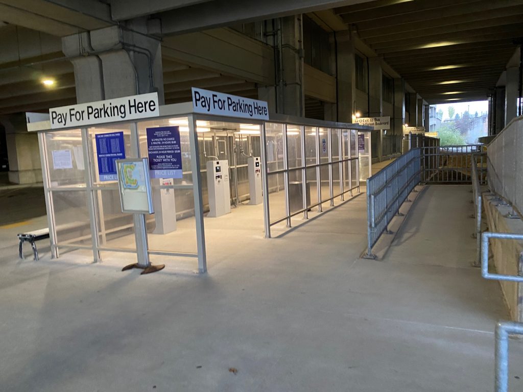
First off, how do you access the train station? Well, there’s a few ways. If you’re coming from the terminal (i.e. from RIPTA bus routes 1, 20, and 66, or if you’re coming off a plane), then it’s a relatively long walk. But, if you’re taking the 14, as I touched upon in that post (read here), there’s a timepoint and stop outside the parking garage that houses the platform. Weirdly enough, there’s only a busway on the inbound side. There’s also a parking garage that one can pay to park here (so in a way, it’s also a park & ride), $5 for up to 24 hours of parking.
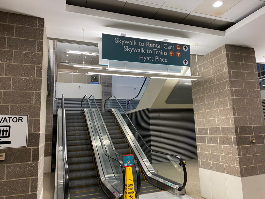
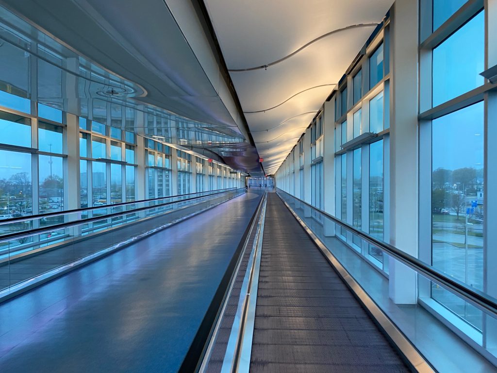
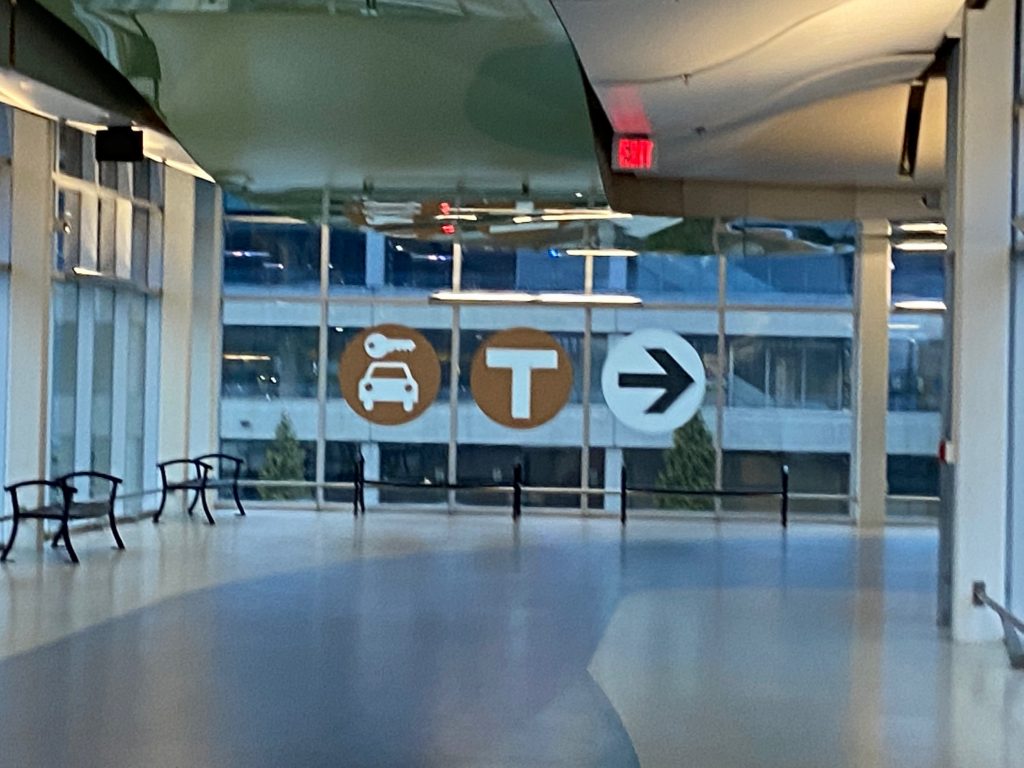
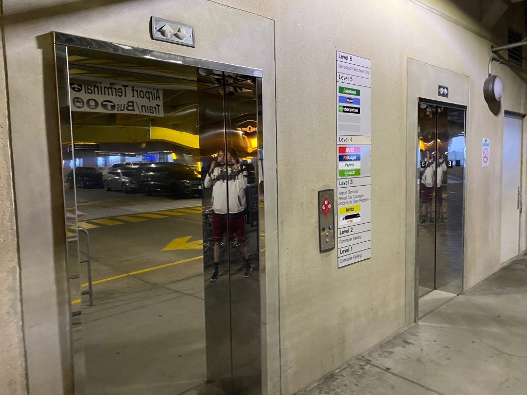
To get here from the main terminal, you have to find an escalator or elevator that brings you up from the first floor (where you’re likely coming from). Then, you have to go all the way up, and cross the skybridge. It feels long but that’s because it’s essentially a straight shot. In reality, it’s only 0.2 miles (rightabout). Of course, there’s some turns, and sometimes an airport employee driving a cart might offer a ride, but that didn’t happen for me. Eventually, though, I reached the end of the skybridge to the car rental area and was greeted by the MBTA station sign reading “WELCOME TO TF GREEN AIRPORT” along with the TTS announcement, the standard affair for newer Commuter Rail stations built within the last two decades. There’s also a bathroom over here, but I never took a peek at it. But, we’re still not done with getting there from the terminal. WAIT! Don’t use that first elevator, as it’ll leave you on the wrong side of the track! To even reach the Commuter Rail, you have to walk across the 3rd floor of the garage and take the elevator on the far side. Fortunately, though, it’s pedestrian friendly and sidewalks exist. Finally, we go into the stairway and take the elevator down to the ground floor, exit through the left door, and FINALLY, we’re at the train platform. Parking can also be paid for over here, as well.
An orange MBTA logo, even though it’s the Commuter Rail. Probably done for consistency’s sake.The elevator. I obviously didn’t pay attention to the sign that said “Access to Train Platform”Once again, you access the platform via the 3rd floor of the garage.
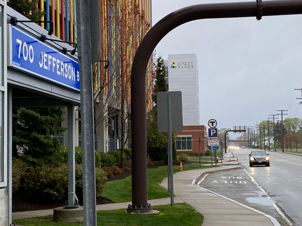
If you’re getting here via Jefferson Boulevard, it’s a much easier said than done affair as there’s access to the train platform from outside the garage. Access to the aforementioned stairway going to the train platform is via the Hyatt parking lot. Both entrances are fortunately ADA compliant, as is the platform itself. No mini-highs (or lows!) to be seen here!
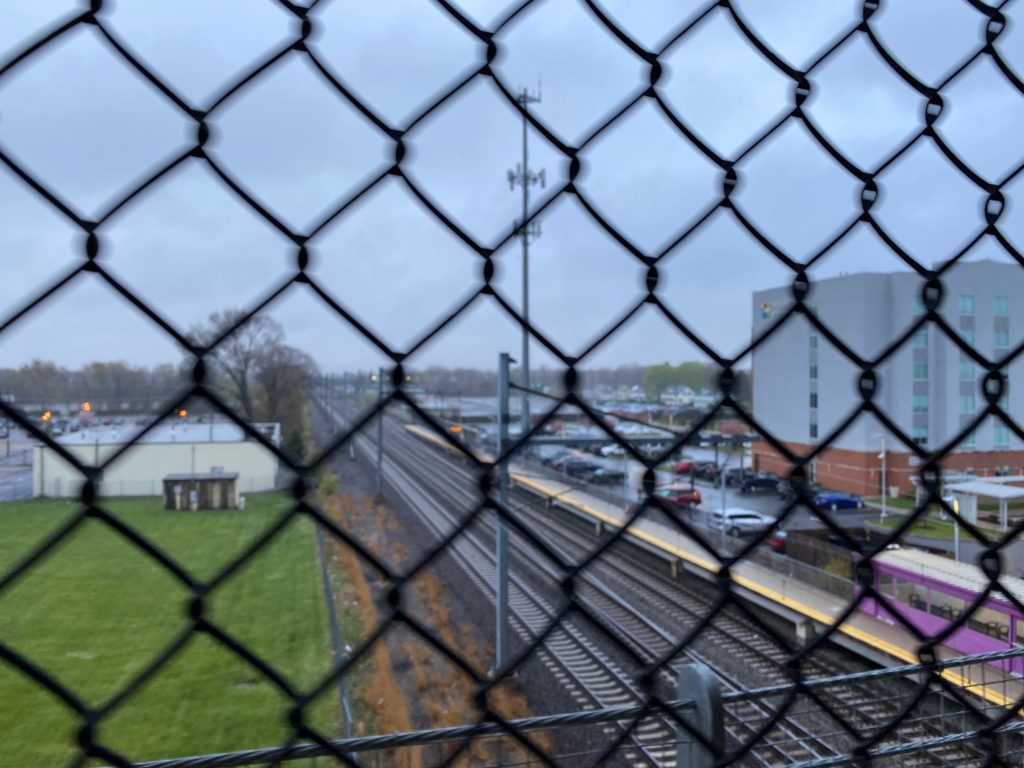
The inbound-only busway on Jefferson BoulevardThe tracks from above (and through a chain-link fence)Need to pay for your parked car?
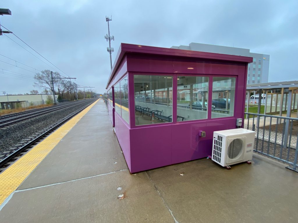
Alright, now what’s the train platform itself like? Well, part of it is sheltered by the fact it’s in a parking garage, while the other part has a long enclosed shelter that looks like it has a HVAC system. To my awareness, I’m not sure any other Commuter Rail station has such a thing. It’s also a bit barren, but standard for a train platform, with some benches and garbage bins. In terms of transit, you have the 14 heading inbound hourly, and outbound hourly 14s alternating between Narragansett and Newport on weekdays at Jefferson Boulevard. At the terminal, you have the 1 (trips ending in Pawtucket, up to every 40 minutes), 20 (up to every 15), and 66 (up to 30 each way). But, that’s if you’re willing to walk there. So, what about the Commuter Rail, the service this station exists to serve? Well, it’s the only stop that begets a zone 9 fare ($12.75), takes over 1 and a half hours to get to Boston South Station, doesn’t run on weekends, and is served by every other outbound train (and when said train reverses to inbound). In other words, whatever serves Wickford, serves here too. Plus, it’s the lowest-ridership station along the Providence-Stoughton Line, likely because driving would be faster or the cost savings vs. a plane to Logan Airport (+ subway/bus fares) would be not much more expensive. Yikes.
T.F. Green Airport/Warwick. Only station signed like this.The Commuter Rail purple shelter
Nearby points of interest: T.F. Green Airport…….and not much else. Pretty much every bus goes to Providence, the 14 and 66 go to CCRI, with the 66 also going to URI. The 14 also goes to Newport and Narragansett. 1 trips originating from here also terminate in Pawtucket, so there’s that.
The good: It’s relatively clean, and it’s in a parking garage meaning the rain isn’t much of an issue. There’s also a shelter on the portion not in the garage. There’s also more transit than Wickford.
The bad: It’s a bit of a walk from the airport terminal, and hardly has any advertising for its existence. There’s also no Amtrak stop here, even though it would be a decent spot for Northeast Regional trains if the side track was electrified (and if there was another track across from the existing platform). It also begets a zone 9 MBTA fare ($12.75!) despite other similarly-distanced stations (e.g. Fitchburg and Wachusett) being zone 8 fares. And yes, it’s the only zone 9 stop in the system, like how Wickford is the only zone 10 stop.
Transit connections: Commuter Rail (Providence) RIPTA (1, 20, 66 at terminal, 14 at Jefferson Blvd.) various airlines
Overall, just take the bus to Providence if you’re able to and transfer to the MBTA there. Or, just use Amtrak at that point. The terminal is nice but that’s not part of the station. But given the state of the station, and with it being the least-used station on the Providence/Stoughton Line, it’s passable but is a nuisance. And with the conditions here, there’s probably a good reason it’s as underutilized as it is. Rating: 6.5/10
This morning, I wrote about the 14, and it was the least used “long haul” RIPTA route. Now, let’s look at its bigger brother, the 60. Let’s take a look at what this route has, shall we? In summary, a lot. We’re talking crossing two whole counties, a pretty sizable island, a suspension bridge, a college campus, and four park & ride lots (with a fifth in walking distance!), all while being anchored by Providence on the northern end and Newport on the southern end.
Coming out of the Newport Visitor’s Center, we hook a left onto America’s Cup Ave. and then another left onto Marlborough Street. As we went through, it was all touristy businesses for a good bit, along with some other points of interest. We then turned left onto Broadway, passing by City Hall and Newport Hospital. It was from here that we then entered Middletown. Shortly afterwards, the route diverged into two branches.
Some businessesCity Hall!Some more “normal”-looking businesses
The route diverged into two: West Main and East Main. The West Main branch features a deviation into an apartment building and the Naval Undersea Warfare Center, which as the name suggests is a military installation. My trip, however, featured none of that, as I was on an East Main trip.
Diverging Main RoadsA shopping center
Overall, while West Main is a bit more lively with a lot more in the way of houses and businesses, East Main is instead lined with farmlands. Occasionally, there’d be a house. However, that was all in Portsmouth. In Middletown, it was still business-lined, and there was a DMV branch nearby.
Farms and the wide open sky
Some of the buildings we passed along the stretch of road, especially in Portsmouth, were quaint and old-styled in nature. Other times, though, it would be something as mundane as your average Cumberland Farms.
An old churchCumby’s!
Eventually, after spending probably half an hour going up East Main, we reached RI-24 and we hooked a left at the first of several park & ride lots, at Boyd’s Lane. But we didn’t deviate into it, and instead we booked it right past. There was also a DOT facility nearby, presumably where they hide all their salt for the winter.
More farmlands
Soon enough, though, we joined up with the West Main branch and HOLY SHIT ANOTHER BRIDGE (yeah I rode this immediately after the 14). This time, we were crossing the Mt. Hope bridge. Not as big as the Newport bridge, but just as iconic.
Look!
Apparently it looks just as pretty at night, at least if a Miles in Transit blog post is to go by. Unlike him, though, I wasn’t about to ride the last 60 of the night and become the most hated passenger among RIPTA drivers. Soon enough, though, we got off and reached Roger Williams University. Now normally the bus goes straight, but because of tree work we had to detour. So, what was the detour? We went right up Metacom Avenue, and then hooked a left onto Griswold Avenue. We then hooked a right back onto RI-114. We progressed through Bristol with its historic downtown, known for the 4th of July parade, paralleling the water and passing Colt State Park.
A McMansionSome Bristol pictures and Colt State Park
Eventually, we left Bristol’s downtown area and kept pressing on up RI-114. Eventually, we entered Warren and it was much of the same. Houses everywhere with suburban businesses. There was also a nice downtown area, just like in Bristol. However, it wasn’t as historic.
However, as we went through Warren, we did pass a Park & Ride lot that’s visible from RI-114 (served directly only by the 61X) as well as Police Cove (if that counts as a P&R). Soon enough, after crossing two bridges, we were in Barrington. Barrington wasn’t really that exciting. However, we did pass a shopping plaza, Barrington HS, and the park & ride at the local Unitarian church (commonly referred to as White Church, likely due to the paint job). It was after this that HOLY SHIT WE’RE GOING EXPRESS, BABY!
Meh. Yet another shopping center.Barrington High!The beginning of the Wampanoag Trail
The road then became the Wampanoag Trail and we basically booked it right into downtown Providence from here. However, there was an issue. Take a look.
Yeah……. Traffic was bad. Meanwhile, I was praying that I would catch the 49 (I did, barely). Of course, from here, the route went over Warren Ave. and dumped us off at 195 westbound, which is VERY, VERY NOTORIOUS FOR BAD TRAFFIC.
Warren Avenue
After about 10 minutes of sitting in traffic, we eventually made it to South Main Street, and from here we basically booked it to Kennedy Plaza. The bus let us off at stop Y, and from here I ran to catch the 49.
Downtown!
The good: It serves a LOT of areas that would otherwise be unserved. Middletown’s main arterials, Portsmouth’s main arterials, and pretty much the entire East Bay. It’s also frequent. Like, VERY frequent. 15 minutes during peak hours, 30 minutes other times during the day on weekdays. Even weekends have 30 (or 45 on Sundays) minute frequency during the daytime! Given this route takes over 1 and a half hours to do end to end, that takes a considerable amount of resources. And the ridership shows that it’s well-spent. How about, the 5th highest ridership route in the entire system? This bad boy clocks in at 2223 daily riders as of 2019, with the only routes surpassing it being the 92, 20, 1, and R Line.
The bad: Remember, the route has two branches and the trips alternate. So, for the individual sections not shared between both branches, frequency can be as bad as every 2 hours. It’s also very, very long. I also can’t help but feel like that it’d be better off running local instead of express into downtown and switching with the 61X in that regard.
Nearby points of interest: A lot. Downtown Newport, the various shopping centers in Middletown, Roger Williams University, and the various East Bay downtowns to name some.
Overall, it’s a very long route but it also serves a lot, and it serves a lot more densely populated areas than the 14. For much of the trip, the bus was about 1/2 to 2/3 full, but people still kept getting on and off at various points along the route. It’s clear that there’s demand for East Bay and Newport bus service, and I hope RIPTA adds more routes in the area some day. Perhaps all day service through Tiverton and Metacom Avenue, terminating at one of the shopping centers? Rating: 8.5/10
First of the long-haul routes! Route 14 is the long-haul West Bay/Newport/Narragansett route in RIPTA’s system, and is also the least-ridden of the four (the other 3 being the 54, 60, and 66). So, let’s get into it. The bus boards at stop Z (which it has solo), with trips alternating between Newport and Narragansett. The Narragansett branch is considerably shorter, but I rode the Newport branch (of which it largely follows the 64). Let’s get into it, shall we?
The old Union Station, as we’re leaving Providence
The bus U-turns onto Memorial Boulevard and immediately we’re going express. It’s the usual sights of RI Hospital and South Providence, along with RIPTA’s Elmwood Ave. garage. From here, we kept going express through Cranston until we reached exit 15.
The industrial bits of Providence from afarThe interstate after getting off at Jefferson Boulevard.
From here, it was largely a mix of industrial buildings, some shops and restaurants, offices, and occasionally a house. We also ran parallel to the Northeast Corridor for the entire time.
Lincoln Ave.
Of course, the route advertised it serviced T.F. Green Airport. Which, is technically true, however there’s a catch. This route doesn’t service the airport itself. Rather, it services the Interlink parking garage and the MBTA Commuter Rail platform, being the only route to do so. Formerly, that was the 8X’s job, which this section of the 14 largely replaced. One minor nitpick here, though, is that the lispy announcer doesn’t say “CONNECTION AVAILABLE TO MBTA COMMUTER RAIL” like in Wickford or Providence for some reason.
The MBTA sign at 700 Jefferson Boulevard, indicating there’s a Commuter Rail platform
We kept going on down Jefferson Boulevard, past the Airport Connector, until we reached Main Avenue. From here, we hooked a right and booked it down Main Ave. The street was primarily residential. We then reached Greenwich Ave, where we were joined by the 21, 22, and 30 (and for a brief bit the 66 too!), although soon enough we reached CCRI. Deviation #1!
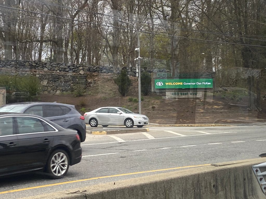
Main Avenue!Looks like Governor McKee was visiting CCRI today
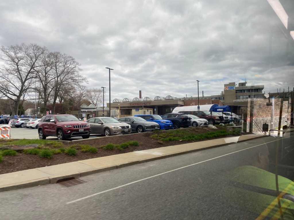
A few people got on at CCRI, and from here we kept on going, albeit through the back entrance rather than the front one. We took a left onto Commonwealth Ave. and another onto Toll Gate Road, and we went down the road at high speed. We past Kent Hospital, went under the interstate, and eventually reached Apponoag Village.
Kent HospitalApponoag Village!
From here, we kept going down US-1, passing by an assortment of businesses and houses. Soon enough, though, we were in East Greenwich and going through its historical downtown.
A bank and an armory!
Of course, however, the historic town center was short-lived and soon enough it was back to suburban businesses. But this time, it was more rural-feeling than usual. We eventually passed Old Forge Road, which turning a left down would get us to Goddard State Park. But, no buses go down that way likely in part due to the low clearance of the Northeast Corridor tracks.
Old Forge Road!
We pressed on further from here, through the quiet and long US-1. It was, yet again, a mixture of suburban businesses and houses. Also, apparently there’s an aquarium out here. Neat. Soon enough, though, we made our second deviation! This time, slightly into Quonset to service Kohl’s. An old lady got on here, though, so there’s almost certainly some kind of demand for non-express Quonset service! So, we deviated and did a circle around the roundabout to get to the busway on the other side of Gate Road, picked a lady up, and then turned left back onto US-1 southbound. We crossed RI-403 and the Quonset spur of the Northeast Corridor, which sits unused to this day.
Some houses Kohl’s!
From here, we kept going down US-1 even more. We passed even more of the same stuff that we’ve seen (suburban houses, businesses) as it got more wooded. Eventually, though, we reached RI-102. Turning left here would bring us to Wickford Village, and a right to Wickford Junction. So, did we turn into either? Well yes, actually. We turned left towards Wickford Village. At least we would’ve if there weren’t any detours. What actually happened was we turned left at the next side street and went down until we reached Boston Neck Road.
???
When we did get to Boston Neck Road, it was pretty much all woodlands with the occasional fenced off area or the occasional dilapidated bus shelter. Soon enough, though, we reached the RI-138/RI-1A park & ride. And, would you believe it, someone actually got on here!
This has clearly seen better days.The RI-138/RI-1A Park & Ride in North Kingstown
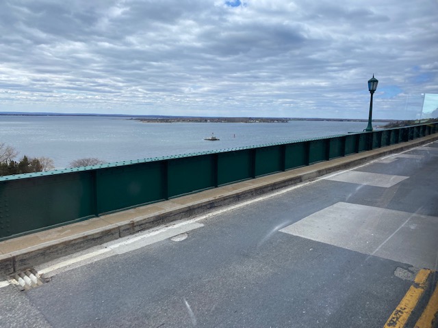
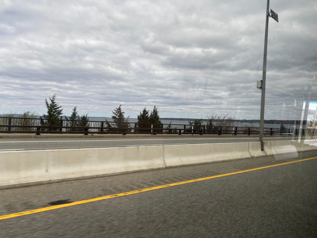
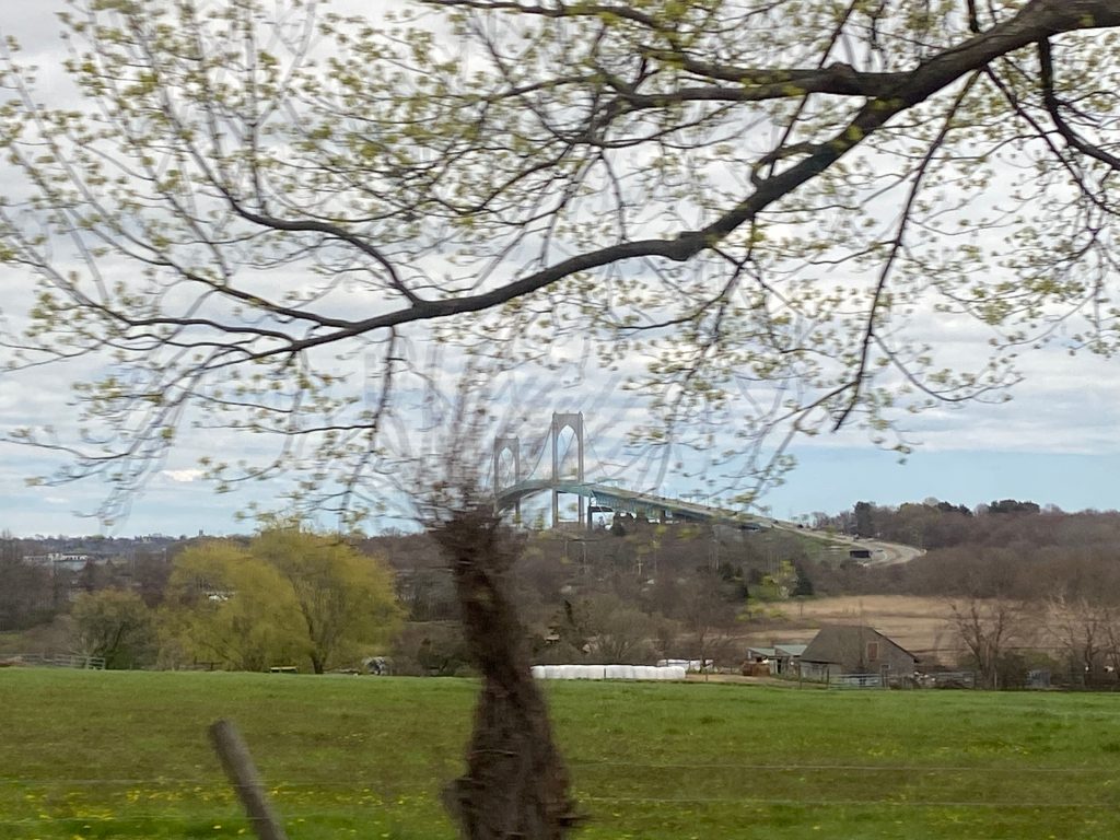
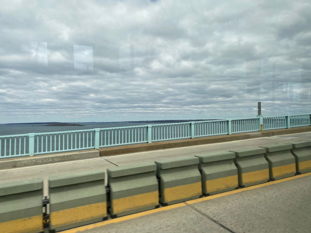
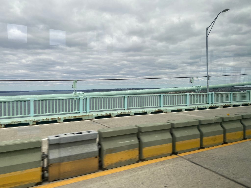
From here, we deviated into the parking lot and then jaunted onto RI-138 and HOLY SHIT WE’RE EXPRESS AND HOLY SHIT I CAN SEE THE NEWPORT BRIDGE AAAAAA MY EYES IT’S SO BEAUTIFUL
MY EYES IT’S SO BEAUTIFUL OH GOD
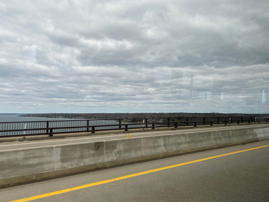
We crossed the Jamestown bridge into, well, Jamestown and took the first exit. From here, we went down a wooded road with some farms along it. We hooked a left onto Narragansett Ave. and soon enough we were at the main town center and the Ferry Landing. We then hooked another left to go back up the island towards RI-138, and soon enough we paid however much a toll is ($4, I think, per vehicle?) to cross the Newport Bridge.
There she is.Some quaint buildingThe Jamestown toll plazaHOLY CRAP MY EYES IT’S SO BEAUTIFUL!!!IT’S SO BEAUTIFUL
Soon enough, though, we were in Newport. However, unlike the 64, we took the exit instead of going straight, and we were on Farewell Street. It wasn’t a long ride, as we then turned right onto America’s Cup Ave. and deviated into the Newport Visitor’s Center. It was here our journey ended.
Farewell St. after being dumped off 138.
Now, let’s get into the “review” bit. The good: It serves a lot. I mean, A LOT. It serves Jefferson Boulevard, CCRI, Apponoag, and is pretty much the only regular bus service through East Greenwich and North Kingstown that isn’t express. It also goes down towards Narragansett, if that’s your thing. And hey, it also services a MBTA station at T.F. Green directly, which the 1, 20, and 66 doesn’t do.
The bad: There’s two branches. Why, exactly, can’t the two branches be two separate routes? It’s also the least frequent of the 4 regional routes, being 1 every hour up to the RI-138/RI-1A park & ride, or if you’re past that, once every other hour. If you’re going to Narragansett, it’d be faster to take the 66 and transfer to the 69 (hehe, nice). Or, if you’re going to Newport, transfer to the 64. Or, just take the 60. If you’re going to Quonset or East Greenwich, though, this is basically your only option outside thevery early morning QX trips (or the 16!). And noone wants to show up at Kennedy Plaza for a bus that arrives at Kohl’s at 5am. What I’d like to know, personally, is how many people get on/off at Newport/Jamestown, vs. Narragansett. If more get off at one vs. the other, I’d propose re-routing to Wickford Junction as a through stop on the more utilized branch, and having the lesser utilized one originate at Wickford.
Overall, it serves a lot. The routing itself isn’t that bad, although I must ask why there’s two different branches south of the park & ride. On weekends, though, it’s essentially a Newport-Providence route, as the Narragansett runs are nonexistent. Ridership isn’t that great for a long-haul route, clocking in at 517 daily passengers as of 2019, but it’s certainly something. The 62 comes in under that, but that doesn’t exist anymore. Rating: 5/10 (but a 10/10 for the views from the Newport and Jamestown bridges!)
Ah, the 49. Such a lovely route…or is it? Let’s take a look.
The journey begins at Kennedy Plaza’s Stop Y….for some reason. Why is beyond me, when stops I and J would’ve been fine enough. Plus, don’t the long-haul routes usually board at the far side of the plaza? Anyways, enough of that. This route is among the most notorious routes, not because of the difficulty of riding it, but rather because of the fact it literally has no reason whatsoever to exist. Why? I’ll get to that later. But first, the trip.
Into darkness we go.
The bus ride begins at stop Y, then takes a turn onto Washington Street. From here, it goes straight into the tunnel. I swear, it’d be better for this route to be at the I or J berths. We go through the tunnel, then out we appear at Thayer Street.
Thayer Street!
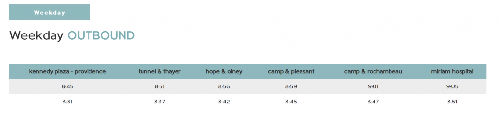
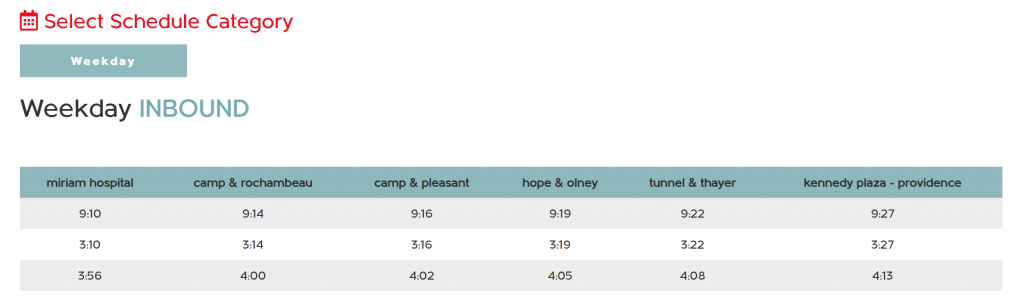
Thayer Street is typically known for all the college-oriented activities, as both Brown and RISD are in the area. However, we aren’t here for that. We hooked two lefts and went up the much quieter Brook Street. Soon enough, it became Hope Street and we passed Hope HS. We effectively followed the 1’s routing from here until we reached Doyle Avenue, at which we turned left down. It was primarily residential in nature with the occasional business, playground, or church. Soon enough, we reached the route’s namesake and hooked a right onto Camp Street. Still, it was largely residential with the same mix of buildings. We then took a left onto Rochambeau Avenue, and a right onto North Main, following the R Line briefly. The shared routing, however, was very short and we then turned down 3rd Street. We made a couple of more turns, and soon enough we reached Miriam Hospital, marking the end.
Some housing near Hope HSTurning down Doyle AvenueSome more housingSome parking on Camp St.Some parking near North MainNorth Burial Ground on North Main StreetA Walgreens as the bus was turningSome more housingMiriam!
The good: It serves the front door of Miriam Hospital, I guess?
The bad: It has no reason to exist. The schedule is unservicable for a local route. Just look:
Why? Just, why? Also, I’ll add that the route’s brochure is grossly outdated as well. The 1 isn’t even on the pamphlet, but rather in its place is the old 42 (merged with the 1). Hell, not even the R Line or the 99 is on it. And, as I said earlier, it’s an up to 10 minute walk to either the 1 or the R Line, both of which run far more frequently (20 minutes and 10 minutes on weekdays, respectively.) AND run on weekends! Like, I could see the case for turning another route (e.g. the 58 or the 71) into a crosstown that services Miriam, but this route has no reason to even exist!
Nearby points of interest: The R Line and the 1. Thayer Street (accessible by a number of other, more frequent routes). Miriam Hospital, even, but even that is better served by the 1 and R Line.
Overall, WHY DOES THIS ROUTE EVEN EXIST?! Like, it’s got NO reason to exist whatsoever. It’s literally sandwiched between the 1 and the R Line, runs waaaay less frequently than either (3 times inbound and only twice outbound – mind you, this isn’t an express!), and lastly it’s literally a short enough walk from Miriam to get to either the 1 or R Line! And, if you DO need transit, you probably need RIde paratransit, rather than a 40ft Gillig BRT bus. I guess even RIPTA found it useless because it’s currently on the chopping block for the proposed service changes this summer. Why it didn’t get axed with the 79 all those years ago is beyond me. Hell, even the ridership shows that it’s useless, averaging 24 people each trip as of 2019, making it the 2nd least used route (with only the 10X being under it)
UPDATE 6/10/22: The route is finally being axed, with the last runs in a week from today. With this in mind, the score is being adjusted. Rating: 0/10 Original rating: 1/10
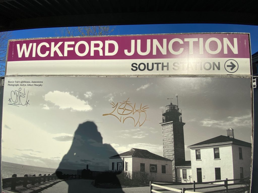
Ah, my first station review/post. Let’s dive into this. Wickford Junction. The present (as of 4/28/22) terminus of the Providence branch of the Providence/Stoughton MBTA Commuter Rail line. It also happens to be a park & ride lot. Let’s begin.
Ah, the ubiquitous MBTA Commuter Rail station sign. Only one way to go from here!
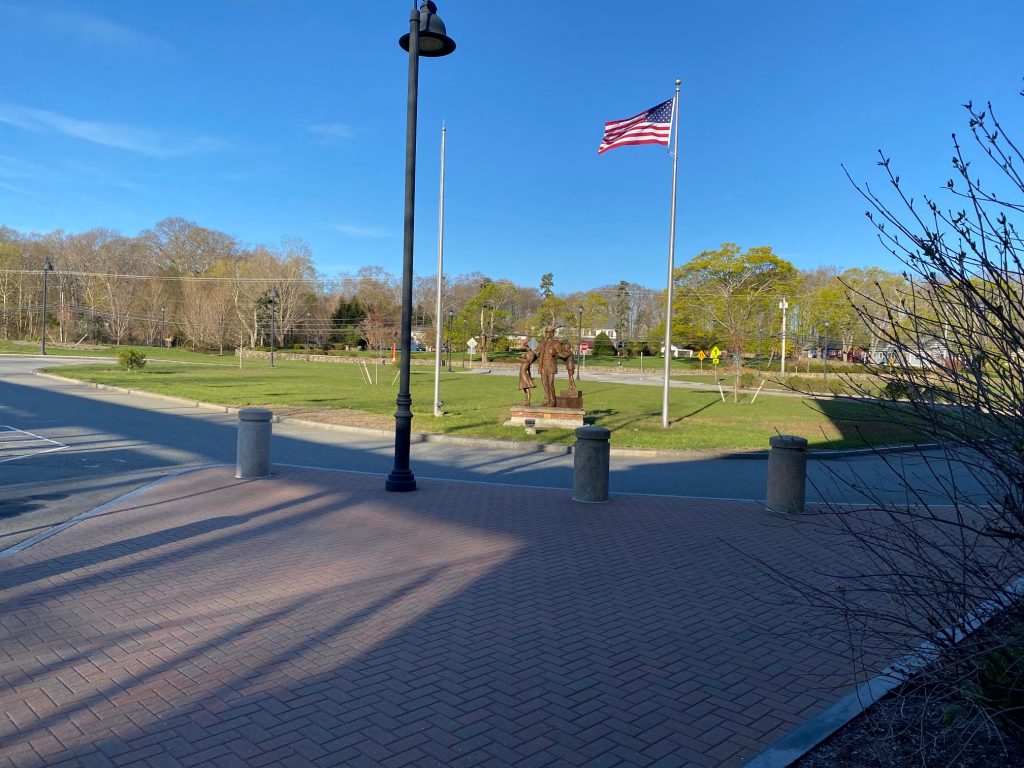
The parking garage that the station is at isn’t anything special. It’s your average parking garage inside. The outside looks nice, however, and there’s a busway for the two(!!!) RIPTA routes that service the station (again, as of 4/28/22). Longer-term plans like the Transit Master Plan call for more routes to originate from here, and to stop on their way to other places, however that is definitely not the case currently.
The busway that I arrived onThe building. Looks quite nice, truth be told.
Now, what about facilities at the station? For what it is, Wickford’s actually well-planned with facilities. You have waiting areas on the 1st-3rd floors (probably the 4th too, I’ll get to that in a bit) that are heated, bathrooms that are kept clean (albeit in the garage portion just outside the waiting area on the 1st floor), vending machines, and ADA-compliant high-level platforms all the way. There’s also RIPTA pamphlets on the 1st floor, however they are out of date (route 62 was axed as part of the Fall’21 service changes).
The bathrooms.The platform
However, even as soon as you get to the 2nd floor, the station’s shortcomings become quite evident. There’s an area for what looks like a mini restaurant in the station, however it appears that nobody has ever moved in. There’s also a section on the far side of the station with an elevator that doesn’t even work. Ticket machines aren’t even plugged in, so you can’t buy tickets before boarding the train. Ridership is good though, if you put the station in a similar category to Wachusett or another far-flung Commuter rail station. However, for it being a “major transit center”, it kinda falls flat on its face. Thanks, Lincoln Chafee. Also, I might add, the 3rd and 4th floors are being used as COVID testing sites, so I couldn’t even explore them.
The facilities at Wickford
Now, one telltale sign of a station that has vending machines (thanks Miles, for mentioning this in your blog!) is to check the sell-by date on the goodies contained within.
Certainly could be worse
Yeah. And the vending machine was half-empty. So, are deliveries just that infrequent because of how unused the station is? Or, is the station used more than I think?
Alright, now transit. You can’t have a transit center without transit, right? Well…..
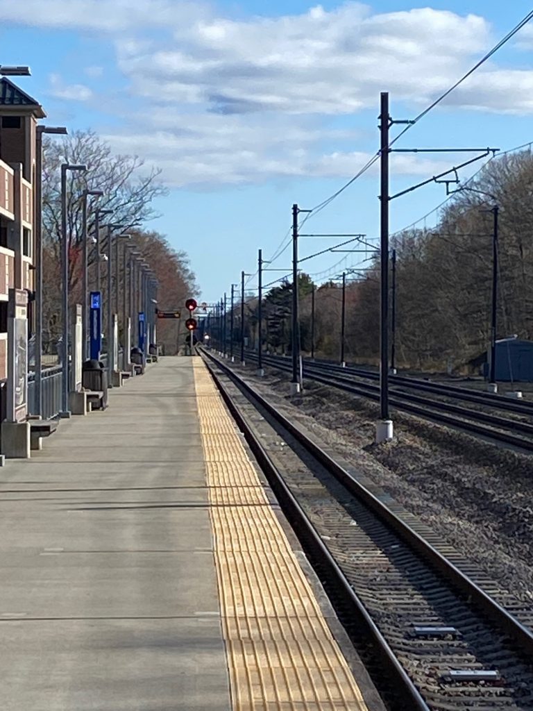
We have about 10 Commuter Rail trains throughout the day, with the first one leaving at 4:35am and the last one arriving at 11:20pm. However…….they only run down here on weekdays only. That means no holiday Commuter Rail trips. But what about RIPTA? That’s easy said and done. We have the 65X express route going to and from Wakefield during peak hours, and the 66 going to and from URI. One’s every 15-20 minutes at weekday peaks only, and the other runs every half hour during weekdays, and every hour during nights and weekends. Last bus in each direction leaves at 11:22pm heading north, and 12:07am(!!) heading south on weekdays, and before 11pm on weekends. Also, no Amtrak because the side tracks aren’t electrified. The Acela burns through here near its max 150mph speed, though!
All aboard the Acela Express…..or not.
Overall, Wickford’s a pretty nice transit center. Just that it, well, doesn’t have any transit. It’s a wasted potential, really. Could’ve lived up to the hype that surrounded it during the planning and construction phases. But alas, there’s pretty much no transit. How can that be fixed, though? Hear me out.
There’s another station just south of here that is also in the middle of nowhere, South Kingstown. However, there’s something there that Wickford lacks: URI. So, what if the MBTA extended the Providence/Stoughton line to URI, while building a second platform and having ALL Providence-bound trains run south to Wickford and URI. Meanwhile, RIPTA turns Wickford into a feeder stop of sorts for the South County routes (think, the 14’s branches, the 66’s southern section, and the 69 primarily, maybe the 64 and QX too) and have some additional South County routes originate from the station as well. (think a Westerly-RI Rte. 3 route, or a route that largely follows US-1)
It’s a far cry, and it probably won’t happen, but it’d bring ridership numbers from the actual 235 daily riders or so (as of 2018) closer to the projected 2000+. Plus, it’d likely encourage some transit-oriented development, and MAYBE, JUST MAYBE, the area will actually become more walkable? Also, why not consolidate Wickford and T.F. Green both into zone 9, or put those two stops with Providence (and presumably Pawtucket too) in zone 8?
The good: It’s a legitimately nice train station. Probably the best I’ve been in (so far), and certainly among the best on the MBTA’s system outside of Boston. It’s clean and has almost all the amenities one would want at a train station.
The bad: Almost all the amenities. You don’t get a ticket booth/machine, nor do you get the luxury of a mini-cafe that some stations get. There’s also pretty much no transit whatsoever.
Nearby points of interest: Well, there’s the shops at Wickford Junction, including a Walmart. In a twist of irony, though, Wickford Junction as a shopping center isn’t really walkable. URI’s also a (approximately) half-hour bus ride away, with its bus connections to the 64 and 69. The 65X will get you to Wakefield, if you’re compelled but that’s only during the evening rush. And you’d have to take the 69 and 66 back. T.F. Green is a half-hour train ride away, and downtown Providence about an hour, with downtown Boston being 2 hours and a zone 10 fare ($13.25, most expensive on the Commuter Rail!) away. Just use RIPTA to get to Providence, though. It’s cheaper ($2) and still takes about an hour, plus you can save some money with getting a zone 8 fare. If South Attleboro ever reopens, you could theoretically even take RIPTA up there and pay a zone 7 fare instead. Hell, even transferring to the 14 at CCRI will still net you a zone 9 fare at T.F. Green (not much of a savings, but it’s still something).
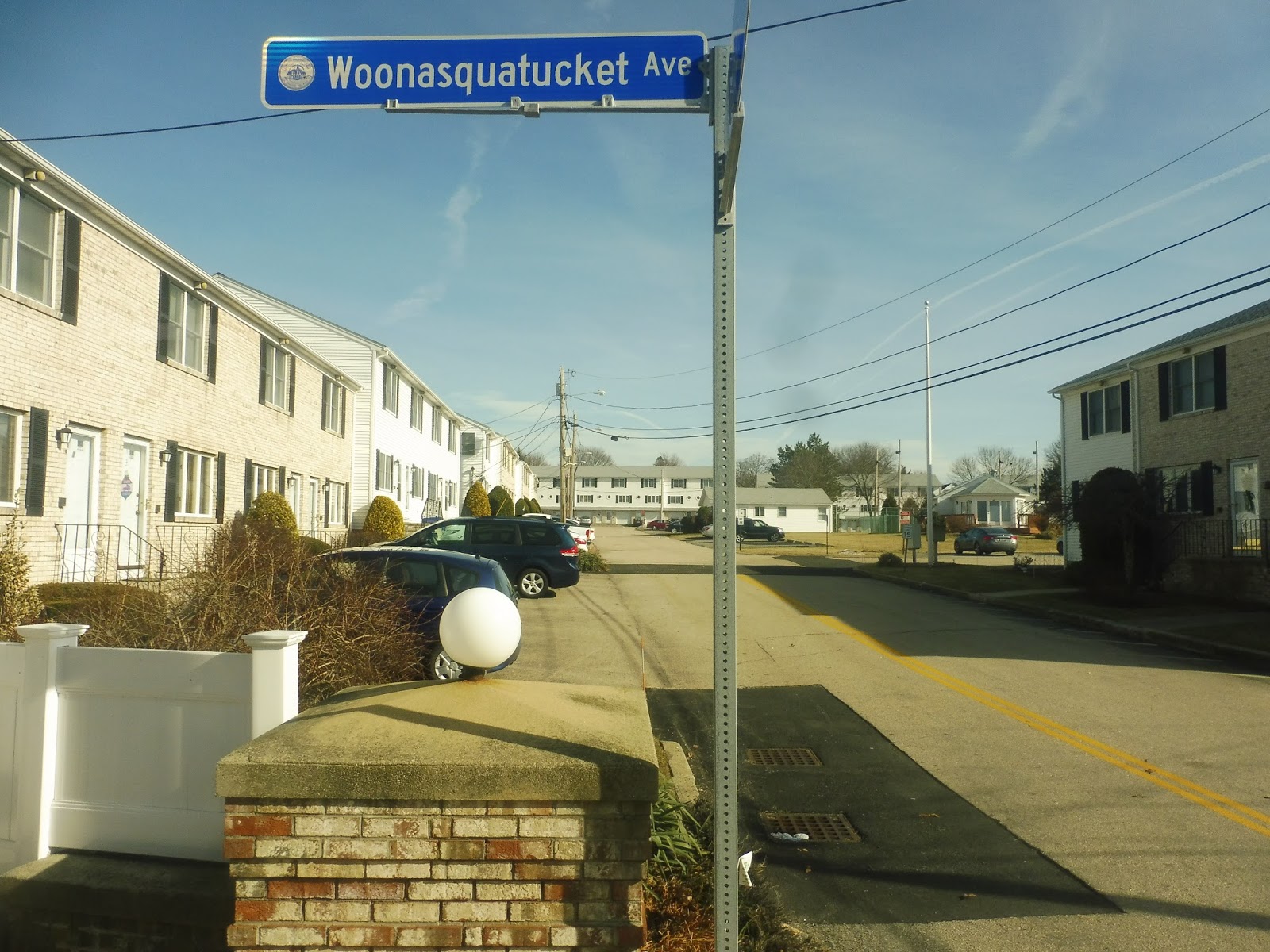
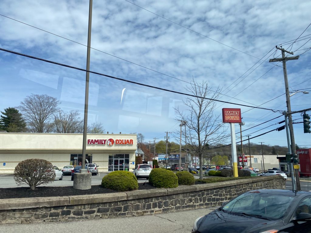
Manton Ave., why must you be weird? Alrighty, here we go with the 27. The journey for this route begins in Centerdale. What and where is Centerdale? It’s basically the “town center” for North Providence, where town hall is located. There’s also a Dollar Tree and Cumberland Farms here (which, I might add, has some pretty good food by convenience store standards!).
Looking uphill in Centerdale
“Which bus ya waitin’ for?” the driver asked me, as he was laying over. I just responded saying I was waiting for the next bus to Providence, then continued my lunch. Once he was ready, he said “Come on up!” and I scanned my Wave QR code. From here, we were off to the races. Our first turn was on to, and I am not kidding with this street name, Woonasquatucket Avenue. Let this picture from Miles’ (from Miles in Transit) post on this very route show how not ideal this name is for a street:
Now, for the non-Rhode Islanders, here’s a pronunciation guide to help you with this: WOO-nuh-squah-tuck-it
And that’s among the EASIER Native American names, if you had trouble! Even the lispy female announcement voice had a bit of trouble!
Anyways, we turned down that street, and it was largely suburban and multi-family houses with the occasional business and whatnot.
A dilapidated business from before turning down Woonasquatucket Ave.Houses!
Eventually, however, we reached the route’s namesake: Manton Avenue. This road has something weird, but we’ll get there eventually. We turned left onto Manton Ave., however, it was DEVIATION SENSATION TIME!!! But nah, we just deviated into a Stop & Shop. Which, I might add, has a lovely green field next to it.
Family Dollar and Manton AvenueLovely green field as the bus deviated into Stop & Shop
We deviated into Stop & Shop, but noone got on (I was already the only one on the bus at this point). From here, we kept going down Manton Ave., going by a bunch of houses and businesses, as well as some construction on new housing. It was largely the same. This also happened to be where Atwells Ave., the road with the famous segment lined with Italian restaurants on Federal Hill, begins.
Atwells Ave.
As we kept going down Manton Ave., we got a couple of passengers and a bus driver heading into downtown to relieve someone out in the field. We kept going down Manton Ave., passing more and more of the same businesses and whatnot, until we reached Olneyville. This was where I’ve seen what is quite possibly the weirdest Dunkin’ in existence. See below.
WHY IS THE DRIVE-THRU IN THE FRONT OF THE STORE?!
We went past the Dunkin’ and a furniture store that was a former warehouse, and we entered Olneyville. It was the usual Olneyville affair, businesses primarily, with connections to the 17, 19, and 28 available here. More passengers got on here, too. However, unlike the 17 and 19, we went up Broadway.
Olneyville!
The journey was near an end, as we trekked up Broadway, which had a number of businesses and houses. Soon enough, we were going over the interstate and were in downtown.
The interstate!
Downtown was the usual affair, and soon enough we were at Kennedy Plaza.
The good: – It’s a direct route serving a low-income area – It services an important place people want to go to (Stop & Shop) – It provides Providence and North Providence with additional connections – It’s frequent! It runs every weekday (until the evening) every 20 minutes
The bad: – However, weekend and night service is lacking. It runs about every 40 minutes (not exact) during the day on Saturdays, every 1 hour and 10 minutes Saturday nights, every hour weekday nights, and every 50 minutes on Sundays. Maybe weekend and night ridership doesn’t justify higher frequency, but it’s still annoying for a “key corridor” route. – Why does this route have two branches? One goes down George Waterman Road, and the other (what I rode) goes down Woonasquatucket Avenue. – I guess it’s nice it provides a transfer point with the 57 and 58, but do people use this? Maybe there’s a market and I’m underestimating it.
Nearby points of interest: Centerdale! Has some nice shops and whatnot. There’s also the Stop & Shop deviation at Manton Ave., as well as Olneyville!
Overall, it’s probably not the best RIPTA has to offer, however it’s better than nothing. Ridership of this route has it at the 3rd lowest ridership “key corridor” route. I’d definitely axe one of the two branches (most likely the George Waterman one) and consolidate the route, if I could. Overall, it could’ve been far worse. Rating: 5/10
BONUS IMAGES: from the George Waterman branch! I didn’t find these befitting for the Beach Bus post, and figured a part 2 to this post wasn’t worth the time and effort to write up.
An apartment complex!A gas station and convenience store in a small plaza!Someone’s house!Almost at Putnam Pike!